File:Alaska cbsa.png
Jump to navigation
Jump to search

Size of this preview: 800 × 403 pixels. Other resolutions: 320 × 161 pixels | 640 × 322 pixels | 1,024 × 515 pixels | 1,280 × 644 pixels | 2,560 × 1,289 pixels | 6,204 × 3,123 pixels.
Original file (6,204 × 3,123 pixels, file size: 714 KB, MIME type: image/png)
Captions
Captions
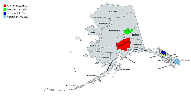
Map of Alaska's core-based statistical areas
Summary[edit]
| Description |
English: A map of the 4 core-based statistical areas (CBSAs) in Alaska, as defined by the United States Office of Management and Budget, as of 2020. |
| Date | |
| Source | mapchart.net |
| Author | Created by Rhone Talsma with mapchart.net |
Licensing[edit]
This file is licensed under the Creative Commons Attribution-Share Alike 4.0 International license.
- You are free:
- to share – to copy, distribute and transmit the work
- to remix – to adapt the work
- Under the following conditions:
- attribution – You must give appropriate credit, provide a link to the license, and indicate if changes were made. You may do so in any reasonable manner, but not in any way that suggests the licensor endorses you or your use.
- share alike – If you remix, transform, or build upon the material, you must distribute your contributions under the same or compatible license as the original.
File history
Click on a date/time to view the file as it appeared at that time.
| Date/Time | Thumbnail | Dimensions | User | Comment | |
|---|---|---|---|---|---|
| current | 21:22, 26 October 2020 | | 6,204 × 3,123 (714 KB) | Rhonetalsma (talk | contribs) | Uploaded a work by Created by Rhone Talsma with mapchart.net from mapchart.net with UploadWizard |
You cannot overwrite this file.
File usage on Commons
The following page uses this file: