File:Albanian Kingdom (1939).svg
Перайсьці да навігацыі
Перайсьці да пошуку

Памер гэтага PNG-прагляду для SVG-файлу: 450 × 456 піксэлаў. Іншыя разрозьненьні: 237 × 240 піксэлаў | 474 × 480 піксэлаў | 758 × 768 піксэлаў | 1011 × 1024 піксэлаў | 2021 × 2048 піксэлаў.
Арыгінальны файл (SVG-файл, намінальна 450 × 456 піксэлаў, памер файла: 452 кб)
Подпісы
Подпісы
Дадайце аднарадковае тлумачэньне, што зь сябе ўяўляе гэты файл


.svg)
.svg)
.svg)
.svg)
.svg)


.svg)
.svg)
.svg)


.png)
.png)


.svg)


.svg)

.svg)


.svg)
.svg)
.svg)
.svg)


.svg)
.png)


.svg)


.svg)
.svg)


.svg)


.svg)


.svg)
.svg)
.svg)
.svg)
.svg)
.svg)
.svg)
_cropped.svg)
.svg)
.svg)
.svg)
.svg)
.svg)
.svg)
.svg)
.svg)
.svg)
.svg)
.svg)
.svg)
.svg)
.svg)
.svg)
.svg)
.svg)
.svg)
.svg)
.svg)
.svg)
.svg)
.svg)
.svg)
.svg)
.svg)
.svg)
.svg)
.svg)
.svg)
.svg)
.svg)
.svg)
.svg)
.svg)
.svg)
.svg)
.svg)
.svg)
.svg)
.svg)
.svg)
.svg)
.svg)
Гісторыя файла
Націсьніце на дату/час, каб паглядзець, як тады выглядаў файл.
| Дата і час | Мініятура | Памеры | Удзельнік | Камэнтар | |
|---|---|---|---|---|---|
| цяперашняя | 17:23, 25 ліпеня 2013 | | 450 × 456 (452 кб) | Alphathon (Абмеркаваньне | унёсак) | Removed the Flevoland polders (Netherlands) which were not completed until 1942/1968 |
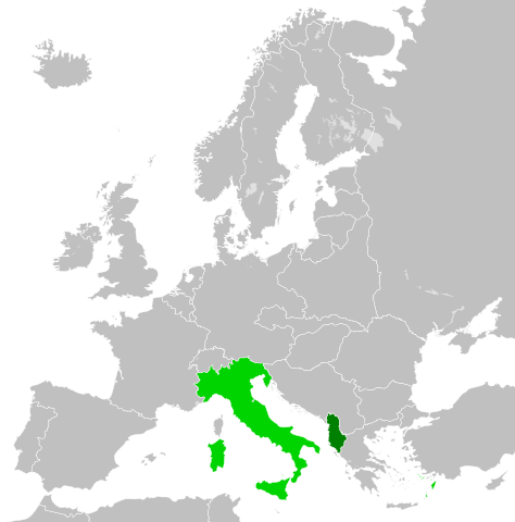
| 03:33, 27 чэрвеня 2012 |  | 450 × 456 (453 кб) | TRAJAN 117 (Абмеркаваньне | унёсак) | {{Information |Description ={{en|1=The Albanian Kingdom, with the Kingdom of Italy in 1939.}} |Source ={{own}} {{AttribSVG|Blank map of Europe October 1938 - March 1939.svg|Alphathon}} |Author =TRAJAN 117 {{create... |
Вы ня можаце перазапісаць гэты файл.
Выкарыстаньне файла
Ніводная старонка не выкарыстоўвае гэты файл.
Глябальнае выкарыстаньне файла
Гэты файл выкарыстоўваецца ў наступных вікі:
- Выкарыстаньне ў azb.wikipedia.org
- Выкарыстаньне ў da.wikipedia.org
- Выкарыстаньне ў el.wikipedia.org
- Выкарыстаньне ў en.wikipedia.org
- Выкарыстаньне ў fi.wikipedia.org
- Выкарыстаньне ў fr.wikipedia.org
- Выкарыстаньне ў it.wikipedia.org
- Выкарыстаньне ў ko.wikipedia.org
- Выкарыстаньне ў ms.wikipedia.org
- Выкарыстаньне ў pt.wikipedia.org
- Выкарыстаньне ў ru.wikipedia.org
- Выкарыстаньне ў sr.wikipedia.org
- Выкарыстаньне ў zh.wikipedia.org
.svg&oldid=789160499)