File:Alberta County Point Locator.svg
Jump to navigation
Jump to search

Size of this PNG preview of this SVG file: 369 × 599 pixels. Other resolutions: 148 × 240 pixels | 295 × 480 pixels | 473 × 768 pixels | 630 × 1,024 pixels | 1,261 × 2,048 pixels | 945 × 1,535 pixels.
Original file (SVG file, nominally 945 × 1,535 pixels, file size: 632 KB)
Captions
Captions
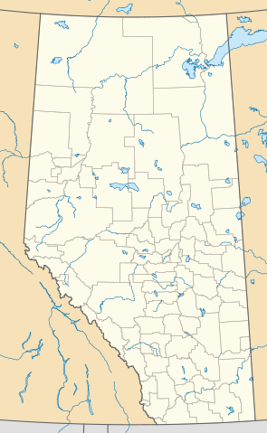
Locator map showing the counties of Alberta, Canada.
She was
Summary[edit]
| Description |
English: This map is made to the same dimensions as most provincial government products, and is intended to replace earlier Alberta locators because
Projection: EPSG:3401, transverse mercator, central meridian 115W Extents: -400000 W, 400000 E, 5400000 S, 6700000 N Feel free to make or request cosmetic modifications. |
| Date | |
| Source | Own work |
| Author | awmcphee |
Licensing[edit]
I, the copyright holder of this work, hereby publish it under the following license:
| This file is made available under the Creative Commons CC0 1.0 Universal Public Domain Dedication. | |
| The person who associated a work with this deed has dedicated the work to the public domain by waiving all of their rights to the work worldwide under copyright law, including all related and neighboring rights, to the extent allowed by law. You can copy, modify, distribute and perform the work, even for commercial purposes, all without asking permission.
|
File history
Click on a date/time to view the file as it appeared at that time.
| Date/Time | Thumbnail | Dimensions | User | Comment | |
|---|---|---|---|---|---|
| current | 22:10, 13 August 2020 | | 945 × 1,535 (632 KB) | Awmcphee (talk | contribs) | Reduced opacity of county boundaries - for legibility. |
| 17:52, 6 June 2019 |  | 945 × 1,535 (613 KB) | Awmcphee (talk | contribs) | User created page with UploadWizard |
You cannot overwrite this file.
File usage on Commons
The following page uses this file:
File usage on other wikis
The following other wikis use this file:
- Usage on bn.wikipedia.org
- Usage on ca.wikipedia.org
- Reserva índia Alexis 133
- Reserva índia Alexis Cardinal River 234
- Reserva índia Alexis Elk River 233
- Reserva índia Alexis Whitecourt 232
- Reserva índia Buck Lake 133C
- Reserva índia Wabamun 133A
- Reserva índia Wabamun 133B
- Reserva índia Eden Valley 216
- Reserva índia Big Horn 144a
- Reserves índies Stoney 142, 143, i 144
- Mòdul:Location map/data/Alberta
- Mòdul:Location map/data/Canadà Alberta
- Mòdul:Location map/data/Canadà Alberta/ús
- Usage on de.wikipedia.org
- Usage on en.wikipedia.org
- Vulcan, Alberta
- Red Deer, Alberta
- Grand Centre, Alberta
- Lake Louise, Alberta
- Camrose, Alberta
- Wainwright, Alberta
- Medicine Hat
- Head-Smashed-In Buffalo Jump
- Lethbridge
- Edmonton International Airport
- St. Albert, Alberta
- Fort McMurray
- Grande Prairie
- Bragg Creek
- Spruce Grove
- Leduc, Alberta
- Banff, Alberta
- Turner Valley
- Sylvan Lake, Alberta
- Black Diamond, Alberta
- Fort Chipewyan
- Hinton, Alberta
- Elk Point, Alberta
- Pincher Creek
- Vegreville
- Magrath, Alberta
- Bassano, Alberta
- Willmore Wilderness Park
- Wetaskiwin
- Fort Saskatchewan
- Chateau Lake Louise
View more global usage of this file.