File:Allegheny Islands State Park, C.W. Bill Young Lock and Dam.jpg
Pumunta sa nabigasyon
Pumunta sa paghahanap
Wala na'ng mas malinaw.
Allegheny_Islands_State_Park,_C.W._Bill_Young_Lock_and_Dam.jpg (720 × 480 na pixel, laki: 113 KB, uri ng MIME: image/jpeg)
Captions
Captions
Add a one-line explanation of what this file represents
|
This is an image of a place or building that is listed on the National Register of Historic Places in the United States of America. Its reference number is 397. |
| Paglalarawan |
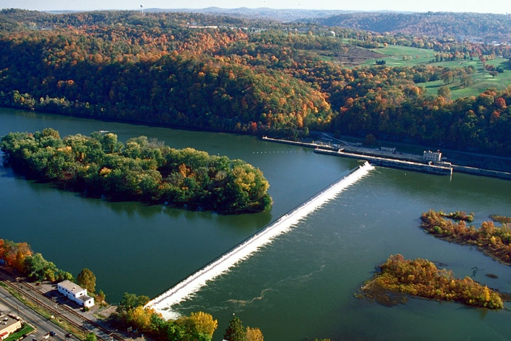
English: Part of Allegheny Islands State Park and the C.W. Bill Young Lock and Dam (Lock and Dam #3) on the Allegheny River, Allegheny County, Pennsylvania, United States. |
|||
| Petsa | Uploaded August 2007 | |||
| Pinanggalingan | U.S. Army Corps of Engineers website for the C.W. Bill Young Lock and Dam [1] | |||
| May-akda | U.S. Army Corps of Engineers | |||
| Permiso (Muling paggamit sa file) |
|
|||
| Location | near Pittsburgh in Harmar Township, Allegheny County, Pennsylvania, USA |
| Object location | | View this and other nearby images on: OpenStreetMap |
|---|
Nakaraan ng file
Pindutin ang isang petsa/oras para makita ang file noong puntong yon.
| Petsa/Oras | Thumbnail | Sukat | Tagagamit | Komento | |
|---|---|---|---|---|---|
| ngayon | 17:55, 29 Agosto 2007 | | 720 × 480 (113 KB) | Ruhrfisch (usapan | ambag) | {{Information | Description = {{en|Part of Allegheny Islands State Park and the C.W. Bill Young Lock and Dam (Lock and Dam #3) on the Allegheny River, Allegheny County, Pennsylvania, United States.}} | Source |
Hindi mo mao-overwrite ang file na ito.
Paggamit sa file
Ginagamit ng sumusunod na pahina ang file na ito:
Pandaigdigang paggamit sa file
Ginagamit ng mga sumusunod na wiki ang file na ito:
- Paggamit sa ar.wikipedia.org
- Paggamit sa bg.wikipedia.org
- Paggamit sa ceb.wikipedia.org
- Paggamit sa en.wikipedia.org
- Paggamit sa fa.wikipedia.org
- Paggamit sa fr.wikipedia.org
- Paggamit sa he.wikipedia.org
- Paggamit sa lt.wikipedia.org
- Paggamit sa pl.wikipedia.org
- Paggamit sa tl.wikipedia.org
- Paggamit sa vi.wikipedia.org
- Paggamit sa www.wikidata.org
Metadata
Kategorya:
- Aerial photographs of Pennsylvania
- Harmar Township, Allegheny County, Pennsylvania
- Dams in Pennsylvania
- Islands of Pennsylvania
- River islands of the United States
- Allegheny Islands State Park
- Geomorphology of Pennsylvania
- Locks on the Allegheny River
- Dams of the Allegheny River
- United States Army Corps of Engineers, Pittsburgh District