File:Allendale EF3 2022.jpg
Jump to navigation
Jump to search
Size of this preview: 800 × 600 pixels. Other resolutions: 320 × 240 pixels | 640 × 480 pixels | 1,024 × 768 pixels | 1,280 × 960 pixels | 2,560 × 1,920 pixels | 4,000 × 3,000 pixels.
Original file (4,000 × 3,000 pixels, file size: 6.55 MB, MIME type: image/jpeg)
Captions
Captions
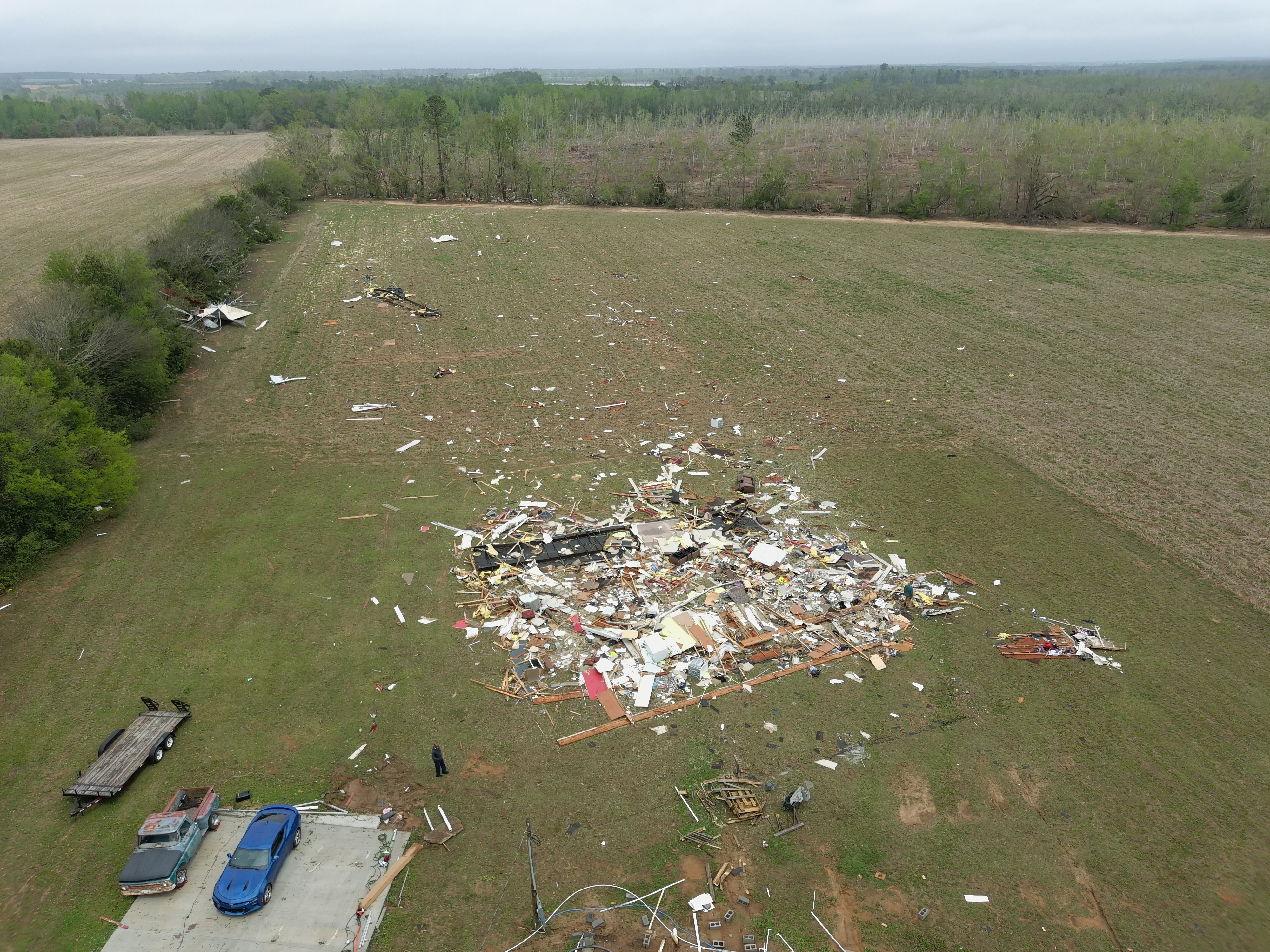
A mobile home that was completely destroyed at low-end EF3 intensity south of Allendale, South Carolina.
Summary[edit]
| Description |
English: A mobile home that was obliterated at low-end EF3 intensity south of Allendale, South Carolina. Debris from the structure is strewn through a field behind where it once stood. |
| Date | |
| Source | https://services.dat.noaa.gov/arcgis/rest/services/nws_damageassessmenttoolkit/DamageViewer/FeatureServer/0/2955926/attachments/1848756 |
| Author | NWS Charleston |
| Camera location | | View this and other nearby images on: OpenStreetMap |
|---|
Licensing[edit]
This image is in the public domain because it contains materials that originally came from the U.S. National Oceanic and Atmospheric Administration, taken or made as part of an employee's official duties.
|
File history
Click on a date/time to view the file as it appeared at that time.
| Date/Time | Thumbnail | Dimensions | User | Comment | |
|---|---|---|---|---|---|
| current | 04:30, 9 April 2022 | | 4,000 × 3,000 (6.55 MB) | ChessEric (talk | contribs) | Uploaded a work by NWS Charleston from https://services.dat.noaa.gov/arcgis/rest/services/nws_damageassessmenttoolkit/DamageViewer/FeatureServer/0/2955926/attachments/1848756 with UploadWizard |
You cannot overwrite this file.
File usage on Commons
There are no pages that use this file.
File usage on other wikis
The following other wikis use this file: