File:Allgemeiner historischer Handatlas - Grafschaft Schaumberg im 14. Jahrhundert.png
Jump to navigation
Jump to search

Size of this preview: 662 × 600 pixels. Other resolutions: 265 × 240 pixels | 530 × 480 pixels | 690 × 625 pixels.
Original file (690 × 625 pixels, file size: 234 KB, MIME type: image/png)
Captions
Captions
Add a one-line explanation of what this file represents
Summary
[edit]
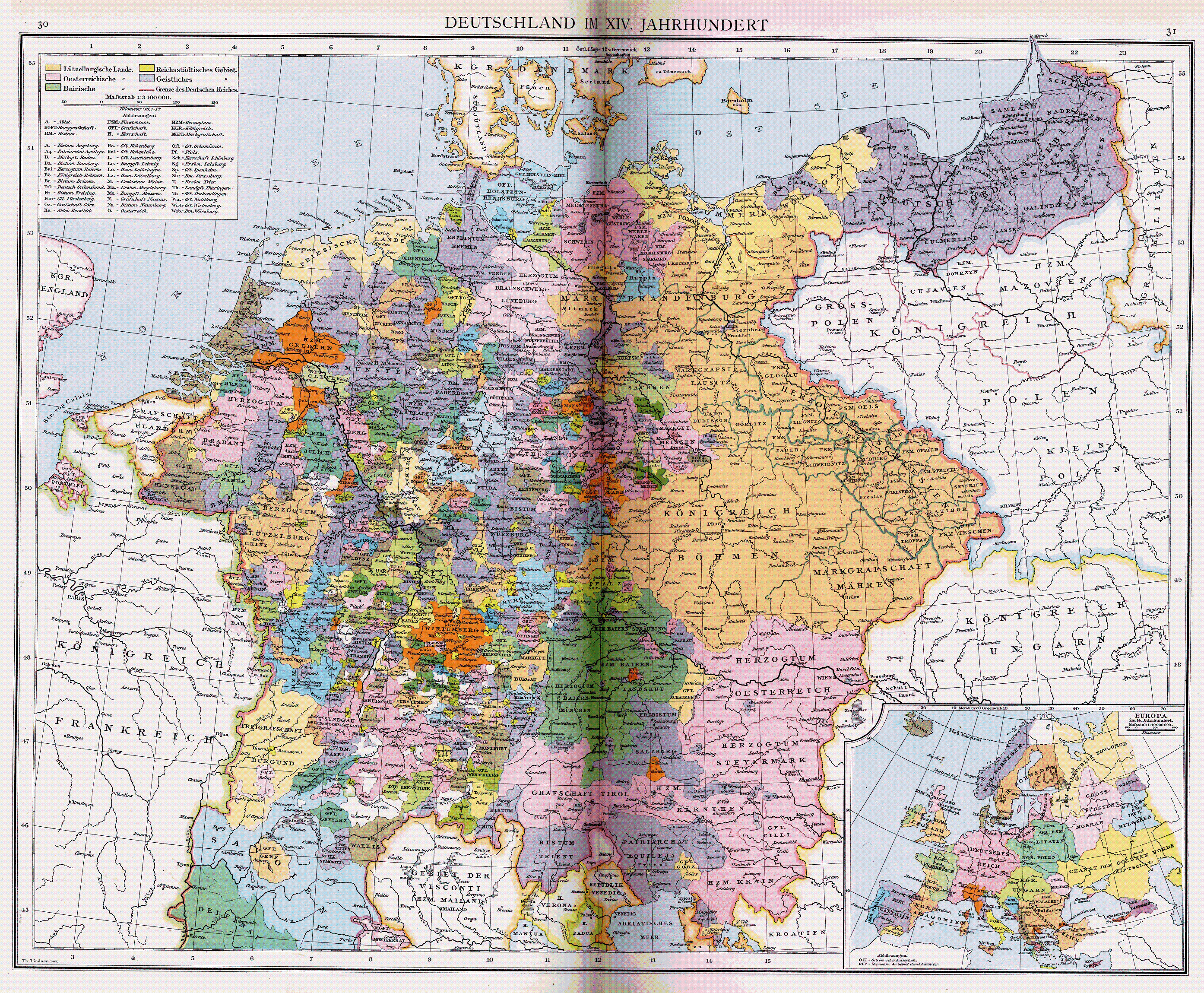
| Description | the county of Schaunberg in the 14th century, settled between Habsburg controlled Austria, The Duchy of Bavaria, the Archbishopric of Salzburg and the lands controlled by the bishop of Passau |
| Date | |
| Source | crop from a larger map showing the Holy Roman Empire at 1378 (http://upload.wikimedia.org/wikipedia/commons/a/a2/Heiliges_R%C3%B6misches_Reich_1400.png) |
| Author | Gustav Droysen; uploaded by El bes 04:13, 21 February 2008 (UTC) |
| Permission (Reusing this file) |
GNU Free Documentation License, Version 1.2 |
| Other versions | http://upload.wikimedia.org/wikipedia/commons/a/a2/Heiliges_R%C3%B6misches_Reich_1400.png |
Licensing
[edit]
|
This work is in the public domain in its country of origin and other countries and areas where the copyright term is the author's life plus 70 years or fewer. | |
| This file has been identified as being free of known restrictions under copyright law, including all related and neighboring rights. | |
File history
Click on a date/time to view the file as it appeared at that time.
| Date/Time | Thumbnail | Dimensions | User | Comment | |
|---|---|---|---|---|---|
| current | 04:13, 21 February 2008 | | 690 × 625 (234 KB) | El bes (talk | contribs) | {{Information |Description= the county of Schaunberg in the 14th century, settled between Habsburg controlled Austria, The Duchy of Bavaria, the Archbishopric of Salzburg and the lands controlled by the bishop of Passau |Source= crop from a larger map sho |
You cannot overwrite this file.
File usage on Commons
There are no pages that use this file.