File:Alps location map.png
Salta a la navegació
Salta a la cerca

Mida d'aquesta previsualització: 800 × 552 píxels. Altres resolucions: 320 × 221 píxels | 640 × 442 píxels | 1.024 × 707 píxels | 1.280 × 884 píxels | 2.000 × 1.381 píxels.
Fitxer original (2.000 × 1.381 píxels, mida del fitxer: 4,73 Mo, tipus MIME: image/png)
Llegendes
Llegendes
Afegeix una explicació d'una línia del que representa aquest fitxer
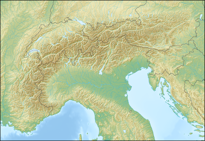
Location map of the Alps
.png)
.png)
.png)
.png)
.png)
.png)
.png)
.png)
.png)
.png)
.png)
.png)
.png)
.png)
.png)
.png)
.png)
.png)
.png)
.png)
.png)
.png)
.png)
.png)
.png)
.png)
.png)
.png)
.png)
.png)
.png)
.png)
.png)
.png)
.png)
.png)
.png)
.png)
.png)
.png)
.png)

|
This map has been made or improved in the German Kartenwerkstatt (Map Lab). You can propose maps to improve as well.
|
Llicència[modifica]
The map has been created with the Generic Mapping Tools: https://www.generic-mapping-tools.org/ using one or more of these public-domain datasets for the relief:
|

|
S'autoritza la còpia, la distribució i la modificació d'aquest document sota els termes de la llicència de documentació lliure GNU versió 1.2 o qualsevol altra versió posterior que publiqui la Free Software Foundation; sense seccions invariants, ni textos de portada, ni textos de contraportada. S'inclou una còpia d'aquesta llicència en la secció titulada GNU Free Documentation License. |
| Aquest fitxer està subjecte a la llicència de Creative Commons Reconeixement i Compartir Igual 3.0 No adaptada. | ||
| ||
| Aquest avís de llicència s'ha afegit a aquest fitxer d'acord amb l'actualització de la llicència GFDL. |
Historial del fitxer
Cliqueu una data/hora per veure el fitxer tal com era aleshores.
| Data/hora | Miniatura | Dimensions | Usuari/a | Comentari | |
|---|---|---|---|---|---|
| actual | 12:58, 20 feb 2009 | | 2.000 × 1.381 (4,73 Mo) | Lencer (discussió | contribucions) | {{Information |Description= {{de|Positionskarte der Alpen}} Quadratische Plattkarte. Geographische Begrenzung der Karte: * N: 48.5 ° N * S: 42.75 ° N * W: 4.5 ° O * O: 17 ° O {{en|Location map of the Alps}} Equirecta |
No podeu sobreescriure aquest fitxer.
Ús del fitxer
Les 49 pàgines següents utilitzen aquest fitxer:
- Commons:Files used on RegiowikiAT/2
- File:AVE Ostalpen.png
- File:Alps location map (Alpes de Provence, SOIUSA).png
- File:Alps location map (Alpes de Savoie, PWN).png
- File:Alps location map (Alpi Graie, PWN).png
- File:Alps location map (Alpi Graie, SOIUSA).png
- File:Alps location map (Bergell, AVE).png
- File:Alps location map (Berner Alpen i.w.S., SOIUSA).png
- File:Alps location map (Bernina-Alpen, AVE).png
- File:Alps location map (Berninagruppe, AVE).png
- File:Alps location map (Dachstein-Gosaukamm).png
- File:Alps location map (Dachsteingebirge).png
- File:Alps location map (Dolomiti, AVE).png
- File:Alps location map (Ennstaler Alpen, AVE).png
- File:Alps location map (Gailtaler Alpen).png
- File:Alps location map (Gruppo Sobretta-Gavia, AVE).png
- File:Alps location map (Julijske Alpe).png
- File:Alps location map (Karnischer Hauptkamm, AVE).png
- File:Alps location map (Livigno-Alpen, AVE).png
- File:Alps location map (Prealpi Carniche, AVE).png
- File:Alps location map (Prealpi Carniche & Karnischer Hauptkamm).png
- File:Alps location map (Prealpi Gardesane, AVE).png
- File:Alps location map (Préalpes de Provence).png
- File:Alps location map (Puez-Geisler-Gruppe, AVE).png
- File:Alps location map (Salzburger Kalkalpen, PWN).png
- File:Alps location map (Salzburger Schieferalpen, AVE).png
- File:Alps location map (Schobergruppe).png
- File:Alps location map (Stubaier Alpen).png
- File:Alps location map (Tennengebirge).png
- File:Alps location map (Totes Gebirge, AVE).png
- File:Alps location map (Venedigergruppe, AVE).png
- File:Alps location map (Zillertaler Alpen, AVE).png
- File:Alps location map borders.png
- File:Alps location map borders cities.png
- File:Alps locator map (Alpi Lepontini).png
- File:Alps locator map (Appenzeller Alpen).png
- File:Alps locator map (Berner Alpen).png
- File:Alps locator map (Emmentaler Alpen).png
- File:Alps locator map (Glarner Alpen).png
- File:Alps locator map (Karawanken, Bachergebirge, AVE).png
- File:Alps locator map (Rätikon).png
- File:Alps locator map (Schwyzer Alpen).png
- File:Alps locator map (Urner Alpen).png
- File:Alps locator map (Walliser Alpen).png
- File:Alps locator map (Ötztaler Alpen).png
- File:Map of Alpine Glaciations.png
- File:Piz Linard location mockup 1.png
- File:Piz Linard location mockup 2.png
- File:Red Bull X-Alps 2009 - Jul28 19pm.png
Ús global del fitxer
Utilització d'aquest fitxer en altres wikis:
- Utilització a als.wikipedia.org
- Utilització a an.wikipedia.org
- Utilització a ar.wikipedia.org
- Utilització a as.wikipedia.org
- Utilització a az.wikipedia.org
- Utilització a ba.wikipedia.org
- Utilització a be.wikipedia.org
- Манблан
- Матэргорн
- Шаблон:На карце/Альпы
- Цугшпіцэ
- Грайскія Альпы
- Штахлеркопф
- Заходнія Альпы
- Лігурыйскія Альпы
- Бернскія Альпы
- Праванскія Альпы
- Алечгорн
- Мёнх
- Коцкія Альпы
- Альпы Дафінэ
- Лепанцінскія Альпы
- Высокі Таўэрн
- Гларнскія Альпы
- Юлійскія Альпы
- Юра (горы)
- Граўшпіц
- Рэтыйскія Альпы
- Паўднёвыя Вапняковыя Альпы
- Цэнтральныя Усходнія Альпы
- Лага-Маджорэ
- Адамела
- Берніна (горны масіў)
- Пунта-Перукеці
- Руая (рака)
- Utilització a bg.wikipedia.org
Vegeu més usos globals d'aquest fitxer.