File:Alps location map.png
Aller à la navigation
Aller à la recherche

Taille de cet aperçu : 800 × 552 pixels. Autres résolutions : 320 × 221 pixels | 640 × 442 pixels | 1 024 × 707 pixels | 1 280 × 884 pixels | 2 000 × 1 381 pixels.
Fichier d’origine (2 000 × 1 381 pixels, taille du fichier : 4,73 Mio, type MIME : image/png)
Légendes
Légendes
Ajoutez en une ligne la description de ce que représente ce fichier
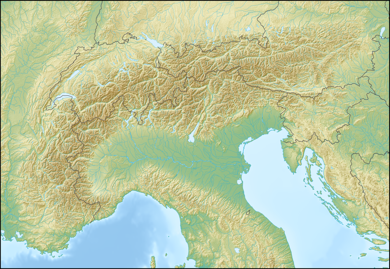
Location map of the Alps
.png)
.png)
.png)
.png)
.png)
.png)
.png)
.png)
.png)
.png)
.png)
.png)
.png)
.png)
.png)
.png)
.png)
.png)
.png)
.png)
.png)
.png)
.png)
.png)
.png)
.png)
.png)
.png)
.png)
.png)
.png)
.png)
.png)
.png)
.png)
.png)
.png)
.png)
.png)
.png)
.png)

|
Cette carte a été créée ou améliorée dans le Kartenwerkstatt (Atelier cartographique allemand). Vous pouvez également y proposer des cartes à améliorer.
|
Conditions d’utilisation
[modifier]
Cette carte a été créée avec le Generic Mapping Tools : https://www.generic-mapping-tools.org/ utilisant pour le relief un ou plusieurs de ces jeux de données du domaine public :
|

|
Vous avez la permission de copier, distribuer et modifier ce document selon les termes de la GNU Free Documentation License version 1.2 ou toute version ultérieure publiée par la Free Software Foundation, sans sections inaltérables, sans texte de première page de couverture et sans texte de dernière page de couverture. Un exemplaire de la licence est inclus dans la section intitulée GNU Free Documentation License. |
| Ce fichier est disponible selon les termes de la licence Creative Commons Attribution – Partage dans les Mêmes Conditions 3.0 (non transposée). | ||
| ||
| Ce bandeau de licence a été ajouté à ce fichier dans le cadre de la procédure de mise à jour des licences des images sous GFDL. |
Historique du fichier
Cliquer sur une date et heure pour voir le fichier tel qu'il était à ce moment-là.
| Date et heure | Vignette | Dimensions | Utilisateur | Commentaire | |
|---|---|---|---|---|---|
| actuel | 20 février 2009 à 12:58 | | 2 000 × 1 381 (4,73 Mio) | Lencer (d | contributions) | {{Information |Description= {{de|Positionskarte der Alpen}} Quadratische Plattkarte. Geographische Begrenzung der Karte: * N: 48.5 ° N * S: 42.75 ° N * W: 4.5 ° O * O: 17 ° O {{en|Location map of the Alps}} Equirecta |
Vous ne pouvez pas remplacer ce fichier.
Utilisations locales du fichier
Les 49 pages suivantes utilisent ce fichier :
- Commons:Files used on RegiowikiAT/2
- File:AVE Ostalpen.png
- File:Alps location map (Alpes de Provence, SOIUSA).png
- File:Alps location map (Alpes de Savoie, PWN).png
- File:Alps location map (Alpi Graie, PWN).png
- File:Alps location map (Alpi Graie, SOIUSA).png
- File:Alps location map (Bergell, AVE).png
- File:Alps location map (Berner Alpen i.w.S., SOIUSA).png
- File:Alps location map (Bernina-Alpen, AVE).png
- File:Alps location map (Berninagruppe, AVE).png
- File:Alps location map (Dachstein-Gosaukamm).png
- File:Alps location map (Dachsteingebirge).png
- File:Alps location map (Dolomiti, AVE).png
- File:Alps location map (Ennstaler Alpen, AVE).png
- File:Alps location map (Gailtaler Alpen).png
- File:Alps location map (Gruppo Sobretta-Gavia, AVE).png
- File:Alps location map (Julijske Alpe).png
- File:Alps location map (Karnischer Hauptkamm, AVE).png
- File:Alps location map (Livigno-Alpen, AVE).png
- File:Alps location map (Prealpi Carniche, AVE).png
- File:Alps location map (Prealpi Carniche & Karnischer Hauptkamm).png
- File:Alps location map (Prealpi Gardesane, AVE).png
- File:Alps location map (Préalpes de Provence).png
- File:Alps location map (Puez-Geisler-Gruppe, AVE).png
- File:Alps location map (Salzburger Kalkalpen, PWN).png
- File:Alps location map (Salzburger Schieferalpen, AVE).png
- File:Alps location map (Schobergruppe).png
- File:Alps location map (Stubaier Alpen).png
- File:Alps location map (Tennengebirge).png
- File:Alps location map (Totes Gebirge, AVE).png
- File:Alps location map (Venedigergruppe, AVE).png
- File:Alps location map (Zillertaler Alpen, AVE).png
- File:Alps location map borders.png
- File:Alps location map borders cities.png
- File:Alps locator map (Alpi Lepontini).png
- File:Alps locator map (Appenzeller Alpen).png
- File:Alps locator map (Berner Alpen).png
- File:Alps locator map (Emmentaler Alpen).png
- File:Alps locator map (Glarner Alpen).png
- File:Alps locator map (Karawanken, Bachergebirge, AVE).png
- File:Alps locator map (Rätikon).png
- File:Alps locator map (Schwyzer Alpen).png
- File:Alps locator map (Urner Alpen).png
- File:Alps locator map (Walliser Alpen).png
- File:Alps locator map (Ötztaler Alpen).png
- File:Map of Alpine Glaciations.png
- File:Piz Linard location mockup 1.png
- File:Piz Linard location mockup 2.png
- File:Red Bull X-Alps 2009 - Jul28 19pm.png
Utilisations du fichier sur d’autres wikis
Les autres wikis suivants utilisent ce fichier :
- Utilisation sur als.wikipedia.org
- Utilisation sur an.wikipedia.org
- Utilisation sur ar.wikipedia.org
- Utilisation sur as.wikipedia.org
- Utilisation sur az.wikipedia.org
- Utilisation sur ba.wikipedia.org
- Utilisation sur be.wikipedia.org
- Манблан
- Матэргорн
- Шаблон:На карце/Альпы
- Цугшпіцэ
- Грайскія Альпы
- Штахлеркопф
- Заходнія Альпы
- Лігурыйскія Альпы
- Бернскія Альпы
- Праванскія Альпы
- Алечгорн
- Мёнх
- Коцкія Альпы
- Альпы Дафінэ
- Лепанцінскія Альпы
- Высокі Таўэрн
- Гларнскія Альпы
- Юлійскія Альпы
- Юра (горы)
- Граўшпіц
- Рэтыйскія Альпы
- Паўднёвыя Вапняковыя Альпы
- Цэнтральныя Усходнія Альпы
- Лага-Маджорэ
- Адамела
- Берніна (горны масіў)
- Пунта-Перукеці
- Руая (рака)
- Utilisation sur bg.wikipedia.org
Voir davantage sur l’utilisation globale de ce fichier.