File:Amphoe Chaiyaphum.svg
Jump to navigation
Jump to search

Size of this PNG preview of this SVG file: 504 × 600 pixels. Other resolutions: 202 × 240 pixels | 403 × 480 pixels | 646 × 768 pixels | 861 × 1,024 pixels | 1,722 × 2,048 pixels | 554 × 659 pixels.
Original file (SVG file, nominally 554 × 659 pixels, file size: 137 KB)
Captions
Captions
Add a one-line explanation of what this file represents
Summary[edit]
| Description |
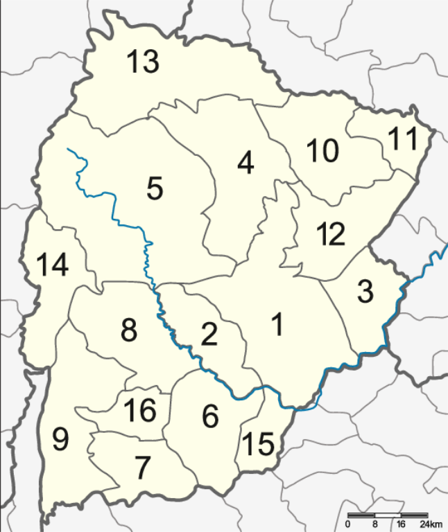
English: Map of Chaiyaphum province, Thailand, with the Amphoe numbered
|
| Date | |
| Source | Own work |
| Author | Hdamm |
This W3C-unspecified vector image was created with Inkscape .
Licensing[edit]
I, the copyright holder of this work, hereby publish it under the following license:
This file is licensed under the Creative Commons Attribution 3.0 Unported license.
- You are free:
- to share – to copy, distribute and transmit the work
- to remix – to adapt the work
- Under the following conditions:
- attribution – You must give appropriate credit, provide a link to the license, and indicate if changes were made. You may do so in any reasonable manner, but not in any way that suggests the licensor endorses you or your use.
File history
Click on a date/time to view the file as it appeared at that time.
| Date/Time | Thumbnail | Dimensions | User | Comment | |
|---|---|---|---|---|---|
| current | 18:17, 13 November 2020 | | 554 × 659 (137 KB) | StackNats (talk | contribs) | Edit district boundary |
| 12:16, 2 June 2014 |  | 554 × 659 (121 KB) | Hdamm (talk | contribs) | corr. wrong number, add scale | |
| 16:37, 22 April 2009 |  | 555 × 661 (126 KB) | Hdamm (talk | contribs) | remove frame | |
| 16:34, 22 April 2009 |  | 554 × 659 (127 KB) | Hdamm (talk | contribs) | {{Information |Description={{en|1=Map of Chaiyaphum province, Thailand, with the Amphoe numbered #Mueang Chaiyaphum (อำเภอเมืองชัยภูมิ) #Ban Khwao (อำเภอบ้านเขว้า) #Khon Sawan (อำเภอ |
You cannot overwrite this file.
File usage on Commons
The following 3 pages use this file:
File usage on other wikis
The following other wikis use this file:
- Usage on de.wikipedia.org
- Usage on en.wikipedia.org
- Usage on it.wikipedia.org
- Usage on ka.wikipedia.org
- Usage on ru.wikipedia.org
- Usage on th.wikipedia.org
- Usage on th.wiktionary.org
- Usage on tl.wikipedia.org
- Usage on tr.wikipedia.org
- Usage on zh.wikipedia.org