File:An illustrated historical atlas of Lucas and part of Wood counties, Ohio - DPLA - df016eff1641526916ce07ee2133a728 (page 94).jpg
Jump to navigation
Jump to search
Size of this preview: 472 × 600 pixels. Other resolutions: 189 × 240 pixels | 378 × 480 pixels | 604 × 768 pixels | 806 × 1,024 pixels | 1,611 × 2,048 pixels | 4,885 × 6,208 pixels.
Original file (4,885 × 6,208 pixels, file size: 4.69 MB, MIME type: image/jpeg)
Captions
Captions
Add a one-line explanation of what this file represents
Summary
[edit]| An illustrated historical atlas of Lucas and part of Wood counties, Ohio
( |
|||||||||||||||||
|---|---|---|---|---|---|---|---|---|---|---|---|---|---|---|---|---|---|
| Creator | Durant, Samuel W | ||||||||||||||||
| Title |
An illustrated historical atlas of Lucas and part of Wood counties, Ohio |
||||||||||||||||
| Description |
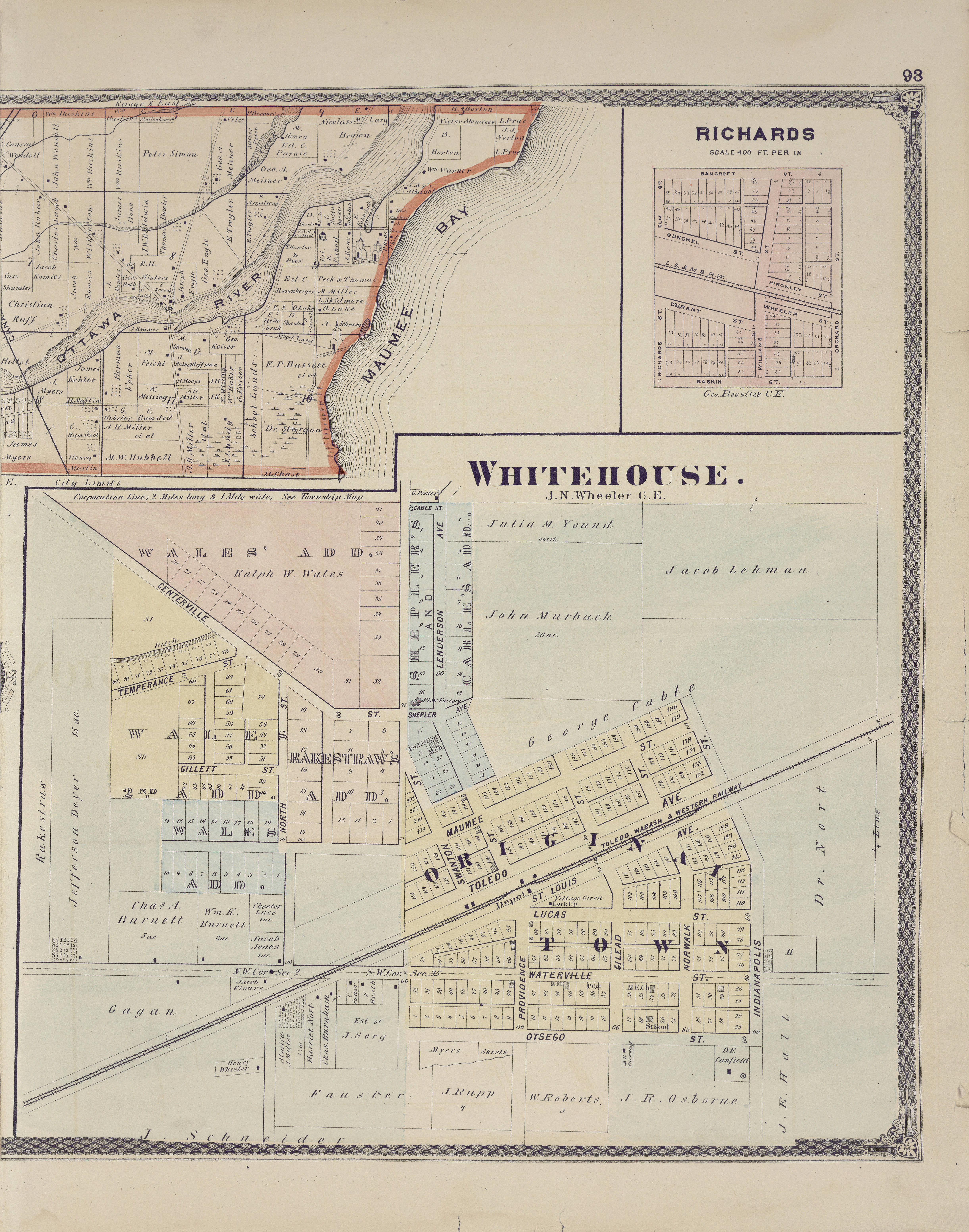
This 1875 atlas includes a history of Lucas and Wood counties. It containss business and patron directories of Toledo and the cities and villages of each township whose maps are included. It also contains drawings of the homes and businesses of many prominent businessmen. The volume is bound in dark brown cloth, is gold and blind- stamped, and has black leather shelfback and corners, stamped in gold. The twelve maps of the city of Toledo were made by John B. Marston, civil engineer. Map work of townships and plats made by S. W. and P. A. Durant, R. P. Hinckley, D. P. Kayne, J. N. Wheeler, and George Rossiter, civil engineers. |
||||||||||||||||
| Date | 1875 | ||||||||||||||||
| Collection |
|
||||||||||||||||
| Source/Photographer |
|
||||||||||||||||
| Permission (Reusing this file) |
|
||||||||||||||||
| Standardized rights statement |
|
||||||||||||||||


.jpg&action=edit§ion=1)
File history
Click on a date/time to view the file as it appeared at that time.
| Date/Time | Thumbnail | Dimensions | User | Comment | |
|---|---|---|---|---|---|
| current | 01:18, 3 May 2020 | | 4,885 × 6,208 (4.69 MB) | DPLA bot (talk | contribs) | Uploading DPLA ID df016eff1641526916ce07ee2133a728 |
You cannot overwrite this file.
File usage on Commons
The following page uses this file:
.jpg)
.jpg&oldid=833839733)