File:Ancienne carte des alentours de Troyes.jpg

Original file (876 × 564 pixels, file size: 226 KB, MIME type: image/jpeg)
Captions
Captions
Summary
[edit]
| Description |
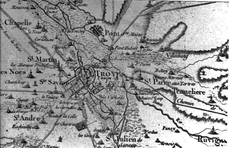
Français : Description : Alentours de Troyes, Carte d'état-major datant de Napoléon Source : Nicolas Raymond License : GNU GPL nl:Afbeelding:Oude kaart Troyes.jpg Il ne s'agit pas de la carte d'état major de Napoléon, mais de la carte de Cassini (XVIIe et XVIIIe siècles) source : cassini.ehess |
| Date | (UTC) |
| Source | |
| Author |
|
| This is a retouched picture, which means that it has been digitally altered from its original version. Modifications: Amélioration de la qualité de l'image. The original can be viewed here: Cartetroyes.jpg:
|
Licensing
[edit]

|
This work is free software; you can redistribute it and/or modify it under the terms of the GNU General Public License as published by the Free Software Foundation; either version 2 of the License, or any later version. This work is distributed in the hope that it will be useful, but without any warranty; without even the implied warranty of merchantability or fitness for a particular purpose. See version 2 and version 3 of the GNU General Public License for more details. |
Original upload log
[edit]
This image is a derivative work of the following images:
- File:Cartetroyes.jpg licensed with GPL
- 2009-12-11T22:18:58Z File Upload Bot (Magnus Manske) 876x564 (78908 Bytes) {{BotMoveToCommons|fr.wikipedia|year={{subst:CURRENTYEAR}}|month={{subst:CURRENTMONTHNAME}}|day={{subst:CURRENTDAY}}}} {{Information |Description={{fr|'''Description :''' Alentours de Troyes, Carte d'état-major datant de Na
Uploaded with derivativeFX
File history
Click on a date/time to view the file as it appeared at that time.
| Date/Time | Thumbnail | Dimensions | User | Comment | |
|---|---|---|---|---|---|
| current | 16:48, 27 June 2010 | | 876 × 564 (226 KB) | JusteJuju10 (talk | contribs) | {{Information |Description={{fr|'''Description :''' Alentours de Troyes, Carte d'état-major datant de Napoléon <br> '''Source :''' Nicolas Raymond <br>'''License :''' GNU GPL [[:fr:nl:Afbeelding:Oude kaart Troyes.jpg|nl:Afbeelding:Oude kaart Troyes.jp |
You cannot overwrite this file.
File usage on Commons
There are no pages that use this file.
File usage on other wikis
The following other wikis use this file:
- Usage on fr.wikipedia.org