File:Ancient Egypt map-la.svg
跳转到导航
跳转到搜索

此SVG文件的PNG预览的大小:293 × 598像素。 其他分辨率:117 × 240像素 | 235 × 480像素 | 376 × 768像素 | 501 × 1,024像素 | 1,003 × 2,048像素 | 1,577 × 3,219像素。
原始文件 (SVG文件,尺寸为1,577 × 3,219像素,文件大小:1.57 MB)
说明
说明
添加一行文字以描述该文件所表现的内容
摘要
[编辑]| 描述 |
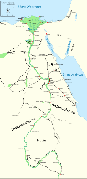
English: Map of Ancient Egypt, showing the Nile up to the fifth cataract, and major cities and sites of the Dynastic period (c. 3150 BC to 30 BC). Jerusalem is shown as reference cities. |
| 日期 | |
| 来源 |
Own work. See #References for references used creating the map. |
| 作者 | Gigillo83 |
| 其他版本 |
[]
|


|
This SVG file contains embedded text that can be translated into your language, using any capable SVG editor, text editor or the SVG Translate tool. For more information see: About translating SVG files. |
许可协议
[编辑]
我,本作品著作权人,特此采用以下许可协议发表本作品:

|
已授权您依据自由软件基金会发行的无固定段落及封面封底文字(Invariant Sections, Front-Cover Texts, and Back-Cover Texts)的GNU自由文件许可协议1.2版或任意后续版本的条款,复制、传播和/或修改本文件。该协议的副本请见“GNU Free Documentation License”。 |
This file is licensed under the Creative Commons Attribution-Share Alike Attribution-Share Alike 4.0 International, 3.0 Unported, 2.5 Generic, 2.0 Generic and 1.0 Generic license.
- 您可以自由地:
- 共享 – 复制、发行并传播本作品
- 修改 – 改编作品
- 惟须遵守下列条件:
- 署名 – 您必须对作品进行署名,提供授权条款的链接,并说明是否对原始内容进行了更改。您可以用任何合理的方式来署名,但不得以任何方式表明许可人认可您或您的使用。
- 相同方式共享 – 如果您再混合、转换或者基于本作品进行创作,您必须以与原先许可协议相同或相兼容的许可协议分发您贡献的作品。
您可以选择您需要的许可协议。
References
[编辑]
Resources used to create the map:
- Shaw, Ian , ed. (2003年) 《 The Oxford History of Ancient Egypt》、Oxford University Press ISBN: 0-19-280293-3.
- Dr. Peter Der Manuelian , ed. (1998年) 《 Egypt: The World of the Pharaohs》、Bonner Straße, Köln (Deutschland): Könemann Verlagsgesellschaft mbH ISBN: 3-89508-913-3.
- Digital Egypt - maps. Retrieved on 2007-11-25.
- NASA PIA04957. Retrieved on 2007-11-25.
- NASA PIA02647. Retrieved on 2007-11-25.
- NASA PIA04965. Retrieved on 2007-11-25.
Reference coordinates:
- Sais 30°57′53″N, 30°46′6″E
- Buto 31°11′47″N, 30°44′41″E
- Alexandria 31°11′53″N 29°55′09″E
- Naukratis 30°54' N 30°35'E coordinates here
- Tanis 30°58′37″N, 31°52′48″E
- Avaris 30°47′N, 31°50′E
- Busiris 30°54′40″N, 31°14′40″E
原始上传日志
[编辑]
The original description page is/was here. All following user names refer to Commons.
- 2009-01-29 13:21 Bibi Saint-Pol 1577×3219×0 (412000 bytes) (remove wrong text, adjust frame)
- 2009-01-29 12:47 Bibi Saint-Pol 1577×3219×0 (413000 bytes) (added frame)
- 2009-01-29 12:35 Bibi Saint-Pol 1577×3219×0 (412000 bytes) (harmonize colors with the standards + replace unsupported Arial fonts by DejaVu )
- 2008-02-11 06:55 Jeff Dahl 1577×3219×0 (391000 bytes) (sp fx)
- 2007-11-29 02:09 Jeff Dahl 1577×3219×0 (391000 bytes) (Rotate Mediterranean Sea label)
- 2007-11-27 23:32 Jeff Dahl 1577×3219×0 (391000 bytes) (Minor adjustments to Naukratis and Buto)
- 2007-11-27 18:59 Jeff Dahl 1577×3219×0 (391000 bytes) (Cairo and Jerusalem now with black dots/italics)
- 2007-11-23 00:04 Jeff Dahl 1577×3219×0 (391000 bytes) (fx scalebar)
- 2007-11-22 23:56 Jeff Dahl 1577×3219×0 (391000 bytes) ({{Information |Description=A map of ancient Egypt, made with Inkscape |Source=self-made |Date=11-22-07 |Author= Jeff Dahl |Permission= |other_versions={{DerivativeVersions|Ancient Egypt map-ru.svg}} }} )
文件历史
点击某个日期/时间查看对应时刻的文件。
| 日期/时间 | 缩略图 | 大小 | 用户 | 备注 | |
|---|---|---|---|---|---|
| 当前 | 2010年3月1日 (一) 21:54 | | 1,577 × 3,219(1.57 MB) | Gigillo83(留言 | 贡献) | Fix write |
| 2010年1月20日 (三) 15:26 |  | 1,577 × 3,219(446 KB) | Gigillo83(留言 | 贡献) | Aggiungo strada | |
| 2010年1月20日 (三) 14:59 |  | 1,577 × 3,219(444 KB) | Gigillo83(留言 | 贡献) | Aggiunti nomi e corretti luoghi | |
| 2010年1月17日 (日) 12:37 |  | 1,577 × 3,219(414 KB) | Gigillo83(留言 | 贡献) | Aggiunte vie e impianti militari | |
| 2010年1月6日 (三) 11:53 |  | 1,577 × 3,219(407 KB) | Gigillo83(留言 | 贡献) | == {{int:filedesc}} == {{inkscape}} {{Information |Description= {{en|Map of Ancient Egypt, showing the Nile up to the fifth cataract, and major cities and sites of the Dynastic period (c. 3150 BC to 30 BC). Jerusalem is shown as reference cities.}} |Sourc |
您不可以覆盖此文件。
文件用途
以下28个页面使用本文件:
- File:Ancient Egypt map-af.svg
- File:Ancient Egypt map-ar.png
- File:Ancient Egypt map-de.svg
- File:Ancient Egypt map-el.svg
- File:Ancient Egypt map-en.svg
- File:Ancient Egypt map-es.svg
- File:Ancient Egypt map-fr.svg
- File:Ancient Egypt map-hiero.svg
- File:Ancient Egypt map-it.svg
- File:Ancient Egypt map-la.png
- File:Ancient Egypt map-la.svg
- File:Ancient Egypt map-lat.svg(文件重定向)
- File:Ancient Egypt map-mk.svg
- File:Ancient Egypt map-nl.svg
- File:Ancient Egypt map-no.svg
- File:Ancient Egypt map-pl.svg
- File:Ancient Egypt map-pt.svg
- File:Ancient Egypt map-ru.svg
- File:Ancient Egypt map-sk.svg
- File:Ancient Egypt map-sr.svg
- File:Ancient Egypt map-vi.svg
- File:Ancient Egypt map-zh-hans.svg
- File:Antik Mısır haritası.png
- File:Antzinako Egipto.svg
- File:Mapo de antikva Egiptio.jpg
- File:Mapo de antikva Egiptio - centro.jpg
- File:Muistne Egiptus.png
- Template:Other versions/Ancient Egypt map
全域文件用途
以下其他wiki使用此文件:
- bg.wikipedia.org上的用途
- cv.wikipedia.org上的用途
- el.wikipedia.org上的用途
- en.wikipedia.org上的用途
- es.wikipedia.org上的用途
- fr.wikipedia.org上的用途
- he.wikipedia.org上的用途
- it.wikipedia.org上的用途
- Limes (storia romana)
- Egitto (provincia romana)
- Prefetto d'Egitto
- Dodecascheno
- Augusto
- Campagne augustee lungo il fronte africano ed arabico
- Limes africano
- Progetto:Laboratorio grafico/Immagini da migliorare/Archivio risolte/39
- Via Hadriana
- Classis Alexandrina
- Politica estera di Augusto
- Utente:Barjimoa/SandboxP
- la.wikipedia.org上的用途
- mk.wikipedia.org上的用途
- nl.wikipedia.org上的用途
- pl.wikipedia.org上的用途
- ru.wikipedia.org上的用途
- uk.wikipedia.org上的用途
- www.wikidata.org上的用途