File:Anderson Building (Omaha) from NW 1.JPG
Jump to navigation
Jump to search

Size of this preview: 800 × 373 pixels. Other resolutions: 320 × 149 pixels | 640 × 299 pixels | 1,024 × 478 pixels | 1,280 × 597 pixels | 2,287 × 1,067 pixels.
Original file (2,287 × 1,067 pixels, file size: 984 KB, MIME type: image/jpeg)
Captions
Captions
Add a one-line explanation of what this file represents
|
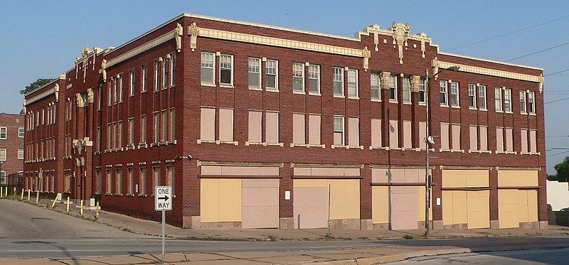
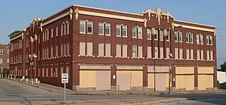
This is an image of a place or building that is listed on the National Register of Historic Places in the United States of America. Its reference number is 9000938. |
Summary[edit]
_from_NW_1.JPG&action=edit§ion=1)
| Description |
English: Anderson Building, located at southeast corner of 24th and Jones Streets in Omaha, Nebraska; seen from the northwest. The west side faces 24th; the north side, Jones. |
| Date | |
| Source | Own work |
| Author | Ammodramus |
| Object location | | View this and other nearby images on: OpenStreetMap |
|---|
_from_NW_1.JPG¶ms=041.253000_N_-095.946670_E_globe:Earth_class:object_region:US_type:landmark_scale:1500_&language=en)
Licensing[edit]
_from_NW_1.JPG&action=edit§ion=2)
I, the copyright holder of this work, hereby publish it under the following license:
| This file is made available under the Creative Commons CC0 1.0 Universal Public Domain Dedication. | |
| The person who associated a work with this deed has dedicated the work to the public domain by waiving all of their rights to the work worldwide under copyright law, including all related and neighboring rights, to the extent allowed by law. You can copy, modify, distribute and perform the work, even for commercial purposes, all without asking permission.
|
File history
Click on a date/time to view the file as it appeared at that time.
| Date/Time | Thumbnail | Dimensions | User | Comment | |
|---|---|---|---|---|---|
| current | 21:03, 30 June 2012 | | 2,287 × 1,067 (984 KB) | Ammodramus (talk | contribs) |
You cannot overwrite this file.
File usage on Commons
The following page uses this file:
File usage on other wikis
The following other wikis use this file:
- Usage on en.wikipedia.org
- Usage on www.wikidata.org
_from_NW_1.JPG&oldid=792140927)