File:Andes Subdivisions according to Tanner, Borsdorf, Stadel (modified).png

Original file (247 × 925 pixels, file size: 45 KB, MIME type: image/png)
Captions
Captions
Summary[edit]
.png&action=edit§ion=1)
| Description |
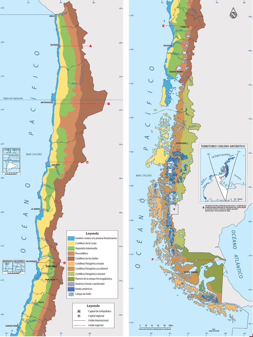
Gliederung der Anden nach Tanner, Borsdorf, Stadel (verändert) Quellen / Hinweis
Die bei Borsdorf und Stadel gezeigte Karte der Anden-Gliederung Abb. 1-2 auf S. 4 (verändert nach Tanner, Kartographie: K. Heinrich, , 2013) ist sehr stark schematisiert und an mehreren Stellen fehlerhaft. Die Übertragung erforderte daher die Hinzuziehung weiterer Kartenwerke, insbesondere:
|
| Date | |
| Source |
Own work Ausschnitt der Wikimedia-Karte "File:Landforms-Worldmap.png" (Darstellung der Gebirge nach Deniz Karagülle et al., vorwiegend relative Höhen und Hangneigungen) Legende Westkordillere
Zentralkordillere
Ostkordillere
Altiplano/Puna
Ausläufer und Küstengebirge
Östliche Vorgebirge |
| Author | Fährtenleser |
Licensing[edit]
.png&action=edit§ion=4)

|
Permission is granted to copy, distribute and/or modify this document under the terms of the GNU Free Documentation License, Version 1.2 or any later version published by the Free Software Foundation; with no Invariant Sections, no Front-Cover Texts, and no Back-Cover Texts. A copy of the license is included in the section entitled GNU Free Documentation License. |
- You are free:
- to share – to copy, distribute and transmit the work
- to remix – to adapt the work
- Under the following conditions:
- attribution – You must give appropriate credit, provide a link to the license, and indicate if changes were made. You may do so in any reasonable manner, but not in any way that suggests the licensor endorses you or your use.
- share alike – If you remix, transform, or build upon the material, you must distribute your contributions under the same or compatible license as the original.
File history
Click on a date/time to view the file as it appeared at that time.
| Date/Time | Thumbnail | Dimensions | User | Comment | |
|---|---|---|---|---|---|
| current | 13:48, 22 September 2021 | 247 × 925 (45 KB) | Fährtenleser (talk | contribs) | Beschriftung Incahuasi fehlte | |
| 10:01, 15 September 2021 | 247 × 925 (45 KB) | Fährtenleser (talk | contribs) | {{Information |Description=Gliederung der Anden nach Tanner, Borsdorf, Stadel (verändert) |Source={{own}} |Date=2021-09-15 |Author= Fährtenleser |Permission= |other_versions= }} Category:Maps of the Andes |
You cannot overwrite this file.
File usage on Commons
There are no pages that use this file.
File usage on other wikis
The following other wikis use this file:
- Usage on de.wikipedia.org
.png&oldid=792148792)