File:Andorra location map.svg
跳至導覽
跳至搜尋

此 SVG 檔案的 PNG 預覽的大小:683 × 599 像素。 其他解析度:274 × 240 像素 | 547 × 480 像素 | 875 × 768 像素 | 1,167 × 1,024 像素 | 2,333 × 2,048 像素 | 1,161 × 1,019 像素。
原始檔案 (SVG 檔案,表面大小:1,161 × 1,019 像素,檔案大小:149 KB)
說明
說明
添加單行說明來描述出檔案所代表的內容
摘要
[編輯]| 描述 |
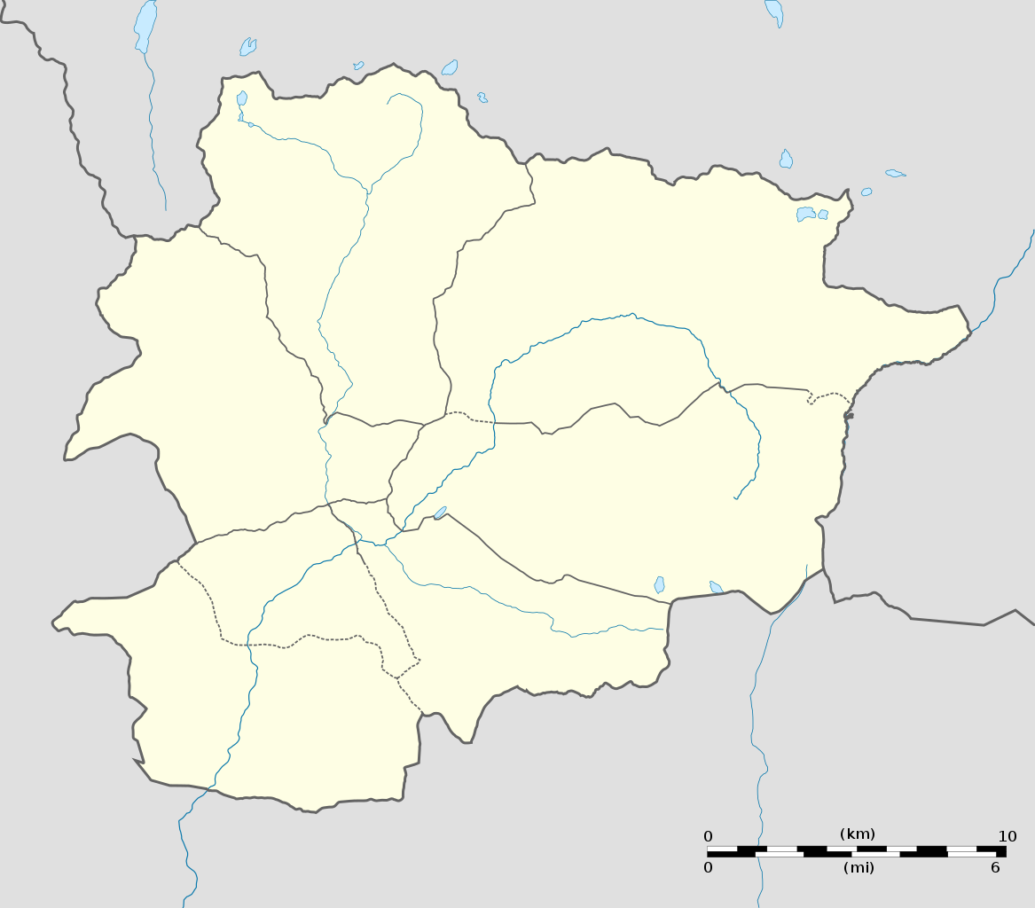
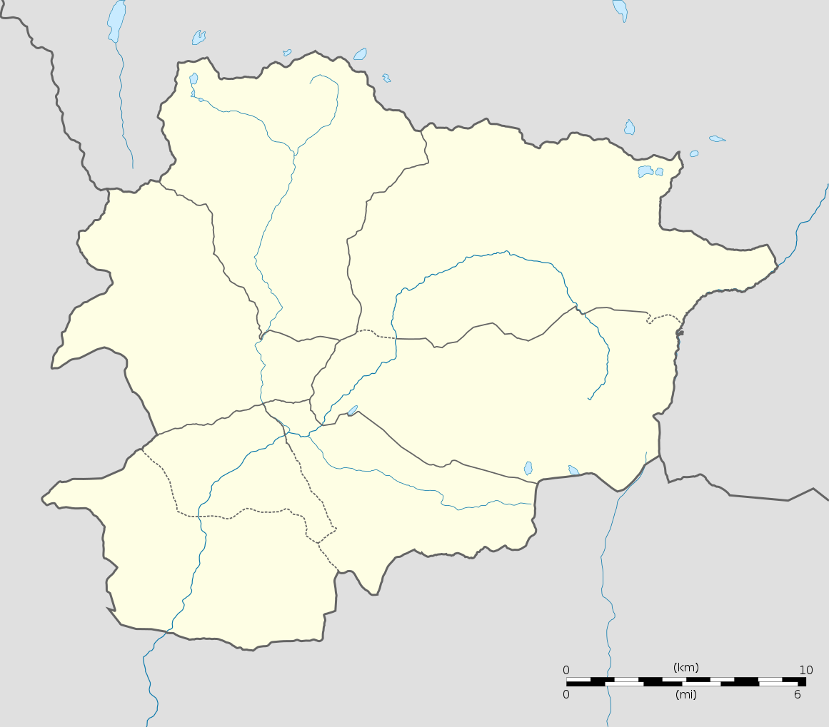
English: Blank administrative map of Andorra with parishes boundaries for geo-location purpose.
Note: Dotted lines are boundaries estimated from very small scale reference maps. Français : Carte administrative vierge de l'Andorre avec limites des paroisses destinée à la géolocalisation. Note : les lignes pointillées sont des limites estimées à partir de cartes de référence à très petite échelle. Equirectangular projection, WGS84 datum
Topographic scale: 1:372,000 (precision: 93 m)
|
||
| 日期 | |||
| 來源 |
自己的作品 (Original text: Own work) |
||
| 作者 | Eric Gaba (Sting - fr:Sting) | ||
| 授權許可 (重用此檔案) |
|
||
| 其他版本 |
|
||
| SVG開發 |

| 拍攝地點 | | 位於此地的本圖片與其他圖片: OpenStreetMap |
|---|
授權條款
[編輯]
我,本作品的著作權持有者,決定用以下授權條款發佈本作品:
此檔案採用創用CC 姓名標示-相同方式分享 3.0 未在地化版本授權條款。
- 您可以自由:
- 分享 – 複製、發佈和傳播本作品
- 重新修改 – 創作演繹作品
- 惟需遵照下列條件:
- 姓名標示 – 您必須指名出正確的製作者,和提供授權條款的連結,以及表示是否有對內容上做出變更。您可以用任何合理的方式來行動,但不得以任何方式表明授權條款是對您許可或是由您所使用。
- 相同方式分享 – 如果您利用本素材進行再混合、轉換或創作,您必須基於如同原先的相同或兼容的條款,來分布您的貢獻成品。

|
已授權您依據自由軟體基金會發行的無固定段落、封面文字和封底文字GNU自由文件授權條款1.2版或任意後續版本,對本檔進行複製、傳播和/或修改。該協議的副本列在GNU自由文件授權條款中。 |
您可以選擇您需要的授權條款。
檔案歷史
點選日期/時間以檢視該時間的檔案版本。
| 日期/時間 | 縮圖 | 尺寸 | 使用者 | 備註 | |
|---|---|---|---|---|---|
| 目前 | 2010年12月27日 (一) 20:06 | | 1,161 × 1,019(149 KB) | Sting(留言 | 貢獻) | Added parishes boundaries (some of them estimated) |
| 2008年12月17日 (三) 20:02 |  | 1,161 × 1,019(142 KB) | Sting(留言 | 貢獻) | Deleted temporary parishes boundaries | |
| 2008年12月17日 (三) 20:01 |  | 1,161 × 1,019(171 KB) | Sting(留言 | 貢獻) | Corrections on international boundaries; added (incomplete but reliable) parishes boundaries | |
| 2008年12月16日 (二) 20:24 |  | 1,161 × 1,019(116 KB) | Sting(留言 | 貢獻) | == Summary == {{Location|42|32|15|N|01|36|00|E|scale:200000}} <br/> {{Information |Description={{en|Blank administrative map of Andorra for geo-location purpose.}} {{fr|Carte administrative vierge de l'Andorre destinée à |
無法覆蓋此檔案。
檔案用途
下列12個頁面有用到此檔案:
- Andorra
- User:Sting/Gallery: Location and locator maps
- User talk:NordNordWest/Archive12
- File:Andorra la Vella in Andorra.svg
- File:Andorra relief location map.jpg
- File:Canillo in Andorra.svg
- File:Encamp in Andorra.svg
- File:Escaldes-Engordany in Andorra.svg
- File:La Massana in Andorra.svg
- File:Ordino in Andorra.svg
- File:Sant Julia de Loria in Andorra.svg
- Category:Andorra
全域檔案使用狀況
以下其他 wiki 使用了這個檔案:
- af.wikipedia.org 的使用狀況
- an.wikipedia.org 的使用狀況
- ar.wikipedia.org 的使用狀況
- ast.wikipedia.org 的使用狀況
- Les Escaldes
- Puertu d'Envalira
- Andorra la Vieya
- Soldeu
- Llagos de Tristaina
- El Tarter
- Incles
- Arans
- Comapedrosa
- Módulu:Mapa de llocalización/datos/Andorra
- Módulu:Mapa de llocalización/datos/Andorra/usu
- Helipuertu d'Andorra la Vieya
- Casa de la Vall
- Ilesia de San Esteban (Andorra)
- Pont de la Margineda
- Ilesia de Sant Vicenç d'Enclar
- Ilesia de Santa Coloma (Andorra)
- Hospital Nostra Senyora de Meritxell
- av.wikipedia.org 的使用狀況
- az.wikipedia.org 的使用狀況
- ba.wikipedia.org 的使用狀況
- be-tarask.wikipedia.org 的使用狀況
- be.wikipedia.org 的使用狀況
- bg.wikipedia.org 的使用狀況
- bn.wikipedia.org 的使用狀況
- bs.wikipedia.org 的使用狀況
檢視此檔案的更多全域使用狀況。