File:Angel Ramos Building at Guajataka.jpg
From Wikimedia Commons, the free media repository
Jump to navigation
Jump to search
Size of this preview: 800 × 600 pixels. Other resolutions: 320 × 240 pixels | 640 × 480 pixels | 1,024 × 768 pixels | 1,280 × 960 pixels | 2,560 × 1,920 pixels | 4,032 × 3,024 pixels.
Original file (4,032 × 3,024 pixels, file size: 3.47 MB, MIME type: image/jpeg)
File information
Structured data
Captions
Summary[edit]
DescriptionAngel Ramos Building at Guajataka.jpg |
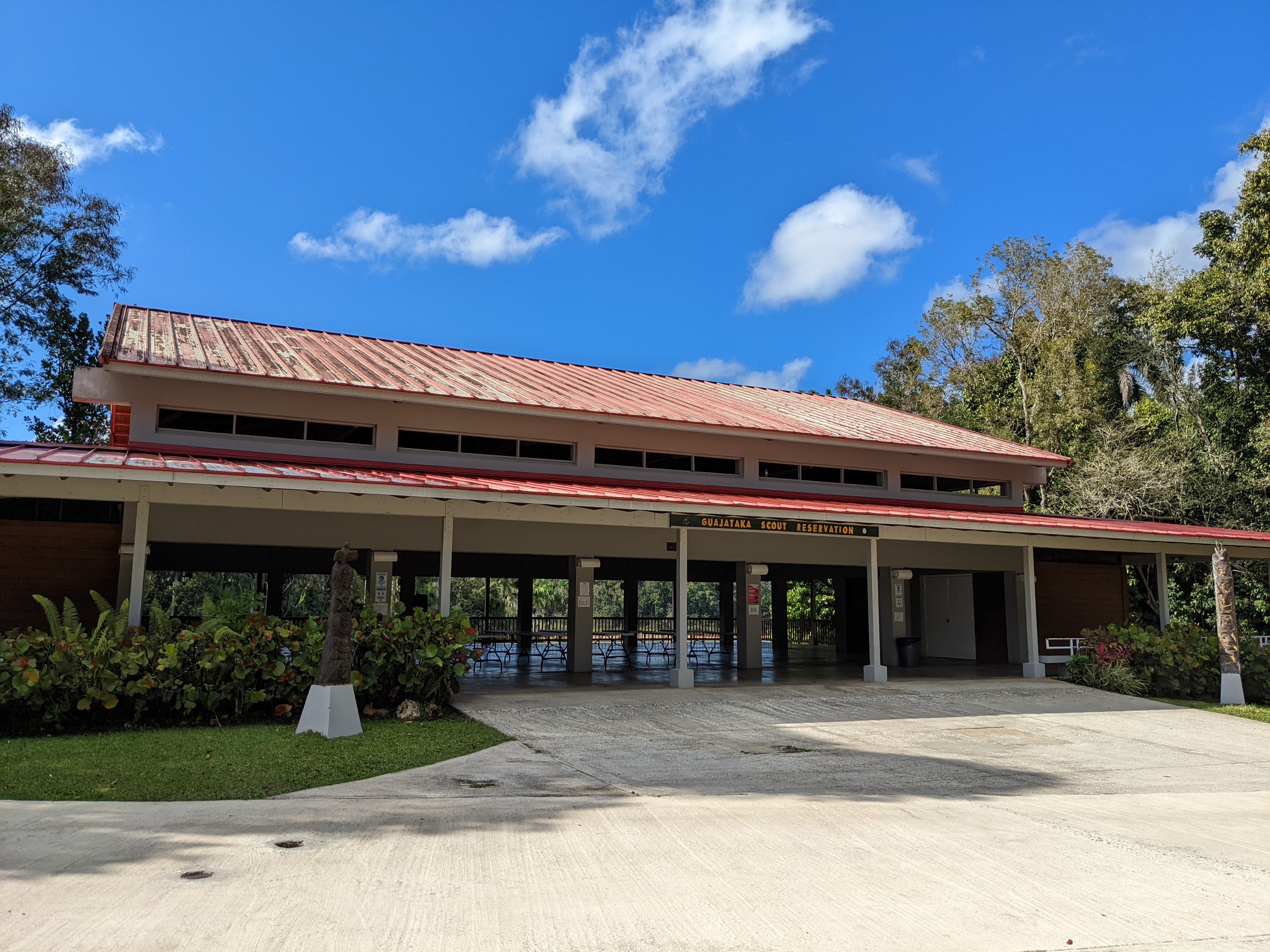
English: Angel Ramos Building at Guajataka Scout Reservation where group activities and conferences can be held. |
Date | |
Source | Own work |
Author | Jmoliver |
Camera location | 18° 22′ 07.25″ N, 66° 55′ 11.6″ W | View this and other nearby images on: OpenStreetMap | 18.368681; -66.919889 |
---|
Licensing[edit]
I, the copyright holder of this work, hereby publish it under the following license:
This file is licensed under the Creative Commons Attribution-Share Alike 4.0 International license.
- You are free:
- to share – to copy, distribute and transmit the work
- to remix – to adapt the work
- Under the following conditions:
- attribution – You must give appropriate credit, provide a link to the license, and indicate if changes were made. You may do so in any reasonable manner, but not in any way that suggests the licensor endorses you or your use.
- share alike – If you remix, transform, or build upon the material, you must distribute your contributions under the same or compatible license as the original.
File history
Click on a date/time to view the file as it appeared at that time.
Date/Time | Thumbnail | Dimensions | User | Comment | |
---|---|---|---|---|---|
current | 18:31, 2 March 2022 | 4,032 × 3,024 (3.47 MB) | Jmoliver (talk | contribs) | Cross-wiki upload from en.wikipedia.org |
You cannot overwrite this file.
File usage on Commons
There are no pages that use this file.
File usage on other wikis
The following other wikis use this file:
- Usage on en.wikipedia.org
Metadata
This file contains additional information such as Exif metadata which may have been added by the digital camera, scanner, or software program used to create or digitize it. If the file has been modified from its original state, some details such as the timestamp may not fully reflect those of the original file. The timestamp is only as accurate as the clock in the camera, and it may be completely wrong.
Camera manufacturer | |
---|---|
Camera model | Pixel 5a |
Copyright holder |
|
Exposure time | 299/1,000,000 sec (0.000299) |
F-number | f/1.73 |
ISO speed rating | 60 |
Date and time of data generation | 15:34, 25 February 2022 |
Lens focal length | 4.38 mm |
Latitude | 18° 22′ 7.25″ N |
Longitude | 66° 55′ 11.6″ W |
Altitude | 214 meters above sea level |
Author | José Oliver-Didier |
City shown | San Sebastián |
City that the picture was taken in | San Sebastián |
Width | 4,032 px |
Height | 3,024 px |
Orientation | Normal |
Horizontal resolution | 72 dpi |
Vertical resolution | 72 dpi |
Software used | HDR+ 1.0.423370582zd |
File change date and time | 15:34, 25 February 2022 |
Y and C positioning | Centered |
Exposure Program | Normal program |
Exif version | 2.31 |
Date and time of digitizing | 15:34, 25 February 2022 |
Meaning of each component |
|
APEX shutter speed | 11.71 |
APEX aperture | 1.58 |
APEX brightness | 9.03 |
APEX exposure bias | 0 |
Maximum land aperture | 1.58 APEX (f/1.73) |
Subject distance | 5.994 meters |
Metering mode | Center weighted average |
Flash | Flash did not fire, compulsory flash suppression |
DateTime subseconds | 285 |
DateTimeOriginal subseconds | 285 |
DateTimeDigitized subseconds | 285 |
Supported Flashpix version | 1 |
Color space | sRGB |
Sensing method | One-chip color area sensor |
Scene type | A directly photographed image |
Custom image processing | Custom process |
Exposure mode | Auto exposure |
White balance | Auto white balance |
Digital zoom ratio | 0 |
Focal length in 35 mm film | 27 mm |
Scene capture type | Standard |
Contrast | Normal |
Saturation | Normal |
Sharpness | Normal |
Subject distance range | Distant view |
GPS time (atomic clock) | 19:34 |
Reference for direction of image | True direction |
Direction of image | 340.61 |
Latitude destination | 18° 22′ 7.82″ N |
Longitude of destination | 66° 55′ 11.81″ W |
GPS date | 25 February 2022 |
Sublocation of city shown | Guajataka Scout Reservation |
Province or state shown | Puerto Rico |
Code for country shown | PRI |
Country shown | Puerto Rico |
IIM version | 4 |
Geodetic survey data used | WGS-84 |
GPS tag version | 2.2.0.0 |
Code for the country that the picture was taken in | PRI |
Country that the picture was taken in | Puerto Rico |
Province or state that the picture was taken in | Puerto Rico |
Sublocation of the city that the picture was taken in | Guajataka Scout Reservation |