File:Annisquam Bridge, Spanning Lobster Cove between Washington & River S, Gloucester (Essex County, Massachusetts).jpg
Jump to navigation
Jump to search

Size of this preview: 761 × 600 pixels. Other resolutions: 305 × 240 pixels | 609 × 480 pixels | 974 × 768 pixels | 1,280 × 1,009 pixels | 2,560 × 2,018 pixels | 4,579 × 3,610 pixels.
Original file (4,579 × 3,610 pixels, file size: 2.01 MB, MIME type: image/jpeg)
Captions
Captions
Add a one-line explanation of what this file represents
|
This is an image of a place or building that is listed on the National Register of Historic Places in the United States of America. Its reference number is 83000572. |
Summary
[edit]| Description |
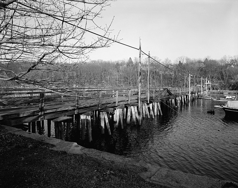
English: Annisquam Bridge, Spanning Lobster Cove between Washington & River S, Gloucester (Essex County, Massachusetts) |
||
| Date | |||
| Source |
Historic American Engineering Record, Library of Congress, Call number HAER MASS,5-GLO,4-3
|
||
| Author | Jeffrey C. Howry, Photographer |

.jpg&action=edit§ion=1)
| Object location | | View this and other nearby images on: OpenStreetMap |
|---|
.jpg¶ms=042.655000_N_-070.675700_E_globe:Earth_class:object_region:US_type:landmark_scale:1500_&language=en)
Licensing
[edit].jpg&action=edit§ion=2)
| This image or media file contains material based on a work of a National Park Service employee, created as part of that person's official duties. As a work of the U.S. federal government, such work is in the public domain in the United States. See the NPS website and NPS copyright policy for more information. |
|
File history
Click on a date/time to view the file as it appeared at that time.
| Date/Time | Thumbnail | Dimensions | User | Comment | |
|---|---|---|---|---|---|
| current | 13:43, 21 January 2010 | | 4,579 × 3,610 (2.01 MB) | Martin H. (talk | contribs) | from full size |
| 16:41, 17 January 2010 |  | 952 × 696 (215 KB) | KudzuVine (talk | contribs) | {{Information |Description={{en|1=Annisquam Bridge, Spanning Lobster Cove between Washington & River S, Gloucester (Essex County, Massachusetts) cropped {{PD-USGov-NPS-HAER|MASS,5-GLO,4-3}}}} |Source=http://memory.loc.gov/pnp/habshaer/ma/ma1300/ma1327/pho |
You cannot overwrite this file.
File usage on Commons
There are no pages that use this file.
File usage on other wikis
The following other wikis use this file:
- Usage on en.wikipedia.org
- Usage on simple.wikipedia.org
- Usage on www.wikidata.org
.jpg&oldid=796062389)