File:Antarctica2.jpg
Zur Navigation springen
Zur Suche springen
Es ist keine höhere Auflösung vorhanden.
Antarctica2.jpg (700 × 567 Pixel, Dateigröße: 76 KB, MIME-Typ: image/jpeg)
Bildtexte
Kurzbeschreibungen
Ergänze eine einzeilige Erklärung, was diese Datei darstellt.

|
This map has been uploaded by Electionworld from en.wikipedia.org to enable the |
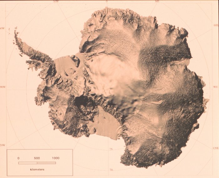
Shaded relief map of Antarctica developed from RADARSAT Synthetic Aperture Radar data. RADARSAT is a Canadian satellite.
Source: U.S. National Oceanic & Atmospheric Administration
Diese Datei ist gemeinfrei (public domain), weil sie Material enthält, das von einem Angestellten der National Oceanic and Atmospheric Administration im Verlaufe seiner offiziellen Arbeit erstellt wurde.
|
Dateiversionen
Klicke auf einen Zeitpunkt, um diese Version zu laden.
| Version vom | Vorschaubild | Maße | Benutzer | Kommentar | |
|---|---|---|---|---|---|
| aktuell | 23:22, 1. Dez. 2006 | | 700 × 567 (76 KB) | Electionworld (Diskussion | Beiträge) | {{ew|en|Andre Engels}} Shaded relief map of Antarctica developed from RADARSAT Synthetic Aperture Radar data. RADARSAT is a Canadian satellite. Source: U.S. National Oceanic & Atmospheric Administration {{PD-USGov-NOAA}} [http://www.photolib.noaa.gov/c |
Du kannst diese Datei nicht überschreiben.
Dateiverwendung
Die folgenden 2 Seiten verwenden diese Datei:
Globale Dateiverwendung
Die nachfolgenden anderen Wikis verwenden diese Datei:
- Verwendung auf ar.wikipedia.org
- Verwendung auf de.wikipedia.org
- Verwendung auf en.wikiversity.org
- User:Marshallsumter/Radiation astronomy2/Radios
- User:Marshallsumter/Radiation astronomy2/Radios/Quiz
- User:Marshallsumter/Radiation astronomy/Courses/Principles/Hourly 3
- User:Marshallsumter/Radiation astronomy2/Radars
- User:Marshallsumter/Radiation astronomy/Courses/Principles/Final quiz
- Titan/Quiz
- Moon/Quiz
- Stars/Sun/Heliology/Quiz
- Earth/Quiz
- Radiation/Electromagnetics
- Stars/Reds/Quiz
- User:Marshallsumter/Radiation astronomy1/Millimeters/Quiz
- Verwendung auf hu.wikipedia.org
- Verwendung auf ja.wikipedia.org
- Verwendung auf szl.wikipedia.org