Category:Topographic maps of Antarctica
Jump to navigation
Jump to search
Subcategories
This category has the following 3 subcategories, out of 3 total.
Media in category "Topographic maps of Antarctica"
The following 95 files are in this category, out of 95 total.
-
 AA bedrock bedmap2.4960.tif 1,920 × 1,080; 3.66 MB
-
 AA bedrock surface.4960.tif 1,920 × 1,080; 2.4 MB
-
 AmesRangeMap.jpg 1,000 × 800; 165 KB
-
 Ant hypso.png 737 × 620; 82 KB
-
 Ant relief.png 800 × 797; 162 KB
-
 Ant reljeef.png 600 × 598; 93 KB
-
 Antarctica (version 2).svg 512 × 511; 1.17 MB
-
 Antarctica de.png 2,842 × 2,834; 1.29 MB
-
 Antarctica de.svg 907 × 906; 4.6 MB
-
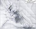
 Antarctica major geographical features.jpg 1,671 × 1,394; 543 KB
-
 Antarctica sl.svg 907 × 906; 5.09 MB
-
 Antarctica surface.jpg 1,026 × 918; 106 KB
-
 Antarctica Without Ice Sheet.png 782 × 1,000; 675 KB
-
 Antarctica-eo.svg 907 × 906; 4.18 MB
-
 Antarctica-est.svg 907 × 906; 4.18 MB
-
 Antarctica-mk.svg 907 × 906; 5.01 MB
-
 Antarctica-pl.svg 907 × 906; 5 MB
-
 Antarctica-ru.svg 512 × 511; 669 KB
-
 Antarctica-vi.svg 512 × 511; 793 KB
-
 Antarctica.svg 512 × 511; 655 KB
-
 Antarctica2.jpg 700 × 567; 76 KB
-
 Antartic - Topografia.png 1,376 × 1,367; 582 KB
-
 ASPA-126-Byers-Peninsula.png 1,848 × 1,298; 1.23 MB
-
 Bowles Ridge and Tangra Mountains BG.png 7,016 × 9,933; 10.96 MB
-
 Bowles Ridge and Tangra Mountains.png 7,016 × 9,933; 11.08 MB
-
 British Antarctic Territory (in Antarctica).svg 907 × 906; 4.53 MB
-
 British Antarctic Territory map.svg 438 × 416; 4.53 MB
-
 Bryan Coast to Ellsworth Land.jpg 4,096 × 3,702; 1.03 MB
-
 Bulgarian-Base-Map-EN.PNG 2,798 × 2,571; 432 KB
-
 Bulgarian-Base-Map.tif 3,194 × 2,800; 1.98 MB
-
 CraryMtnsMap.jpg 1,000 × 800; 145 KB
-
 Deception Island Map lv.svg 820 × 763; 768 KB
-
 Deception Island Map.svg 820 × 763; 461 KB
-
 Deglaciated Antarctic Topography.png 782 × 882; 669 KB
-
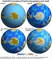 Earth2014 visualisation Antarctica.jpg 2,500 × 2,830; 710 KB
-
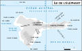
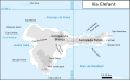 Elephant Island map-CA.svg 702 × 433; 67 KB
-
 Elephant Island map-en.svg 702 × 433; 68 KB
-
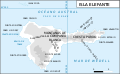 Elephant Island map-es.svg 702 × 433; 68 KB
-
 Elephant Island map-fr.svg 702 × 433; 68 KB
-
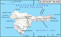 Elephant map.png 702 × 433; 110 KB
-
 Ellsworth Land - Palmer Land.jpg 4,096 × 3,165; 1.35 MB
-
 Great Soviet Encyclopedia, 1-st edition, vol.03. img 01.jpg 3,916 × 5,766; 21.04 MB
-
 Greenwich es.png 764 × 473; 352 KB
-
 Greenwich-Island.jpg 2,623 × 1,468; 1.85 MB
-
 HamptonMap.jpg 1,000 × 800; 126 KB
-
 Ile de Greenwich (carte-fr).svg 1,102 × 683; 343 KB
-
 Ile de la Deception Norwegian.svg 820 × 763; 291 KB
-
 Ile de la Deception.svg 820 × 763; 454 KB
-
 Islas del Atlántico Sur department.PNG 1,184 × 1,068; 447 KB
-
 Kgeorge map.png 660 × 402; 296 KB
-
 King George Island map-en.svg 661 × 403; 209 KB
-
 King George Island map-es.svg 661 × 403; 200 KB
-
 King George Island map-fr.svg 661 × 403; 260 KB
-
 Lake Vanda map.jpg 800 × 386; 123 KB
-
 Livingston-Greenwich-map-no-photos.jpg 7,824 × 3,164; 2.78 MB
-
 Livingston-Greenwich-map.jpg 7,828 × 5,386; 5.07 MB
-
 Livingston-Island-Map-2010-15.jpg 5,337 × 4,006; 3.26 MB
-
 Livingston-Island-Map-2010-15.png 5,337 × 4,006; 9.65 MB
-
 Livingston-Island-Map-2010-BG.jpg 5,029 × 3,490; 6.8 MB
-
 Livingston-Island-Map-2010.jpg 5,027 × 3,487; 7.07 MB
-
 Livingston-Island-Overview-Map.tif 6,096 × 3,974; 2.87 MB
-
 Mcmurdo sound USGS map.jpg 800 × 574; 138 KB
-
 MOUNT THURMAN.pdf 6,875 × 5,312; 813 KB
-
 MountBerlinMap.jpg 1,000 × 800; 179 KB
-
 MountMelbourneMap.jpg 1,000 × 800; 216 KB
-
 MountMoultonMap.jpg 1,000 × 800; 172 KB
-
 MountMurphyMap.jpg 1,000 × 800; 161 KB
-
 MountOverlordMap.jpg 1,000 × 800; 212 KB
-
 MountSidleyWaescheMap.jpg 1,000 × 800; 181 KB
-
 MountTakaheMap.jpg 1,000 × 800; 139 KB
-
 MountToneyMap.jpg 1,000 × 800; 154 KB
-
 Orcadas.png 538 × 365; 15 KB
-
 Palmer Land North USGS Sketch.jpg 2,759 × 4,096; 1.42 MB
-
 Ross Island Map topo-en.svg 1,510 × 1,211; 421 KB
-
 Ross Island Map topo-fr.svg 1,510 × 1,211; 461 KB
-
 Ross Island Map topo-HE.svg 1,510 × 1,211; 417 KB
-
 Ross Island Map topo-mk.svg 1,510 × 1,211; 866 KB
-
 Ross Island Mapa topografico ESP.svg 1,510 × 1,211; 418 KB
-
 Smith-Island-Map-2010.jpg 2,127 × 1,780; 822 KB
-
 Tangra-2004-05-Survey-Route.jpg 1,709 × 1,681; 981 KB
-
 Tangra-2004-5-Survey-Route.png 1,709 × 1,681; 8.23 MB
-
 Tangra-Map.jpg 2,297 × 1,435; 1.91 MB
-
 Tangra-Route.JPG 2,483 × 2,449; 1,007 KB
-
 Tangra-Survey-Route-Map.png 1,352 × 1,347; 210 KB
-
 Taylor Valley map.jpg 850 × 544; 185 KB
-
 Thurston Island - en.svg 2,328 × 1,322; 278 KB
-
 Thurston Island - fr.svg 2,328 × 1,322; 262 KB
-
 Thurston Island - ru.svg 2,328 × 1,322; 261 KB
-
-
 Thurston Island to Jones Mountains.pdf 10,110 × 8,958; 1.55 MB
-
 Topographic map of antarctica.png 1,000 × 850; 256 KB
-
 Topographic Map of Ellsworth Mountains with interval of 100m.png 2,000 × 1,414; 1.13 MB
-
 Topographic map of the Ellsworth Mountains with an interval of 100m.png 2,000 × 1,414; 1.62 MB
-
 West Antarctica Map 001.png 656 × 758; 220 KB
-
 World map part Antarctica.png 550 × 550; 142 KB


.svg)


.svg)


.svg)


