File:Antigua Estación del Ferrocarril de Bugaba.-.jpg
Jump to navigation
Jump to search

Size of this preview: 800 × 533 pixels. Other resolutions: 320 × 213 pixels | 640 × 427 pixels | 1,024 × 683 pixels | 1,280 × 853 pixels | 2,560 × 1,707 pixels | 6,000 × 4,000 pixels.
Original file (6,000 × 4,000 pixels, file size: 3.13 MB, MIME type: image/jpeg)
Captions
Captions
Add a one-line explanation of what this file represents
Summary
[edit]
| Description |
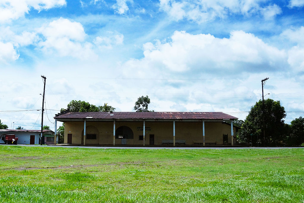
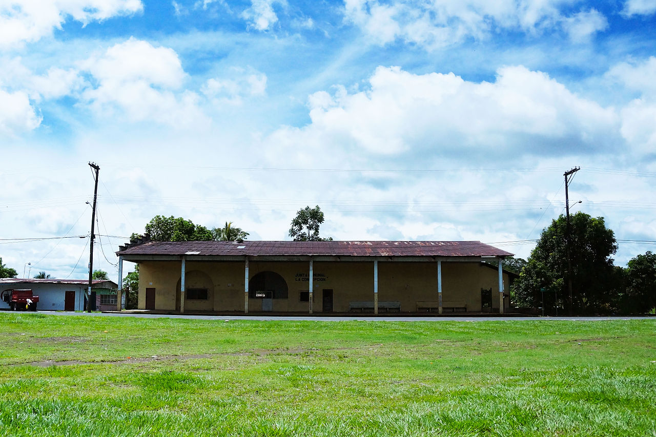
Español: Mediante Ley 44 de 2000 se declaró monumento histórico nacional al edificio que albergó la Estación del Ferrocarril y las áreas colindantes ubicadas en Calle tercera y cuarta Oeste, frente a la Plaza del Ferrocarril.42
La Estación Central estaba ubicada en el edificio que hoy, alberga a la Biblioteca pública Santiago Anguizola Delgado; a un costado de la Gobernación de la Provincia. El 22 de abril de 1916, el presidente Belisario Porras inauguró oficialmente esta obra, cuya extensión fue de 92.517 kilómetros. “El costo de esta obra, según datos del Museo de Obaldía, fue de B/. 1, 670,000 e incluía: talleres, líneas telegráficas y teléfono, locomotoras y carros. Luis Máximo Miranda, profesor de Historia Universal, en la UNACHI, señaló que el pasaje que se cobró inicialmente, fue de un real de estación a estación. Por supuesto, la primera clase pagaba el doble. Como es lógico, años después los costos operativos subieron y se hizo necesaria la figura del colector o encargado de cobrar las tarifas.
|
||
| Date | Taken on 30 September 2013, 12:17:07 | ||
| Source | Own work | ||
| Author | Joseph vasquez alen |
| Camera location | | View this and other nearby images on: OpenStreetMap |
|---|
Licensing
[edit]
I, the copyright holder of this work, hereby publish it under the following license:
This file is licensed under the Creative Commons Attribution-Share Alike 3.0 Unported license.
- You are free:
- to share – to copy, distribute and transmit the work
- to remix – to adapt the work
- Under the following conditions:
- attribution – You must give appropriate credit, provide a link to the license, and indicate if changes were made. You may do so in any reasonable manner, but not in any way that suggests the licensor endorses you or your use.
- share alike – If you remix, transform, or build upon the material, you must distribute your contributions under the same or compatible license as the original.

|
This image was uploaded as part of Wiki Loves Monuments 2013.
|
 |
File history
Click on a date/time to view the file as it appeared at that time.
| Date/Time | Thumbnail | Dimensions | User | Comment | |
|---|---|---|---|---|---|
| current | 23:05, 30 September 2013 | | 6,000 × 4,000 (3.13 MB) | Joseph vasquez alen (talk | contribs) | User created page with UploadWizard |
You cannot overwrite this file.
File usage on Commons
There are no pages that use this file.
File usage on other wikis
The following other wikis use this file:
- Usage on es.wikipedia.org
- Usage on fr.wikipedia.org
- Usage on uk.wikipedia.org