File:Antonio Salamanca, Tabula moderna Terrae Sanctae (FL6879376 2369003).jpg
Jump to navigation
Jump to search
Size of this preview: 800 × 491 pixels. Other resolutions: 320 × 196 pixels | 640 × 393 pixels | 1,024 × 629 pixels | 1,280 × 786 pixels | 3,150 × 1,934 pixels.
Original file (3,150 × 1,934 pixels, file size: 2.5 MB, MIME type: image/jpeg)
Captions
Captions
Add a one-line explanation of what this file represents
Summary
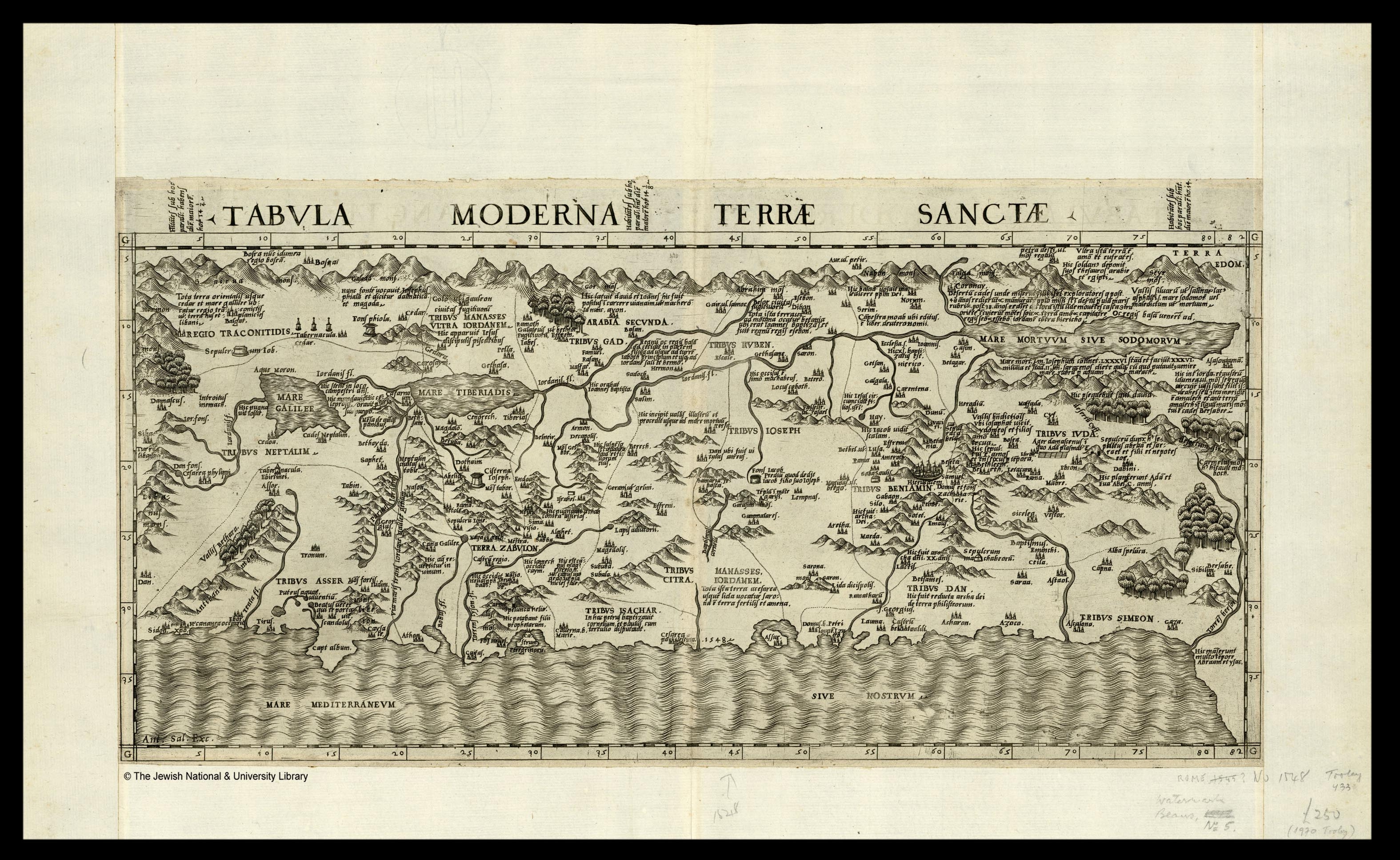
[edit]| Antonio Salamanca: Tabula moderna Terrae Sanctae
( |
|||||||||||||||||||||||||||
|---|---|---|---|---|---|---|---|---|---|---|---|---|---|---|---|---|---|---|---|---|---|---|---|---|---|---|---|
| Artist |
|
||||||||||||||||||||||||||
| Title |
Tabula moderna Terrae Sanctae |
||||||||||||||||||||||||||
| Description |
Tabula moderna Terrae Sanctae. Ant. Sal. Exc. |
||||||||||||||||||||||||||
| Language | Latin | ||||||||||||||||||||||||||
| Publication date | 1548 | ||||||||||||||||||||||||||
| Dimensions | 261 × 510 mm (10.27 × 20.07 in) | ||||||||||||||||||||||||||
| Collection |
|
||||||||||||||||||||||||||
| Current location |
|
||||||||||||||||||||||||||
| Place of publication | Rome | ||||||||||||||||||||||||||
| search Merhav catalog | Rome | ||||||||||||||||||||||||||
| Notes | Copperplate; [Tooley, Italian maps of the 16th century, No. 433. Watermark Beans no.5]; See: Lafréry. A.: Geografia: tavole moderne di geografia de la maggior parte del mondo. Roma, 1575? no.95. | ||||||||||||||||||||||||||
| IE PID | IE6879364 | ||||||||||||||||||||||||||
| Rosetta filename | FL6879376 | ||||||||||||||||||||||||||
| NNL item ID (P3959) | 990023690030205171 | ||||||||||||||||||||||||||
| search Merhav catalog | Latin, Antonio Salamanca | ||||||||||||||||||||||||||
| search Merhav catalog | Twelve tribes of IsraelMaps | ||||||||||||||||||||||||||
| Source/Photographer |
|
||||||||||||||||||||||||||
| Other versions | |||||||||||||||||||||||||||
| Jpg / Tif version |
|
||||||||||||||||||||||||||


.jpg)

.jpg&action=edit§ion=1)
Licensing
[edit].jpg&action=edit§ion=2)
The copyright situation of this work is theoretically uncertain, because in the country of origin copyright lasts 70 years after the death of the author, and the date of the author's death is unknown. However, the date of creation of the work was over 120 years ago, and it is thus a reasonable assumption that the copyright has expired (see here for the community discussion). Do not use this template if the date of death of the author is known.
| |
| This file has been identified as being free of known restrictions under copyright law, including all related and neighboring rights. | |
File history
Click on a date/time to view the file as it appeared at that time.
| Date/Time | Thumbnail | Dimensions | User | Comment | |
|---|---|---|---|---|---|
| current | 22:59, 28 July 2023 | | 3,150 × 1,934 (2.5 MB) | Geagea (talk | contribs) | pattypan 22.03 |
You cannot overwrite this file.
File usage on Commons
The following page uses this file:
.jpg&oldid=799420801)