File:Appalachian Uplands.jpg
Jump to navigation
Jump to search

Size of this preview: 800 × 509 pixels. Other resolutions: 320 × 203 pixels | 640 × 407 pixels | 1,024 × 651 pixels | 1,315 × 836 pixels.
Original file (1,315 × 836 pixels, file size: 112 KB, MIME type: image/jpeg)
Captions
Captions
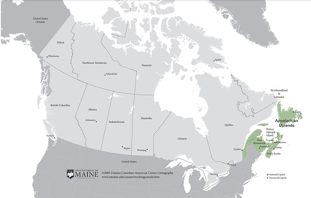
Area of the Appalachian Uplands physiographic region in Canada that is an extension of the Appalachian Highlands in the United States.
Summary
[edit]
| Description |
English: University of Maine Digital Commons 2005 map from Canadian-American Center Cartography. Canadian-American Center Cartography, "Appalachian Uplands Region Map" (2005). Maps for Teaching Canada. 1.
https://digitalcommons.library.umaine.edu/canam_teachmaps/1 |
| Date | |
| Source | https://digitalcommons.library.umaine.edu/canam_teachmaps/1/ |
| Author | University of Maine |
Provide attribution using this citation: Canadian-American Center Cartography, "Appalachian Uplands Region Map" (2005). Maps for Teaching Canada. 1. https://digitalcommons.library.umaine.edu/canam_teachmaps/1
Licensing
[edit]
This file is licensed under the Creative Commons Attribution 4.0 International license.
- You are free:
- to share – to copy, distribute and transmit the work
- to remix – to adapt the work
- Under the following conditions:
- attribution – You must give appropriate credit, provide a link to the license, and indicate if changes were made. You may do so in any reasonable manner, but not in any way that suggests the licensor endorses you or your use.
File history
Click on a date/time to view the file as it appeared at that time.
| Date/Time | Thumbnail | Dimensions | User | Comment | |
|---|---|---|---|---|---|
| current | 17:13, 29 August 2023 | | 1,315 × 836 (112 KB) | Deanrah (talk | contribs) | Uploaded a work by University of Maine from https://digitalcommons.library.umaine.edu/canam_teachmaps/1/ with UploadWizard |
You cannot overwrite this file.
File usage on Commons
There are no pages that use this file.