File:Aquaduct-zuidtangent.jpg
Jump to navigation
Jump to search

Size of this preview: 794 × 599 pixels. Other resolutions: 318 × 240 pixels | 636 × 480 pixels | 1,018 × 768 pixels | 1,280 × 966 pixels | 1,632 × 1,232 pixels.
Original file (1,632 × 1,232 pixels, file size: 621 KB, MIME type: image/jpeg)
Captions
Captions
Add a one-line explanation of what this file represents
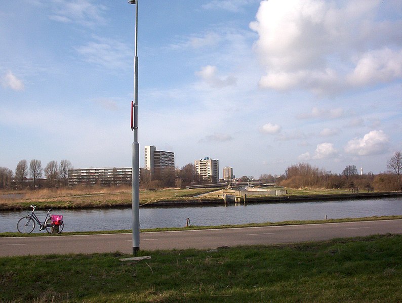
View of ringvaart aquaduct over the Zuid Tangent bus line north of geniedijk (part of Stelling van Amsterdam dike) looking north west at Schalkwijk. The spot is just north of fort Vijfhuizen. On the left hand side of the bus line the geniedijk continues through Haarlem. In the distance to the right is the white radio and television communications tower of KPN, itself situated close to the fort Penningsveer. Photo date: March 2007
| Camera location | | View this and other nearby images on: OpenStreetMap |
|---|
| I, the copyright holder of this work, release this work into the public domain. This applies worldwide. In some countries this may not be legally possible; if so: I grant anyone the right to use this work for any purpose, without any conditions, unless such conditions are required by law. |
File history
Click on a date/time to view the file as it appeared at that time.
| Date/Time | Thumbnail | Dimensions | User | Comment | |
|---|---|---|---|---|---|
| current | 17:20, 28 May 2010 | | 1,632 × 1,232 (621 KB) | Gladiool (talk | contribs) | Fixed color/contrast. |
| 14:10, 4 March 2007 |  | 1,632 × 1,232 (642 KB) | Jane023 (talk | contribs) | View of ringvaart aquaduct over the Zuid Tangent bus line north of geniedijk (part of Stelling van Amsterdam dike) looking north west at Schalkwijk. The spot is just north of fort Vijfhuizen. In the distance to the right is the white radio and television |
You cannot overwrite this file.
File usage on Commons
The following page uses this file:
File usage on other wikis
The following other wikis use this file:
- Usage on en.wikipedia.org
- Usage on nl.wikipedia.org
- Usage on www.wikidata.org