File:Aquidneck Island map.png
(Redirected from File:Aquidneck Island map.gif)
No higher resolution available.
Aquidneck_Island_map.png (238 × 310 pixels, file size: 13 KB, MIME type: image/png)
Captions
Captions
Add a one-line explanation of what this file represents
| Description |
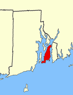
The U.S. state of en:Rhode Island, with en:Aquidneck Island highlighted in red. Created for use on the en:Aquidneck Island article. Original graphic in public domain from NationalAtlas.gov. Modified by Cleared as filed. Aquidneck Island map.png |
| Date | 14 November 2005 (original upload date) |
| Source | Transferred from en.wikipedia to Commons. |
| Author | Cleared as filed at English Wikipedia |
Licensing
[edit]
Cleared as filed at the English-language Wikipedia, the copyright holder of this work, hereby publishes it under the following license:
| This file is licensed under the Creative Commons Attribution-Share Alike 3.0 Unported license. Subject to disclaimers. | ||
| Attribution: Cleared as filed at the English-language Wikipedia | ||
| ||
| This licensing tag was added to this file as part of the GFDL licensing update. |

|
Permission is granted to copy, distribute and/or modify this document under the terms of the GNU Free Documentation License, Version 1.2 or any later version published by the Free Software Foundation; with no Invariant Sections, no Front-Cover Texts, and no Back-Cover Texts. A copy of the license is included in the section entitled GNU Free Documentation License. Subject to disclaimers. |
Original upload log
[edit]
The original description page was here. All following user names refer to en.wikipedia.
- 2005-11-14 02:53 Cleared as filed 238×310×8 (12778 bytes) The U.S. state of [[Rhode Island]], with [[Aquidneck Island]] highlighted in red. Created for use on the [[Aquidneck Island]] article. Original graphic in public domain from NationalAtlas.gov. Modified by [[User:Cleared as filed|Cleared as filed]].
Original upload log
[edit]
| Date/Time | Dimensions | User | Comment |
|---|---|---|---|
| 4 September 2007, 21:47:45 | 238 × 310 (12778 bytes) | Ppntori (talk · contribs) | {{Information |Description=The U.S. state of [[:en:Rhode Island]], with [[:en:Aquidneck Island]] highlighted in red. Created for use on the [[:en:Aquidneck Island]] article. Original graphic in public domain from NationalAtlas.gov. Modified by [[:en:Us |
File history
Click on a date/time to view the file as it appeared at that time.
| Date/Time | Thumbnail | Dimensions | User | Comment | |
|---|---|---|---|---|---|
| current | 19:34, 17 August 2014 | | 238 × 310 (13 KB) | GifTagger (talk | contribs) | Bot: Converting file to superior PNG file. (Source: Aquidneck_Island_map.gif). This GIF was problematic due to non-greyscale color table. |
You cannot overwrite this file.
File usage on Commons
The following 2 pages use this file:
- File:Aquidneck Island map.gif (file redirect)
- Category:Aquidneck Island
File usage on other wikis
The following other wikis use this file:
- Usage on arz.wikipedia.org
- Usage on ceb.wikipedia.org
- Usage on es.wikipedia.org
- Usage on fo.wikipedia.org
- Usage on fr.wikipedia.org
- Usage on it.wikipedia.org
- Usage on ja.wikipedia.org
- Usage on ko.wikipedia.org
- Usage on nl.wikipedia.org
- Usage on ru.wikipedia.org
- Usage on sv.wikipedia.org
- Usage on www.wikidata.org