File:Arab-Israeli Map1.png
(Redirected from File:Arab-Israeli Map1.GIF)

Size of this preview: 800 × 427 pixels. Other resolutions: 320 × 171 pixels | 640 × 342 pixels | 1,090 × 582 pixels.
Original file (1,090 × 582 pixels, file size: 115 KB, MIME type: image/png)
Captions
Captions
Add a one-line explanation of what this file represents
Summary
[edit]
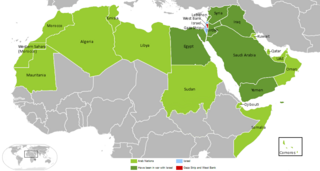
Arab-Israeli Map
Copied from en:Image:Arab-Israeli_Map1.GIF, uploaded by en:User:Arab League on 14:45, 18 August 2006 .
For other version, see Image:Arab Israeli Conflict 4.png
Licensing
[edit]
| This work has been released into the public domain by its author, Arab League at English Wikipedia. This applies worldwide. In some countries this may not be legally possible; if so: Arab League grants anyone the right to use this work for any purpose, without any conditions, unless such conditions are required by law. |
Original upload log
[edit]
| Date/Time | Dimensions | User | Comment |
|---|---|---|---|
| 1 December 2006, 17:12:36 | 819 × 466 (15860 bytes) | Milan.sk (talk · contribs) |
File history
Click on a date/time to view the file as it appeared at that time.
| Date/Time | Thumbnail | Dimensions | User | Comment | |
|---|---|---|---|---|---|
| current | 23:09, 28 March 2018 | | 1,090 × 582 (115 KB) | Maphobbyist (talk | contribs) | South Sudan border in the little world map |
| 21:55, 19 March 2018 |  | 1,090 × 582 (92 KB) | Maphobbyist (talk | contribs) | Modern borders of Turkey, because Hatay Province is part of Turkey since 1939 and borders of South Sudan which became independent in 2011. | |
| 20:36, 18 March 2018 |  | 819 × 466 (17 KB) | Maphobbyist (talk | contribs) | Reverted to version as of 19:39, 17 August 2014 (UTC) | |
| 12:18, 21 January 2017 |  | 800 × 455 (131 KB) | عادل (talk | contribs) | correction of Egypt borders | |
| 19:39, 17 August 2014 |  | 819 × 466 (17 KB) | GifTagger (talk | contribs) | Bot: Converting file to superior PNG file. (Source: Arab-Israeli_Map1.GIF). This GIF was problematic due to non-greyscale color table. |
You cannot overwrite this file.
File usage on Commons
The following 9 pages use this file:
- Atlas of Israel
- User:Geagea/Israel/2017 January 21
- User:Geagea/Israel/2018 March 18
- User:Geagea/Israel/2018 March 19
- User:Geagea/Israel/2018 March 28
- User:Magog the Ogre/Maps of conflicts/2014 August
- User:Magog the Ogre/Maps of conflicts/2017 January
- User:Magog the Ogre/Maps of conflicts/2018 March
- File:Arab-Israeli Map1.GIF (file redirect)
File usage on other wikis
The following other wikis use this file:
- Usage on en.wikipedia.org
- Usage on fr.wikipedia.org
- Usage on sq.wikipedia.org