File:Arable density map 2021.png
Jump to navigation
Jump to search
Size of this preview: 800 × 340 pixels. Other resolutions: 320 × 136 pixels | 640 × 272 pixels | 1,024 × 435 pixels | 2,400 × 1,020 pixels.
Original file (2,400 × 1,020 pixels, file size: 450 KB, MIME type: image/png)
Captions
Captions
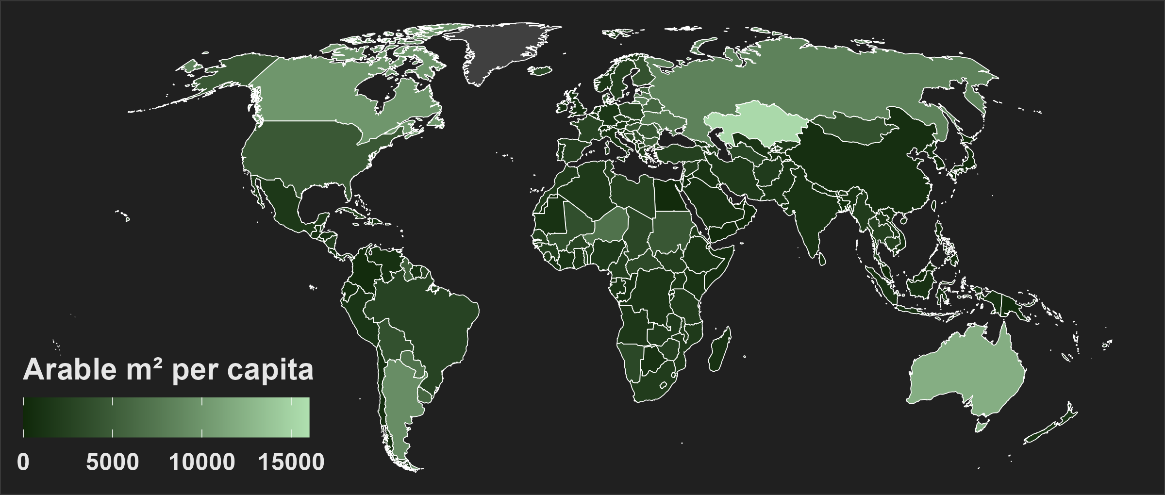
Arable density (mi2 per capita) by country
Summary
[edit]
| Description | |
| Date | |
| Source | Own work |
| Author | Wizmut |
Licensing
[edit]
I, the copyright holder of this work, hereby publish it under the following license:
| This file is made available under the Creative Commons CC0 1.0 Universal Public Domain Dedication. | |
| The person who associated a work with this deed has dedicated the work to the public domain by waiving all of their rights to the work worldwide under copyright law, including all related and neighboring rights, to the extent allowed by law. You can copy, modify, distribute and perform the work, even for commercial purposes, all without asking permission.
|
- ↑ Land Use. fao.org. Retrieved on 25 January 2024.
- ↑ Annual population. fao.org. Retrieved on 25 January 2024.
File history
Click on a date/time to view the file as it appeared at that time.
| Date/Time | Thumbnail | Dimensions | User | Comment | |
|---|---|---|---|---|---|
| current | 22:57, 26 January 2024 | | 2,400 × 1,020 (450 KB) | Wizmut (talk | contribs) | Fix Somaliland (as defined by source) |
| 22:39, 26 January 2024 |  | 2,400 × 1,020 (450 KB) | Wizmut (talk | contribs) | Add greenland (no data) | |
| 22:19, 26 January 2024 |  | 2,400 × 1,020 (440 KB) | Wizmut (talk | contribs) | Uploaded own work with UploadWizard |
You cannot overwrite this file.
File usage on Commons
There are no pages that use this file.
File usage on other wikis
The following other wikis use this file:
- Usage on en.wikipedia.org