File:Arcambal Béars3.JPG
Jump to navigation
Jump to search
Size of this preview: 450 × 600 pixels. Other resolutions: 180 × 240 pixels | 360 × 480 pixels | 576 × 768 pixels | 768 × 1,024 pixels | 1,920 × 2,560 pixels.
Original file (1,920 × 2,560 pixels, file size: 2.7 MB, MIME type: image/jpeg)
Captions
Captions
Add a one-line explanation of what this file represents
Summary
[edit]
| Description |
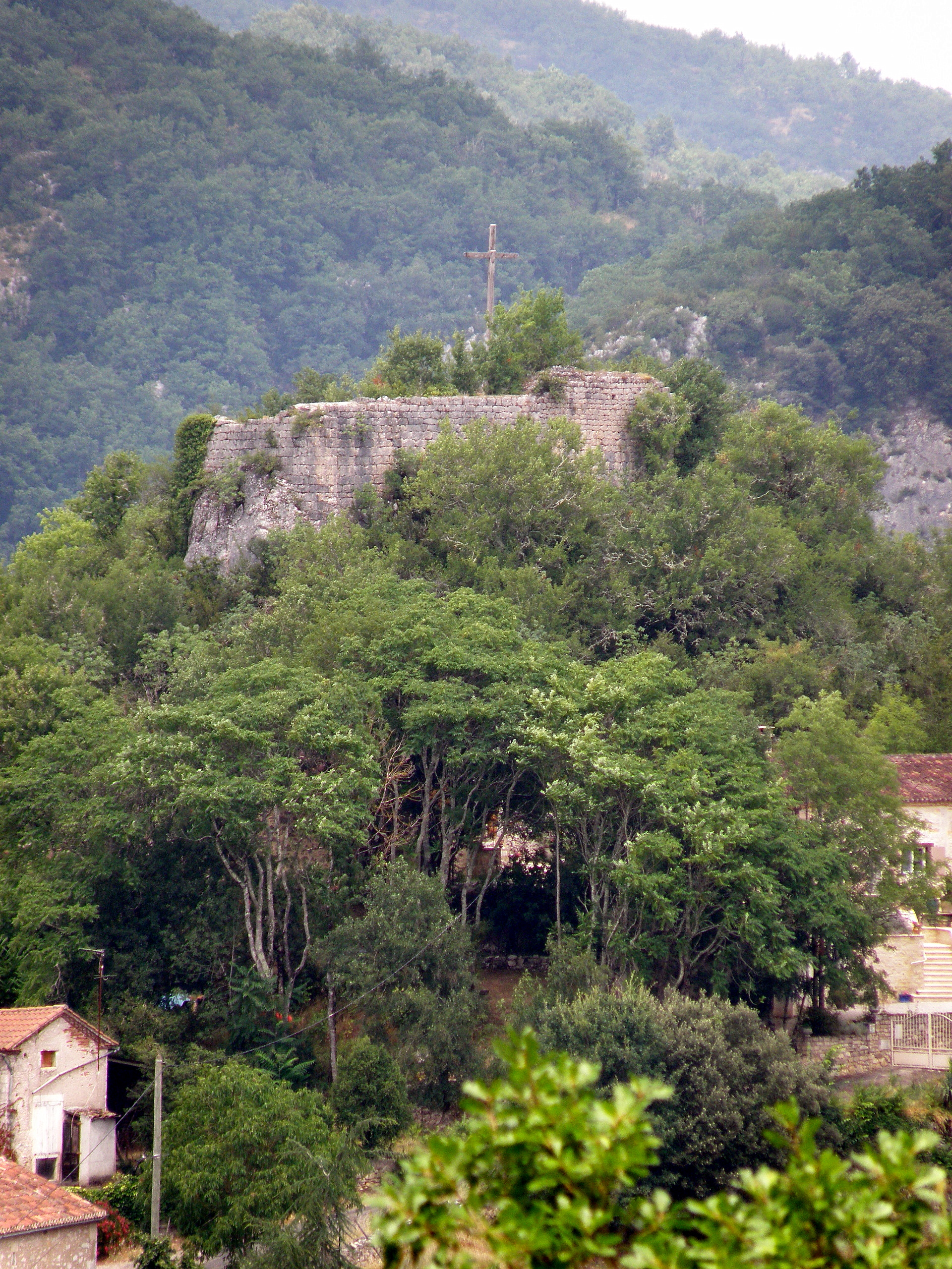
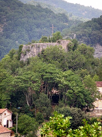
Français : Arcambal, commune et village du département du Lot (région Midi-Pyrénées, France), situé sur la rive gauche (c'est-à-dire sud) de la rivière Lot, env. 5 km (à vol d’oiseau) à l’est de Cahors. Hameau de Béars, situé dans un lobe de méandre du Lot, dans le nord de la commune. Château ruiné coiffant une butte située au centre de la petite localité. Nous regardons vers le nord. |
| Source | Self-photographed |
| Author | Torsade de Pointes |
Licensing
[edit]
| I, the copyright holder of this work, release this work into the public domain. This applies worldwide. In some countries this may not be legally possible; if so: I grant anyone the right to use this work for any purpose, without any conditions, unless such conditions are required by law. |
File history
Click on a date/time to view the file as it appeared at that time.
| Date/Time | Thumbnail | Dimensions | User | Comment | |
|---|---|---|---|---|---|
| current | 17:27, 21 September 2010 | | 1,920 × 2,560 (2.7 MB) | Torsade de Pointes (talk | contribs) | {{Information |Description={{fr|1=Arcambal (Lot) }} |Source=Photographie personnelle |Author=Torsade de Pointes |Date= |Permission= |other_versions= }} |
You cannot overwrite this file.
File usage on Commons
There are no pages that use this file.
File usage on other wikis
The following other wikis use this file: