File:Argentina Santa Fe location map.svg
跳转到导航
跳转到搜索

此SVG文件的PNG预览的大小:360 × 600像素。 其他分辨率:144 × 240像素 | 288 × 480像素 | 461 × 768像素 | 614 × 1,024像素 | 1,229 × 2,048像素 | 720 × 1,200像素。
原始文件 (SVG文件,尺寸为720 × 1,200像素,文件大小:311 KB)
说明
说明
添加一行文字以描述该文件所表现的内容
摘要
[编辑]| 描述 |
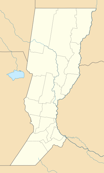
Deutsch: Positionskarte von Santa Fe (Argentinien) English: Location map of Santa Fe province (Argentina) Español: Mapa de localización de la Provincia de Santa Fe.
Equirectangular projection, N/S stretching 115 %. Geographic limits of the map:
|
| 日期 | (UTC) |
| 来源 |
本檔案衍生自: |
| 作者 |
|
| 其他版本 |
|

许可协议
[编辑]
本文件采用知识共享署名-相同方式共享 3.0 未本地化版本许可协议授权。
- 您可以自由地:
- 共享 – 复制、发行并传播本作品
- 修改 – 改编作品
- 惟须遵守下列条件:
- 署名 – 您必须对作品进行署名,提供授权条款的链接,并说明是否对原始内容进行了更改。您可以用任何合理的方式来署名,但不得以任何方式表明许可人认可您或您的使用。
- 相同方式共享 – 如果您再混合、转换或者基于本作品进行创作,您必须以与原先许可协议相同或相兼容的许可协议分发您贡献的作品。
原始上传日志
[编辑]
This image is a derivative work of the following images:
- File:Argentina_location_map.svg licensed with Cc-by-sa-3.0, GFDL
- File:Map_of_Santa_Fe_Province.svg licensed with Cc-by-sa-3.0,2.5,2.0,1.0, GFDL
Uploaded with derivativeFX
文件历史
点击某个日期/时间查看对应时刻的文件。
| 日期/时间 | 缩略图 | 大小 | 用户 | 备注 | |
|---|---|---|---|---|---|
| 当前 | 2017年9月10日 (日) 10:50 | | 720 × 1,200(311 KB) | Milenioscuro(留言 | 贡献) | capas |
| 2014年8月27日 (三) 04:50 |  | 720 × 1,200(484 KB) | קרלוס הגדול(留言 | 贡献) | Border between Buenos Aires to Cordoba | |
| 2013年7月11日 (四) 14:54 |  | 720 × 1,200(484 KB) | Milenioscuro(留言 | 贡献) | == {{int:filedesc}} == {{Information |Description={{de|Positionskarte von Santa Fe (Argentinien)}}{{en|Location map of Santa Fe province (Argentina)}}{{es|1=Mapa de localización de la Provincia de Santa Fe.}} Equi... |
您不可以覆盖此文件。
文件用途
以下15个页面使用本文件:
- File:Argentina Santa Fe topographic location map.png
- Category:Association football clubs of Santa Fe Province
- Category:Births in Santa Fe Province
- Category:Cities in Santa Fe Province
- Category:Deaths in Santa Fe Province
- Category:Departments of Santa Fe Province
- Category:Maps of Santa Fe Province
- Category:Municipalities in Santa Fe Province
- Category:People of Santa Fe Province
- Category:Populated places in Santa Fe Province
- Category:Rail transport in Santa Fe Province
- Category:Santa Fe Province
- Category:Sports in Santa Fe Province
- Category:Train stations in Santa Fe Province
- Category:Transport in Santa Fe Province
全域文件用途
以下其他wiki使用此文件:
- de.wikipedia.org上的用途
- Pati (Talsperre)
- Estadio Monumental Rafaela
- Estadio 15 de Abril
- Wikipedia:Kartenwerkstatt/Positionskarten/Südamerika
- Estadio Marcelo Bielsa
- Estadio Gigante de Arroyito
- Estadio Brigadier General Estanislao López
- Benutzer:Kaisehr74/In Arbeit 8
- Puente Colgante de Santa Fe
- Vorlage:Positionskarte Argentinien Santa Fe
- Flughafen Reconquista
- en.wikipedia.org上的用途
- Rosario
- Santa Fe, Argentina
- Roldán, Santa Fe
- Rafaela
- Aarón Castellanos, Santa Fe
- Castellanos, Santa Fe
- Ramona, Santa Fe
- Llambi Campbell
- Module:Location map/data/Argentina Santa Fe Province
- Module:Location map/data/Argentina Santa Fe Province/doc
- Humberto Primo
- San Antonio, Santa Fe
- San Antonio-Castellanos
- Grutly
- eo.wikipedia.org上的用途
- es.wikipedia.org上的用途
查看此文件的更多全域用途。