File:Arizona US Congressional District 8 (since 2013).tif
Salta a la navegació
Salta a la cerca

Mida d'aquesta previsualització PNG del fitxer TIF: 800 × 389 píxels. Altres resolucions: 320 × 156 píxels | 640 × 311 píxels | 1.024 × 498 píxels | 2.072 × 1.008 píxels.
Fitxer original (2.072 × 1.008 píxels, mida del fitxer: 3,15 Mo, tipus MIME: image/tiff)
Llegendes
Llegendes
Afegeix una explicació d'una línia del que representa aquest fitxer
Resum[modifica]
| Descripció |
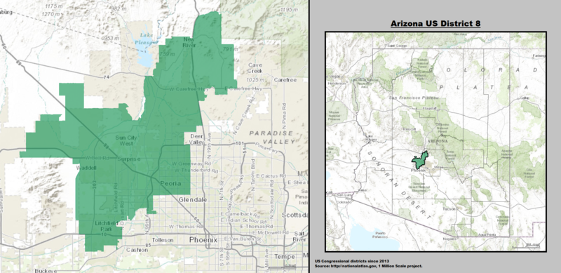
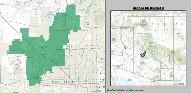
English: Boundaries for Arizona’s 8th United States Federal Congressional District. |
| Data | |
| Font | GIS shapefile data created by the United States Department of the Interior, as part of the "1 Million Scale" geospatial data project. Retrieved from: http://nationalatlas.gov/atlasftp-1m.html?openChapters=#chpbound |
| Autor | 1: GIS (congressional districts, 2013) shapefile data was created by the United States Department of the Interior. 2: Data was rendered using ArcGIS® software by Esri. 3: File developed for use on Wikipedia and elsewhere by 7partparadigm. |
Llicència[modifica]
This map was obtained from an edition of the National Atlas of the United States. Like almost all works of the U.S. federal government, works from the National Atlas are in the public domain in the United States.
Online access: NationalAtlas.gov | 1970 print edition: Library of Congress, Perry-Castañeda Library
|
Historial del fitxer
Cliqueu una data/hora per veure el fitxer tal com era aleshores.
| Data/hora | Miniatura | Dimensions | Usuari/a | Comentari | |
|---|---|---|---|---|---|
| actual | 21:20, 15 maig 2014 |  | 2.072 × 1.008 (3,15 Mo) | 7partparadigm (discussió | contribucions) | User created page with UploadWizard |
No podeu sobreescriure aquest fitxer.
Ús del fitxer
Les 2 pàgines següents utilitzen aquest fitxer:
Ús global del fitxer
Utilització d'aquest fitxer en altres wikis:
- Utilització a ca.wikipedia.org
- Utilització a de.wikipedia.org
- Utilització a en.wikipedia.org
- Utilització a fa.wikipedia.org
- Utilització a fr.wikipedia.org
- Utilització a hu.wikipedia.org
- Utilització a it.wikipedia.org
- Utilització a www.wikidata.org