File:Arkansas-second-congressional-district.svg
跳至導覽
跳至搜尋

此 SVG 檔案的 PNG 預覽的大小:554 × 491 像素。 其他解析度:271 × 240 像素 | 542 × 480 像素 | 867 × 768 像素 | 1,155 × 1,024 像素 | 2,311 × 2,048 像素。
原始檔案 (SVG 檔案,表面大小:554 × 491 像素,檔案大小:269 KB)
說明
說明
添加單行說明來描述出檔案所代表的內容
摘要
[編輯]
| 描述 |
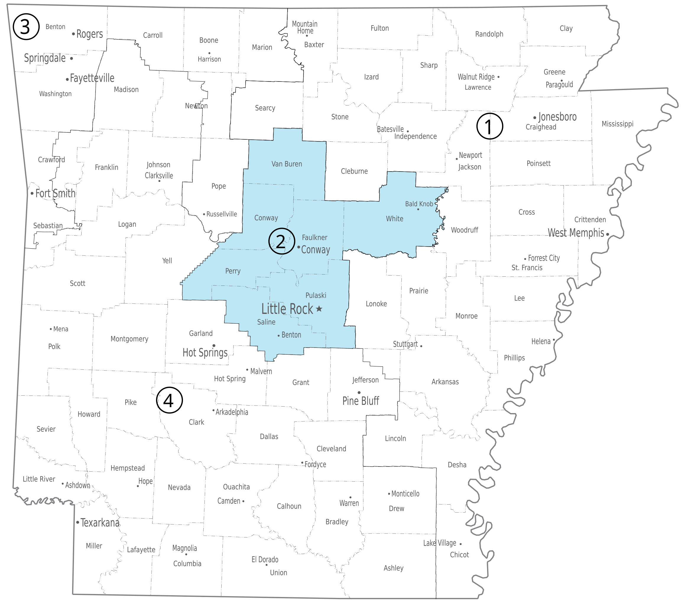
English: Second congressional district of the U.S. state of Arkansas. |
| 日期 | |
| 來源 | U.S. National Atlas, http://www.nationalatlas.gov/printable/images/pdf/congdist/pagecgd113_ar.pdf |
| 作者 | U.S. Government |
授權條款
[編輯]
本地圖取自美國國家地圖集的某個版本。國家地圖集的絕大多數作品是美國聯邦政府的作品,因此屬於公有領域。
連結網址︰ NationalAtlas.gov | 1970年印刷版︰ 國會檔案館, Perry-Castañeda圖書館
|
檔案歷史
點選日期/時間以檢視該時間的檔案版本。
| 日期/時間 | 縮圖 | 尺寸 | 用戶 | 備註 | |
|---|---|---|---|---|---|
| 目前 | 2014年4月12日 (六) 21:13 | | 554 × 491(269 KB) | Granttchart(對話 | 貢獻) | Save without Illustrator metadata, fix some drawing issues |
| 2014年4月12日 (六) 16:27 |  | 554 × 491(2.71 MB) | Granttchart(對話 | 貢獻) | {{Information |Description ={{en|1==={{int:filedesc}}== {{Information |description={{en|1=Second congressional district of the U.S. state of Arkansas.}} |date=2014-04-12 10:20:25 |source=U.S. National Atlas, http://www.nationalatlas.gov/printable/im... |
無法覆蓋此檔案。
檔案用途
下列2個頁面有用到此檔案:
全域檔案使用狀況
以下其他 wiki 使用了這個檔案:
- fr.wikipedia.org 的使用狀況
- nl.wikipedia.org 的使用狀況
- simple.wikipedia.org 的使用狀況
- www.wikidata.org 的使用狀況
- zh.wikipedia.org 的使用狀況