File:Armenia locator map ITA.png
Jump to navigation
Jump to search
No higher resolution available.
Armenia_locator_map_ITA.png (330 × 354 pixels, file size: 9 KB, MIME type: image/png)
Captions
Captions
Add a one-line explanation of what this file represents
Summary
[edit]
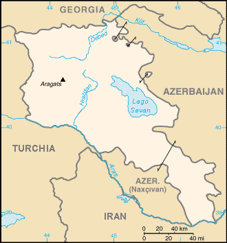
| Description | Armenia locator map |
| Date | |
| Source | Own work |
| Author | Vilnius |
Licensing
[edit]
| I, the copyright holder of this work, release this work into the public domain. This applies worldwide. In some countries this may not be legally possible; if so: I grant anyone the right to use this work for any purpose, without any conditions, unless such conditions are required by law. |
File history
Click on a date/time to view the file as it appeared at that time.
| Date/Time | Thumbnail | Dimensions | User | Comment | |
|---|---|---|---|---|---|
| current | 15:03, 17 March 2008 | | 330 × 354 (9 KB) | Vilnius~commonswiki (talk | contribs) | This picture is the italian translation of a map from The CIA World Fact Book, representing Armenia and its region. |
| 12:52, 17 March 2008 |  | 300 × 302 (28 KB) | Vilnius~commonswiki (talk | contribs) | {{Information |Description= Armenia locator map |Source=self-made |Date=17/03/2008 |Author= Vilnius |Permission= |other_versions= }} |
You cannot overwrite this file.
File usage on Commons
There are no pages that use this file.
File usage on other wikis
The following other wikis use this file:
- Usage on ace.wikipedia.org
- Usage on ca.wikipedia.org
- Usage on en.wikipedia.org
- Usage on fa.wikipedia.org
- Usage on ur.wikipedia.org
- Usage on www.wikidata.org