File:Arnimer Dorfstraße 29.jpg
Jump to navigation
Jump to search
Size of this preview: 799 × 599 pixels. Other resolutions: 320 × 240 pixels | 640 × 480 pixels | 1,024 × 768 pixels | 1,280 × 960 pixels | 1,702 × 1,277 pixels.
Original file (1,702 × 1,277 pixels, file size: 1.02 MB, MIME type: image/jpeg)
Captions
Captions
Add a one-line explanation of what this file represents
Summary
[edit]
| Description |
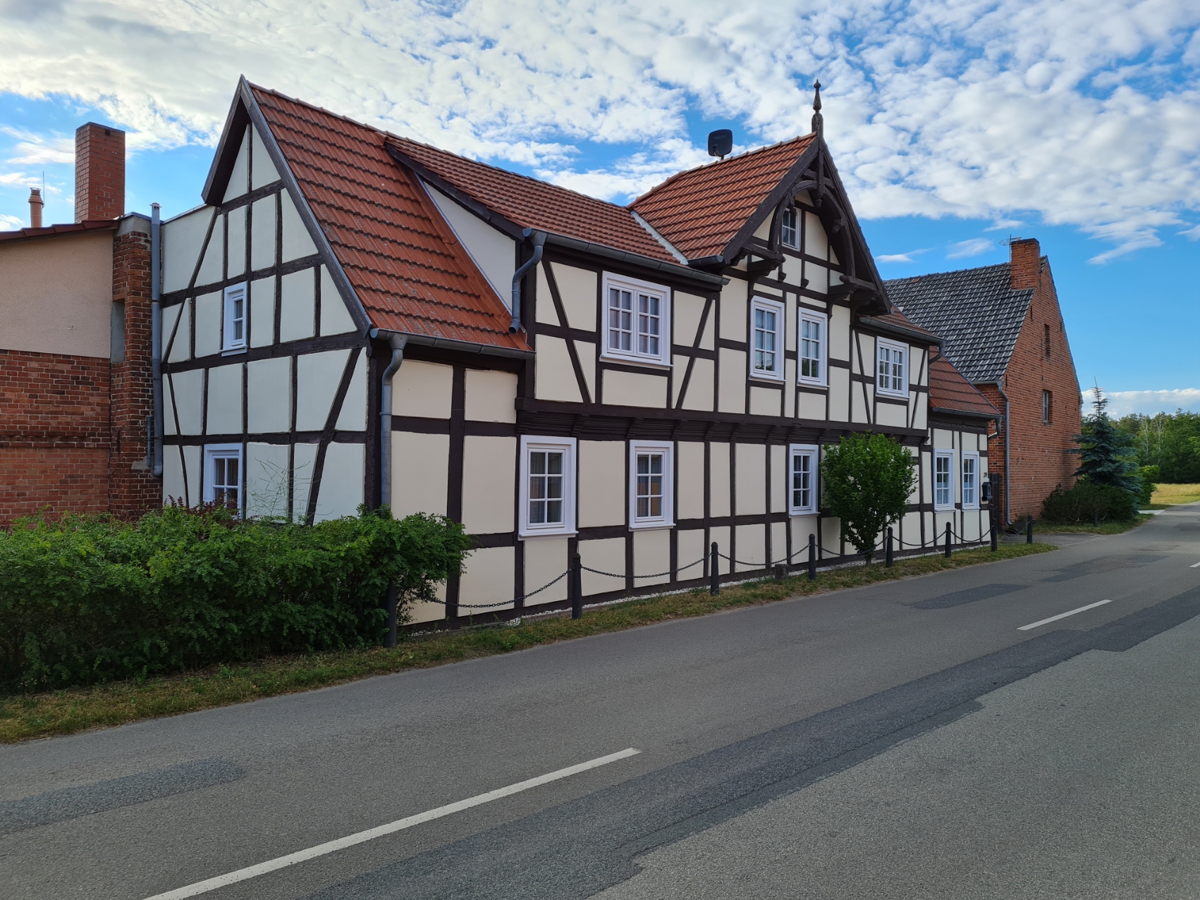
Deutsch: Arnimer Dorfstraße 29 (Bauernhaus) |
| Date | |
| Source | Own work |
| Author | Ortssucher |
| Camera location | | View this and other nearby images on: OpenStreetMap |
|---|
| Object location | | View this and other nearby images on: OpenStreetMap |
|---|
This is a picture of the Saxony-Anhalt Kulturdenkmal (cultural heritage monument) with the ID 09409882 (Wikidata)
|
Licensing
[edit]
I, the copyright holder of this work, hereby publish it under the following license:
This file is licensed under the Creative Commons Attribution-Share Alike 4.0 International license.
- You are free:
- to share – to copy, distribute and transmit the work
- to remix – to adapt the work
- Under the following conditions:
- attribution – You must give appropriate credit, provide a link to the license, and indicate if changes were made. You may do so in any reasonable manner, but not in any way that suggests the licensor endorses you or your use.
- share alike – If you remix, transform, or build upon the material, you must distribute your contributions under the same or compatible license as the original.
File history
Click on a date/time to view the file as it appeared at that time.
| Date/Time | Thumbnail | Dimensions | User | Comment | |
|---|---|---|---|---|---|
| current | 15:47, 19 June 2022 | | 1,702 × 1,277 (1.02 MB) | Ortssucher (talk | contribs) | == {{int:filedesc}} == {{Information |description={{de|1=Arnimer Dorfstraße 29 (Bauernhaus)}} |date=2022-06-13 |source={{own}} |Author=Ortssucher |permission= |other versions= }} {{Location|52.62725|11.94796}} {{Object location|52.62735|11.94786}} {{Baudenkmal Sachsen-Anhalt|09409882}} =={{int:license-header}}== {{self|cc-by-sa-4.0}} Category:Arnim (Stendal) Category:Cultural heritage monuments in Stendal |
You cannot overwrite this file.
File usage on Commons
There are no pages that use this file.
File usage on other wikis
The following other wikis use this file:
- Usage on de.wikipedia.org