File:Aspachmühle 2018 04.JPG
Jump to navigation
Jump to search

Size of this preview: 800 × 561 pixels. Other resolutions: 320 × 224 pixels | 640 × 449 pixels | 1,024 × 718 pixels | 1,280 × 898 pixels | 2,560 × 1,795 pixels | 4,500 × 3,156 pixels.
Original file (4,500 × 3,156 pixels, file size: 8.15 MB, MIME type: image/jpeg)
Captions
Captions
Add a one-line explanation of what this file represents
Summary[edit]
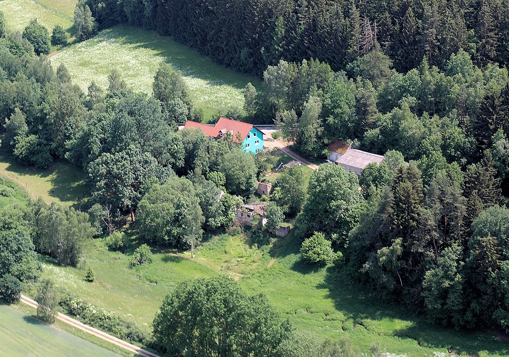
| Description | Die Aspachmühle liegt am Stelzlmühlbach. Von der alten Mühle sind nur noch einige Fundamentreste vorhanden. |
| Date | |
| Source | Own work |
| Author | A. Köppl |
| Permission (Reusing this file) |
Bei Verwendung des Bildes Zusatz angeben: (Zusatz = Alois Köppl, Gleiritsch) |
Licensing[edit]
I, the copyright holder of this work, hereby publish it under the following license:
This file is licensed under the Creative Commons Attribution 3.0 Unported license.
- You are free:
- to share – to copy, distribute and transmit the work
- to remix – to adapt the work
- Under the following conditions:
- attribution – You must give appropriate credit, provide a link to the license, and indicate if changes were made. You may do so in any reasonable manner, but not in any way that suggests the licensor endorses you or your use.
File history
Click on a date/time to view the file as it appeared at that time.
| Date/Time | Thumbnail | Dimensions | User | Comment | |
|---|---|---|---|---|---|
| current | 12:38, 15 February 2023 | | 4,500 × 3,156 (8.15 MB) | A. Köppl (talk | contribs) | {{Information |Description=Die Aspachmühle liegt am Stelzlmühlbach. Von der alten Mühle sind nur noch einige Fundamentreste vorhanden. |Source={{own}} |Date=2018 |Author= A. Köppl |Permission=Bei Verwendung des Bildes Zusatz angeben: (Zusatz = Alois Köppl, Gleiritsh) |other_versions= }} Category:Aerial photographs of Aspachmühle |
You cannot overwrite this file.
File usage on Commons
There are no pages that use this file.
File usage on other wikis
The following other wikis use this file:
- Usage on de.wikipedia.org