File:Assateague Island aerial view.jpg
Ir a la navegación
Ir a la búsqueda

Tamaño de esta previsualización: 800 × 534 píxeles. Otras resoluciones: 320 × 214 píxeles | 640 × 427 píxeles | 1024 × 683 píxeles | 1500 × 1001 píxeles.
Archivo original (1500 × 1001 píxeles; tamaño de archivo: 593 kB; tipo MIME: image/jpeg)
Leyendas
Leyendas
Añade una explicación corta acerca de lo que representa este archivo
| Descripción |
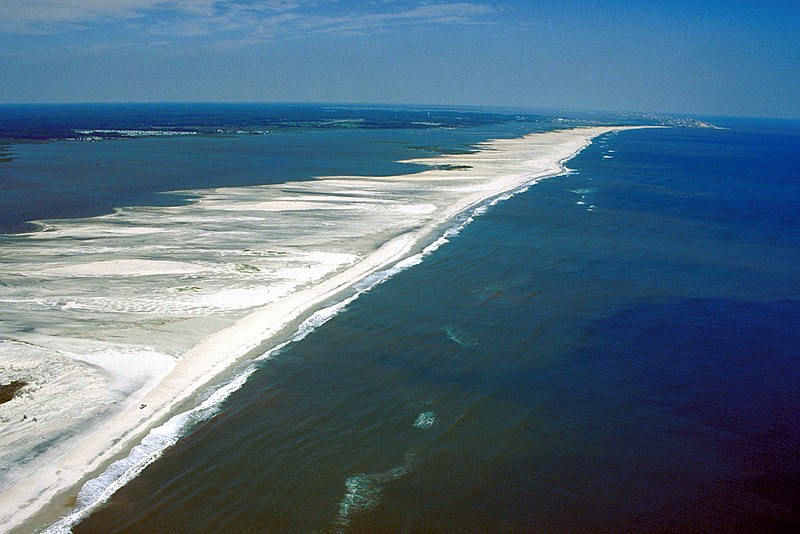
English: Aerial view of Assateague Island on the Atlantic Ocean in Maryland, USA.
|
|||
| Fecha | ||||
| Fuente |
U.S. Army Corps of Engineers Digital Visual Library Image page Image description page Digital Visual Library home page |
|||
| Autor | Susanne Bledsoe, U.S. Army Corps of Engineers | |||
| Permiso (Reutilización de este archivo) |
|
|||
| Localización | Assateague Island, Worcester County, Maryland, USA |
| Posición de la cámara | | Ubicación de esta y otras imágenes en: OpenStreetMap |
|---|
Historial del archivo
Haz clic sobre una fecha y hora para ver el archivo tal como apareció en ese momento.
| Fecha y hora | Miniatura | Dimensiones | Usuario | Comentario | |
|---|---|---|---|---|---|
| actual | 01:02 8 abr 2007 | | 1500 × 1001 (593 kB) | DanMS (discusión | contribs.) | {{Information | Description = {{en|Aerial view of Assateague Island on the Atlantic Ocean in Maryland, USA. The photograph shows the erosion to the beaches due to Atlantic storms. In the far distance at the top right is Ocean City, Maryland.}} | |
No puedes sobrescribir este archivo.
Usos del archivo
No hay páginas que enlacen a este archivo.
Uso global del archivo
Las wikis siguientes utilizan este archivo:
- Uso en de.wikipedia.org
- Uso en en.wikipedia.org
- Uso en es.wikipedia.org
- Uso en fa.wikipedia.org
- Uso en fr.wikipedia.org
- Uso en gl.wikipedia.org
- Uso en ko.wikipedia.org
- Uso en tr.wikipedia.org
- Uso en uk.wikipedia.org