File:Atu feb 21 2011.jpg
Jump to navigation
Jump to search

Size of this preview: 459 × 599 pixels. Other resolutions: 184 × 240 pixels | 368 × 480 pixels | 588 × 768 pixels | 784 × 1,024 pixels | 1,569 × 2,048 pixels | 7,200 × 9,400 pixels.
Original file (7,200 × 9,400 pixels, file size: 8.58 MB, MIME type: image/jpeg)
Captions
Captions
Add a one-line explanation of what this file represents
| Warning | The original file is very high-resolution. It might not load properly or could cause your browser to freeze when opened at full size. |
|---|
Summary[edit]
| Description |
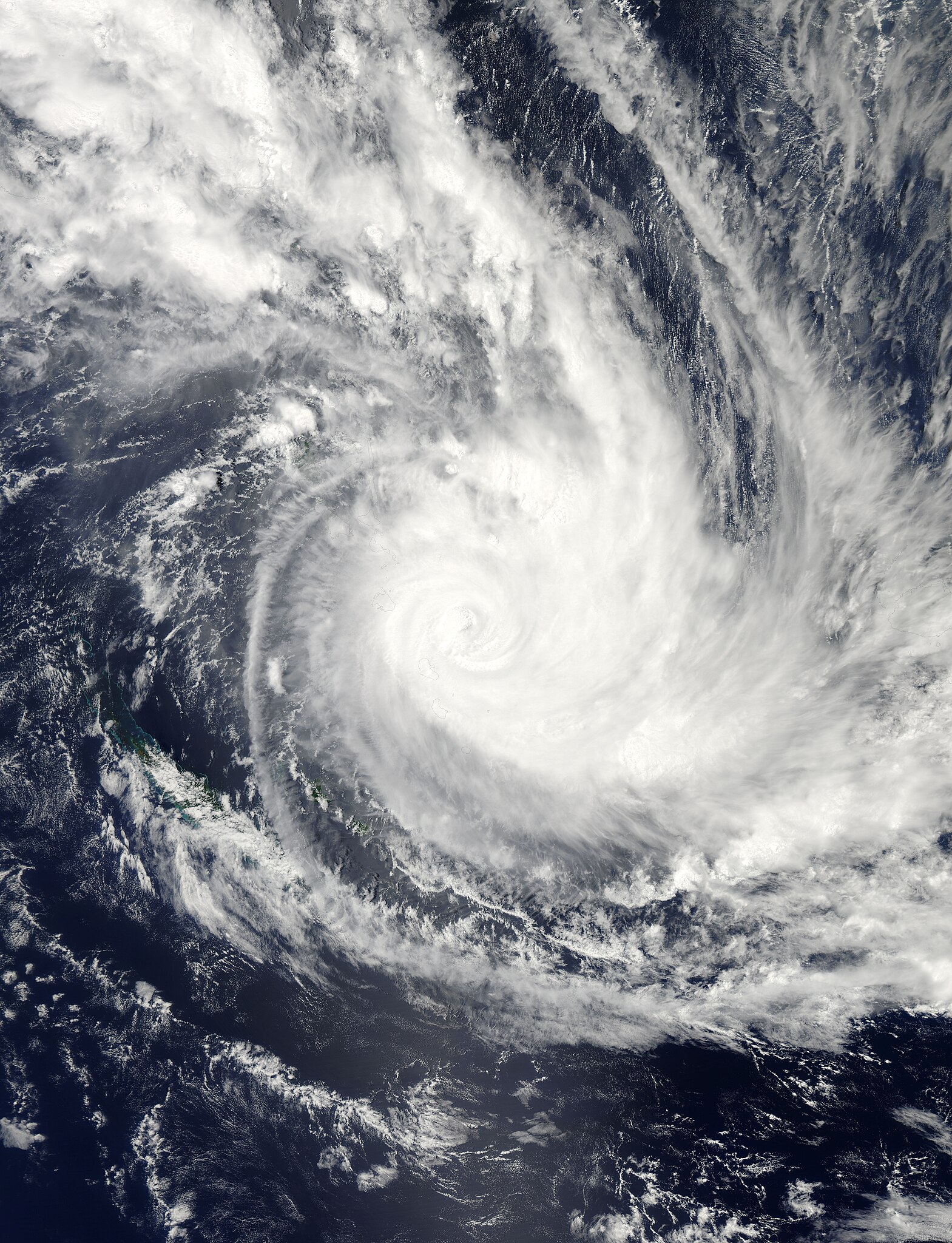
English: Tropical Cyclone Atu raged over the southern Pacific Ocean in late February 2011, stretching from New Caledonia to Fiji. The U.S. Navy’s Joint Typhoon Warning Center (JTWC) reported that, as of 8:00 p.m. local time on February 21, Atu was located roughly 115 nautical miles (215 kilometers) east-southeast of Port Vila, Vanuatu. The storm had maximum sustained winds of 100 knots (185 kilometers per hour) and gusts up to 125 knots (230 kilometers per hour).
The Moderate Resolution Imaging Spectroradiometer (MODIS) on NASA’s Aqua satellite captured this natural-color image around 11:30 a.m. local time on February 21, 2011. The center of the storm appears just east of the Vanuatu archipelago. The JTWC forecast that Atu would accelerate roughly toward the southeast, and would probably intensify slightly over the next 24 hours. After about 36 hours, however, Atu was expected to quickly weaken, thanks to increasing vertical wind shear and lower sea surface temperatures. |
| Date | |
| Source | http://earthobservatory.nasa.gov/NaturalHazards/view.php?id=49381 |
| Author | NASA images courtesy Jeff Schmaltz, MODIS Rapid Response Team at NASA GSFC. Caption by Michon Scott. |
Licensing[edit]
| This file is in the public domain in the United States because it was solely created by NASA. NASA copyright policy states that "NASA material is not protected by copyright unless noted". (See Template:PD-USGov, NASA copyright policy page or JPL Image Use Policy.) | ||
 |
Warnings:
|
File history
Click on a date/time to view the file as it appeared at that time.
| Date/Time | Thumbnail | Dimensions | User | Comment | |
|---|---|---|---|---|---|
| current | 13:59, 13 August 2023 | | 7,200 × 9,400 (8.58 MB) | Nino Marakot (talk | contribs) | Original image |
| 19:50, 21 February 2011 |  | 7,200 × 9,400 (11.26 MB) | Supportstorm (talk | contribs) | {{Information |Description ={{en|1=Tropical Cyclone Atu raged over the southern Pacific Ocean in late February 2011, stretching from New Caledonia to Fiji. The U.S. Navy’s Joint Typhoon Warning Center (JTWC) reported that, as of 8:00 p.m. local time |
You cannot overwrite this file.
File usage on Commons
There are no pages that use this file.
File usage on other wikis
The following other wikis use this file:
- Usage on en.wikipedia.org
- Usage on ko.wikipedia.org
- Usage on pt.wikipedia.org
- Usage on ru.wikipedia.org
- Usage on zh.wikipedia.org