File:August 17, 1999 Izmit earthquake Duzce.jpg
Jump to navigation
Jump to search

Size of this preview: 800 × 533 pixels. Other resolutions: 320 × 213 pixels | 640 × 427 pixels | 1,024 × 683 pixels | 1,280 × 853 pixels | 1,536 × 1,024 pixels.
Original file (1,536 × 1,024 pixels, file size: 706 KB, MIME type: image/jpeg)
Captions
Captions
Add a one-line explanation of what this file represents
Summary[edit]
| Description |
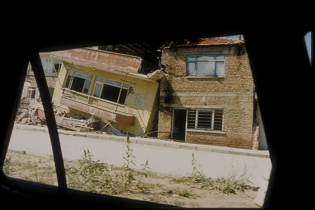
English: Duzce is east of Sakarya/Adapazari. It was struck by a second earthquake (Mw 7.1) on November 12, 1999, that killed at least 619 people. Between Adapazari and Duzce. The brick structure on the right performed well. The reinforced concrete frame brick-infilled building slid into the brick structure causing "blunt" damage. (This photograph was taken through a car window.) |
| Date | |
| Source | https://www.ngdc.noaa.gov/hazardimages/#/earthquake/23 |
| Author | NOAA National Geophysical Data Center |
Licensing[edit]
This image is in the public domain because it contains materials that originally came from the U.S. National Oceanic and Atmospheric Administration, taken or made as part of an employee's official duties.
|
File history
Click on a date/time to view the file as it appeared at that time.
| Date/Time | Thumbnail | Dimensions | User | Comment | |
|---|---|---|---|---|---|
| current | 20:15, 10 September 2023 | | 1,536 × 1,024 (706 KB) | Kurmanbek (talk | contribs) | Uploaded a work by NOAA National Geophysical Data Center from https://www.ngdc.noaa.gov/hazardimages/#/earthquake/23 with UploadWizard |
You cannot overwrite this file.
File usage on Commons
There are no pages that use this file.