File:Austro-Hungarian map of the blockade of Crete 1897.JPG
Jump to navigation
Jump to search

Size of this preview: 800 × 400 pixels. Other resolutions: 320 × 160 pixels | 640 × 320 pixels | 1,024 × 512 pixels | 1,754 × 877 pixels.
Original file (1,754 × 877 pixels, file size: 198 KB, MIME type: image/jpeg)
Captions
Captions
Add a one-line explanation of what this file represents
| Description |
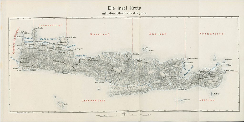
English: Austro-Hungarian map of the International Squadron′s zones of blockading responsibilities around Crete in 1897. |
| Date | |
| Source | The British in Crete, 1896 to 1913: Dividing Crete |
| Author | Unattributed |
This media file is in the public domain in the United States. This applies to U.S. works where the copyright has expired, often because its first publication occurred prior to January 1, 1929, and if not then due to lack of notice or renewal. See this page for further explanation.
|
 | |
 |
This image might not be in the public domain outside of the United States; this especially applies in the countries and areas that do not apply the rule of the shorter term for US works, such as Canada, Mainland China (not Hong Kong or Macao), Germany, Mexico, and Switzerland. The creator and year of publication are essential information and must be provided. See Wikipedia:Public domain and Wikipedia:Copyrights for more details.
|
File history
Click on a date/time to view the file as it appeared at that time.
| Date/Time | Thumbnail | Dimensions | User | Comment | |
|---|---|---|---|---|---|
| current | 18:34, 23 December 2017 | | 1,754 × 877 (198 KB) | Mdnavman (talk | contribs) | {{Information |Description = Austro-Hungarian map of the International Squadron′s zones of blockading responsibilities around Crete in 1897. |Source = [https://briti... |
You cannot overwrite this file.
File usage on Commons
There are no pages that use this file.
File usage on other wikis
The following other wikis use this file:
- Usage on en.wikipedia.org
- Usage on fr.wikipedia.org
- Usage on tr.wikipedia.org
- Usage on uk.wikipedia.org