File:BH municipality location.gif
Jump to navigation
Jump to search

Size of this preview: 631 × 599 pixels. Other resolutions: 253 × 240 pixels | 505 × 480 pixels | 808 × 768 pixels | 1,078 × 1,024 pixels | 1,600 × 1,520 pixels.
Original file (1,600 × 1,520 pixels, file size: 147 KB, MIME type: image/gif)
Captions
Captions
Add a one-line explanation of what this file represents
Summary[edit]
| Description |
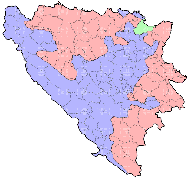
English: Municipaliteis in Bosnia-Herzegovina.
|
| Date | |
| Source | Own work |
| Author | Argo Navis (Ante Perkovic) |
Licensing[edit]
| I, the copyright holder of this work, release this work into the public domain. This applies worldwide. In some countries this may not be legally possible; if so: I grant anyone the right to use this work for any purpose, without any conditions, unless such conditions are required by law. |
File history
Click on a date/time to view the file as it appeared at that time.
| Date/Time | Thumbnail | Dimensions | User | Comment | |
|---|---|---|---|---|---|
| current | 17:04, 7 October 2011 | | 1,600 × 1,520 (147 KB) | Mostarac (talk | contribs) | dodana općina Usora i izbirsana netočna granica između istočnog i zapadnog Mostara |
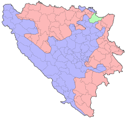
| 16:54, 9 July 2006 |  | 1,600 × 1,520 (110 KB) | Argo Navis (talk | contribs) | ||
| 16:35, 9 July 2006 |  | 1,600 × 1,520 (79 KB) | Argo Navis (talk | contribs) | Municipaliteis in Bosnia-Herzegovina. * Red = Republika Srpska * Green = Federation of Bosnia-Herzegovina * Blue = Brčko district | |
| 22:16, 8 July 2006 |  | 1,600 × 1,520 (262 KB) | Argo Navis (talk | contribs) | Municipaliteis in Bosnia-Herzegovina. * Red = Federation of Bosnia-Herzegovina * Blue = Republika Srpska |
You cannot overwrite this file.
File usage
The following 3 pages use this file:
Global file usage
The following other wikis use this file:
- Usage on ar.wikipedia.org
- Usage on azb.wikipedia.org
- Usage on az.wikipedia.org
- Usage on ba.wikipedia.org
- Usage on ca.wikipedia.org
- Usage on ckb.wikipedia.org
- Usage on cs.wikipedia.org
- Usage on da.wikipedia.org
- Usage on de.wikipedia.org
- Usage on en.wikipedia.org
- Usage on eo.wikipedia.org
- Usage on fa.wikipedia.org
- Usage on fr.wikipedia.org
- Usage on gl.wikipedia.org
- Usage on hr.wikipedia.org
- Usage on id.wikipedia.org
- Usage on ja.wikipedia.org
- Usage on lt.wikipedia.org
- Usage on ms.wikipedia.org
- Usage on mzn.wikipedia.org
- Usage on nl.wikipedia.org
- Usage on oc.wikipedia.org
- Usage on pms.wikipedia.org
- Usage on pt.wikipedia.org
- Usage on sah.wikipedia.org
- Usage on sq.wikipedia.org
- Usage on sv.wikipedia.org
- Usage on tk.wikipedia.org
- Usage on uk.wikipedia.org
- Usage on vi.wikipedia.org
- Usage on www.wikidata.org
- Usage on zh.wikipedia.org