File:BIRPS profiles.png
Jump to navigation
Jump to search

Size of this preview: 800 × 579 pixels. Other resolutions: 320 × 232 pixels | 640 × 463 pixels | 1,024 × 741 pixels | 1,280 × 927 pixels | 2,428 × 1,758 pixels.
Original file (2,428 × 1,758 pixels, file size: 3.49 MB, MIME type: image/png)
Captions
Captions
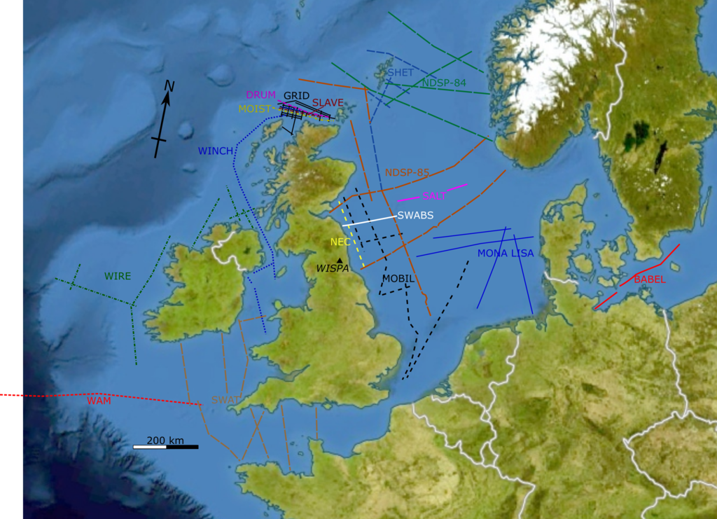
Map showing location of most of the seismic profiles acquired by the BIRPS group
Summary
[edit]
| Description |
English: Map showing location of most of the seismic profiles acquired by the BIRPS group. The base map is a cropped version of File:Europe bluemarble laea location map.jpg. The seismic profile locations have been taken from various publications by the BIRPS group - note that many of these maps were not high quality and the locations shown are, at best, approximate. |
| Date | |
| Source | Own work |
| Author | Mikenorton |
Licensing
[edit]
I, the copyright holder of this work, hereby publish it under the following license:
This file is licensed under the Creative Commons Attribution-Share Alike 4.0 International license.
- You are free:
- to share – to copy, distribute and transmit the work
- to remix – to adapt the work
- Under the following conditions:
- attribution – You must give appropriate credit, provide a link to the license, and indicate if changes were made. You may do so in any reasonable manner, but not in any way that suggests the licensor endorses you or your use.
- share alike – If you remix, transform, or build upon the material, you must distribute your contributions under the same or compatible license as the original.
File history
Click on a date/time to view the file as it appeared at that time.
| Date/Time | Thumbnail | Dimensions | User | Comment | |
|---|---|---|---|---|---|
| current | 20:54, 15 October 2021 | | 2,428 × 1,758 (3.49 MB) | Mikenorton (talk | contribs) | Uploaded own work with UploadWizard |
You cannot overwrite this file.
File usage on Commons
There are no pages that use this file.
File usage on other wikis
The following other wikis use this file:
- Usage on en.wikipedia.org