File:BOB 01 and Jamala 2013-05-10.jpg
Jump to navigation
Jump to search
Size of this preview: 581 × 599 pixels. Other resolutions: 233 × 240 pixels | 465 × 480 pixels | 745 × 768 pixels | 993 × 1,024 pixels | 1,300 × 1,341 pixels.
Original file (1,300 × 1,341 pixels, file size: 1.4 MB, MIME type: image/jpeg)
Captions
Captions
Add a one-line explanation of what this file represents
Summary
[edit]
| Description |
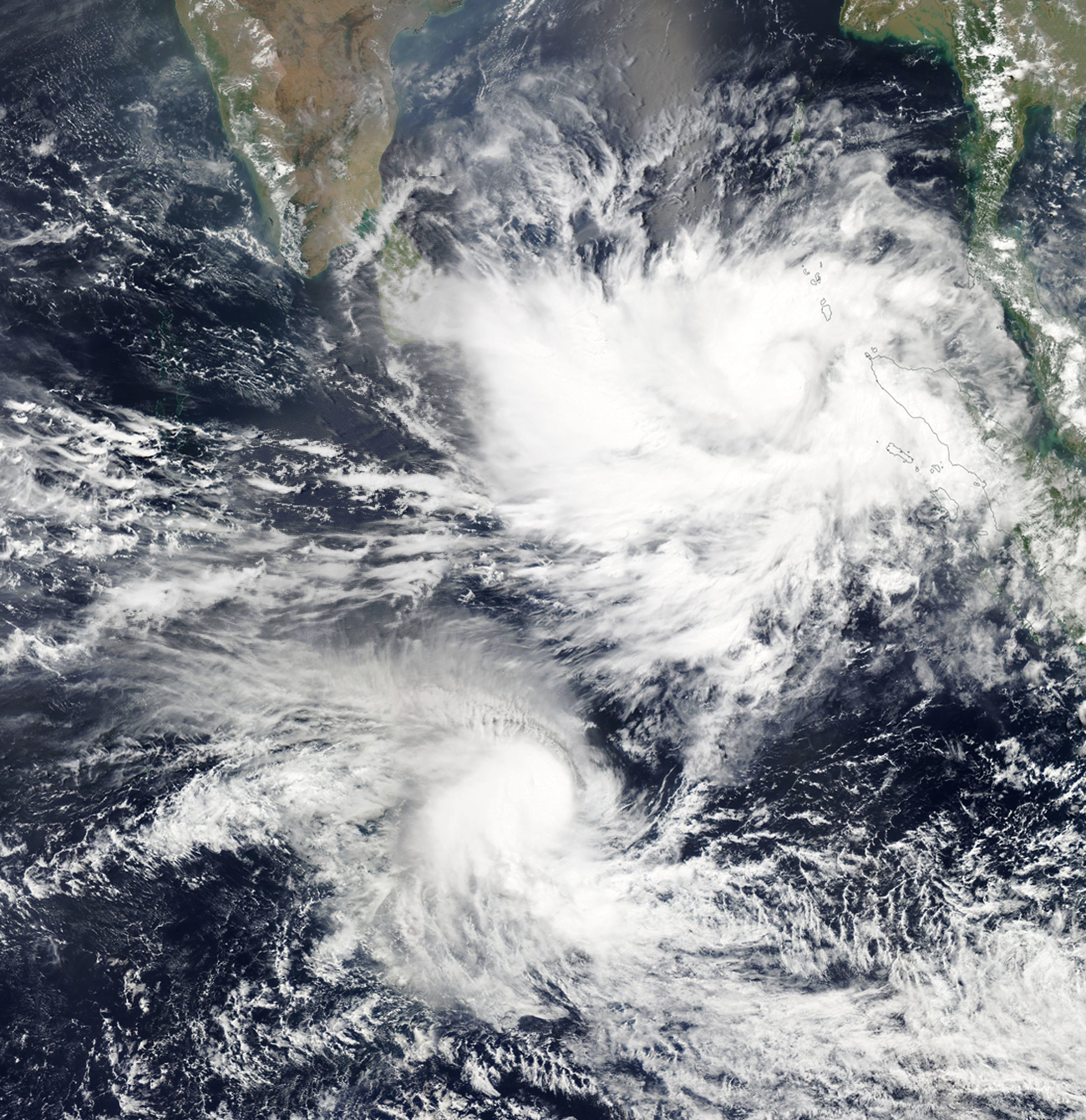
English: The image shows two cyclones in the Indian Ocean, Depression BOB 01 (later becoming Cyclonic Storm Viyaru) north of the equator and Moderate Tropical Storm Jamala south of the equator. Having two storms on either side of the equator allows us to see the Coriolis Effect in action by comparing the storms’ opposing angles of rotation.
While Jamala was forecasted to head southwest over water, BOB 01 was forecasted to move northwest and gain strength over the next few days before turning northeast and making landfall in Myanmar. This image is a digital composite of the MODIS Terra and Aqua layers superimposed over each other to remove blanks in the image caused by satellite orbit. Any additional voids were removed by the spot healing tool of Photoshop. |
| Date | |
| Source | NASA WorldView |
| Author | NASA |
Licensing
[edit]
| This file is in the public domain in the United States because it was solely created by NASA. NASA copyright policy states that "NASA material is not protected by copyright unless noted". (See Template:PD-USGov, NASA copyright policy page or JPL Image Use Policy.) | ||
 |
Warnings:
|
File history
Click on a date/time to view the file as it appeared at that time.
| Date/Time | Thumbnail | Dimensions | User | Comment | |
|---|---|---|---|---|---|
| current | 08:32, 21 March 2019 | | 1,300 × 1,341 (1.4 MB) | Tatiraju.rishabh (talk | contribs) | User created page with UploadWizard |
You cannot overwrite this file.
File usage on Commons
The following page uses this file: