File:Bad Birnbach, fahrerloser Bus 2017, Haltestellenschild, 1.jpeg
From Wikimedia Commons, the free media repository
Jump to navigation
Jump to search
Size of this preview: 800 × 521 pixels. Other resolutions: 320 × 208 pixels | 640 × 417 pixels | 1,024 × 667 pixels | 1,280 × 833 pixels | 3,072 × 2,000 pixels.
Original file (3,072 × 2,000 pixels, file size: 2.24 MB, MIME type: image/jpeg)
File information
Structured data
Captions
DescriptionBad Birnbach, fahrerloser Bus 2017, Haltestellenschild, 1.jpeg |
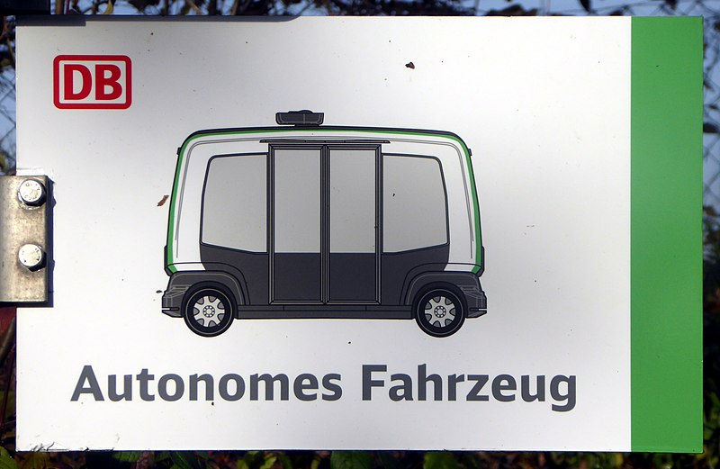
Deutsch: Bad Birnbach, Bushaltestellenschild des autonomen Versuchsbusses an der T(h)erme.
Esperanto: Bad Birnbach (DE), bushalteja tabulo de la eksperimenta senŝofora buso, ĉe la varmbaneja centro. |
|||
Date | ||||
Source | Self-photographed | |||
Author | Renardo la vulpo | |||
Permission (Reusing this file) |
I, the copyright holder of this work, hereby publish it under the following license:
|
Object location | 48° 26′ 26.3″ N, 13° 04′ 58″ E | View this and other nearby images on: OpenStreetMap | 48.440639; 13.082778 |
---|
File history
Click on a date/time to view the file as it appeared at that time.
Date/Time | Thumbnail | Dimensions | User | Comment | |
---|---|---|---|---|---|
current | 22:38, 24 November 2017 | 3,072 × 2,000 (2.24 MB) | Renardo la vulpo (talk | contribs) | {{Information |Description={{de|1=Bad Birnbach, Bushaltestellenschild des autonomen Versuchsbusses an der T(h)erme.}} {{eo|1=Bad Birnbach (DE), bushalteja tabulo de la eksperimenta senŝofora buso, ĉe la varmbaneja centro.}} |Source=... |
You cannot overwrite this file.
File usage on Commons
There are no pages that use this file.
Metadata
This file contains additional information such as Exif metadata which may have been added by the digital camera, scanner, or software program used to create or digitize it. If the file has been modified from its original state, some details such as the timestamp may not fully reflect those of the original file. The timestamp is only as accurate as the clock in the camera, and it may be completely wrong.
Camera manufacturer | Panasonic |
---|---|
Camera model | DMC-TZ61 |
Exposure time | 1/800 sec (0.00125) |
F-number | f/5.1 |
ISO speed rating | 100 |
Date and time of data generation | 14:45, 23 November 2017 |
Lens focal length | 19 mm |
Latitude | 48° 26′ 28.68″ N |
Longitude | 13° 4′ 56.7″ E |
Orientation | Normal |
Horizontal resolution | 180 dpi |
Vertical resolution | 180 dpi |
Software used | GIMP 2.8.20 |
File change date and time | 23:25, 24 November 2017 |
Y and C positioning | Co-sited |
Exposure Program | Normal program |
Exif version | 2.3 |
Date and time of digitizing | 14:45, 23 November 2017 |
Meaning of each component |
|
Image compression mode | 4 |
APEX exposure bias | 0 |
Maximum land aperture | 4.703125 APEX (f/5.1) |
Metering mode | Center weighted average |
Light source | Unknown |
Flash | Flash did not fire, compulsory flash suppression |
Supported Flashpix version | 1 |
Color space | sRGB |
Sensing method | One-chip color area sensor |
File source | Digital still camera |
Scene type | A directly photographed image |
Custom image processing | Normal process |
Exposure mode | Auto exposure |
White balance | Auto white balance |
Digital zoom ratio | 0 |
Focal length in 35 mm film | 106 mm |
Scene capture type | Standard |
Scene control | None |
Contrast | Normal |
Saturation | Normal |
Sharpness | Normal |
GPS time (atomic clock) | 12:38 |
Receiver status | Measurement in progress |
Measurement mode | 2-dimensional measurement |
Measurement precision | Poor (2.2) |
Geodetic survey data used | WGS-84 |
Name of GPS area | --- |
GPS date | 23 November 2017 |
GPS tag version | 0.0.3.2 |
Image width | 3,264 px |
Image height | 2,448 px |
Name of GPS processing method | 14 bytes undefined data |