File:Baden in 1-25.000, Stand 1901 in 600 dpi.jpg

Original file (19,332 × 14,545 pixels, file size: 94.98 MB, MIME type: image/jpeg)
Captions
Captions
| Warning | The original file is very high-resolution. It might not load properly or could cause your browser to freeze when opened at full size. |
|---|
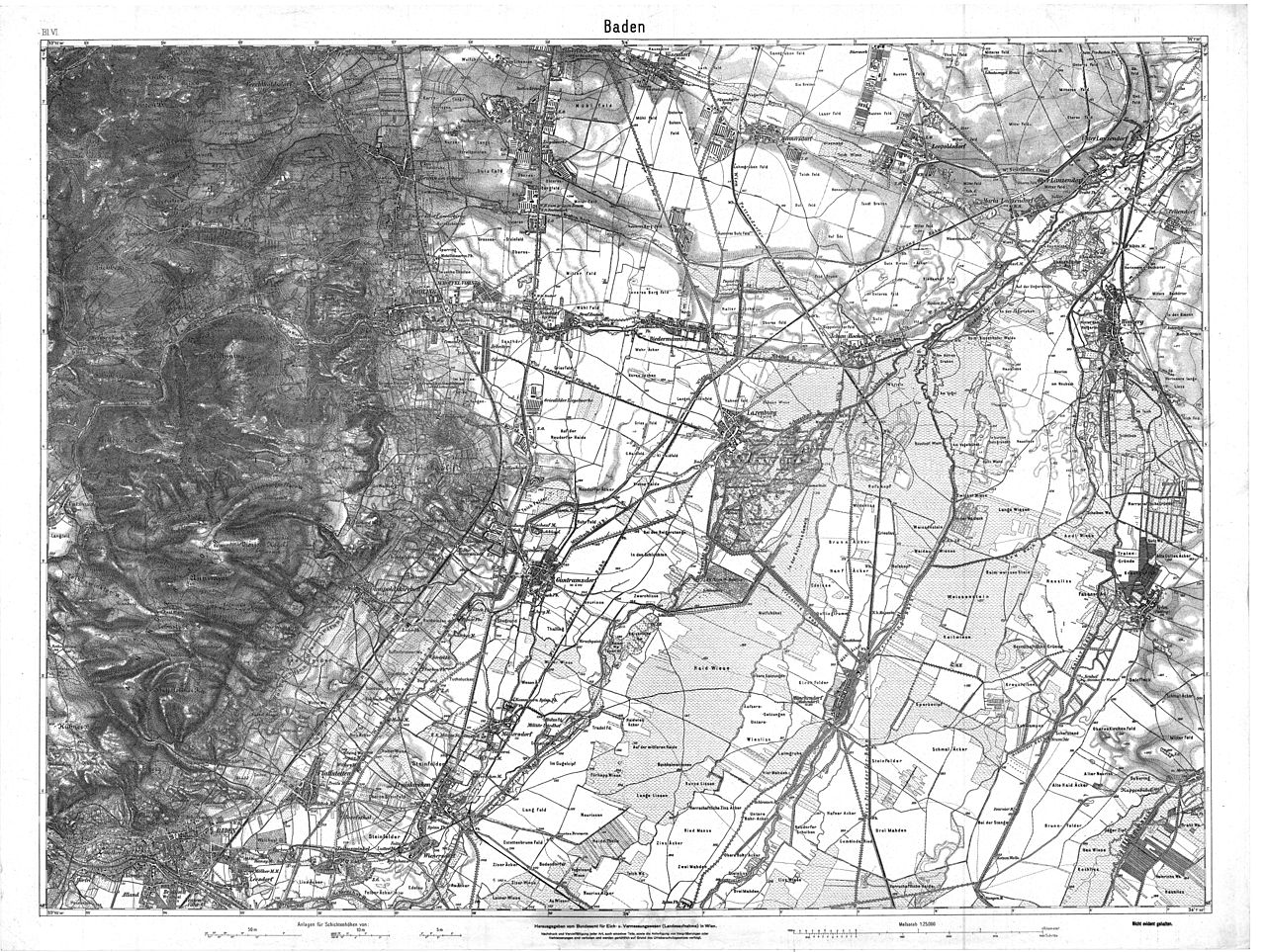
| Description | historische Landkarte 1:25.000. Umgebung von Mödling und Himberg im Süden von Wien |
| Date |
Jahrhundertwende 19./20 Jh. (vor 1919: Laxenburger Straße noch als Hof-Straße, Laxenburg noch als k.k Schloss), die Karte ist Blatt VI (siehe links oben) einer Serie, deren andere Blätter mit Nachträgen nur bis 1901 geführt wurden, siehe das nördlich angrenzende Blatt Wien Süd  |
| Source | Archiv des Militärgeographischen Institutes in Wien (Flohmarktverkauf ca 1970) |
| Author | Österreichisch-Ungarische Monarchie, Militärgeographisches Institut, Herausgabevermerk des Bundesamtes für Eich- und Vermessungswesen (Landesaufnahme) in Wien |
| Permission (Reusing this file) |
historisches amtliches Werk aus dem 19. Jh., freies Werk |
|
This work is in the public domain in its country of origin and other countries and areas where the copyright term is the author's life plus 70 years or fewer.
| |
| This file has been identified as being free of known restrictions under copyright law, including all related and neighboring rights. | |
File history
Click on a date/time to view the file as it appeared at that time.
| Date/Time | Thumbnail | Dimensions | User | Comment | |
|---|---|---|---|---|---|
| current | 20:54, 12 March 2010 | | 19,332 × 14,545 (94.98 MB) | Josef Moser (talk | contribs) | {{Information |Description=historische Landkarte 1:25.000. Umgebung von Mödling und Himberg im Süden von Wien |Source=Archiv des Militärgeographischen Institutes in Wien (Flohmarktverkauf ca 1970) |Date=Jahrhundertwende 19./20 Jh. (vor 1919: Laxenburge |
You cannot overwrite this file.
File usage on Commons
There are no pages that use this file.