File:Baie de Tokyo vue par Sentinel 2.jpg
Original file (5,000 × 5,000 pixels, file size: 30.49 MB, MIME type: image/jpeg)
Captions
Captions
Summary
[edit]
| Description |
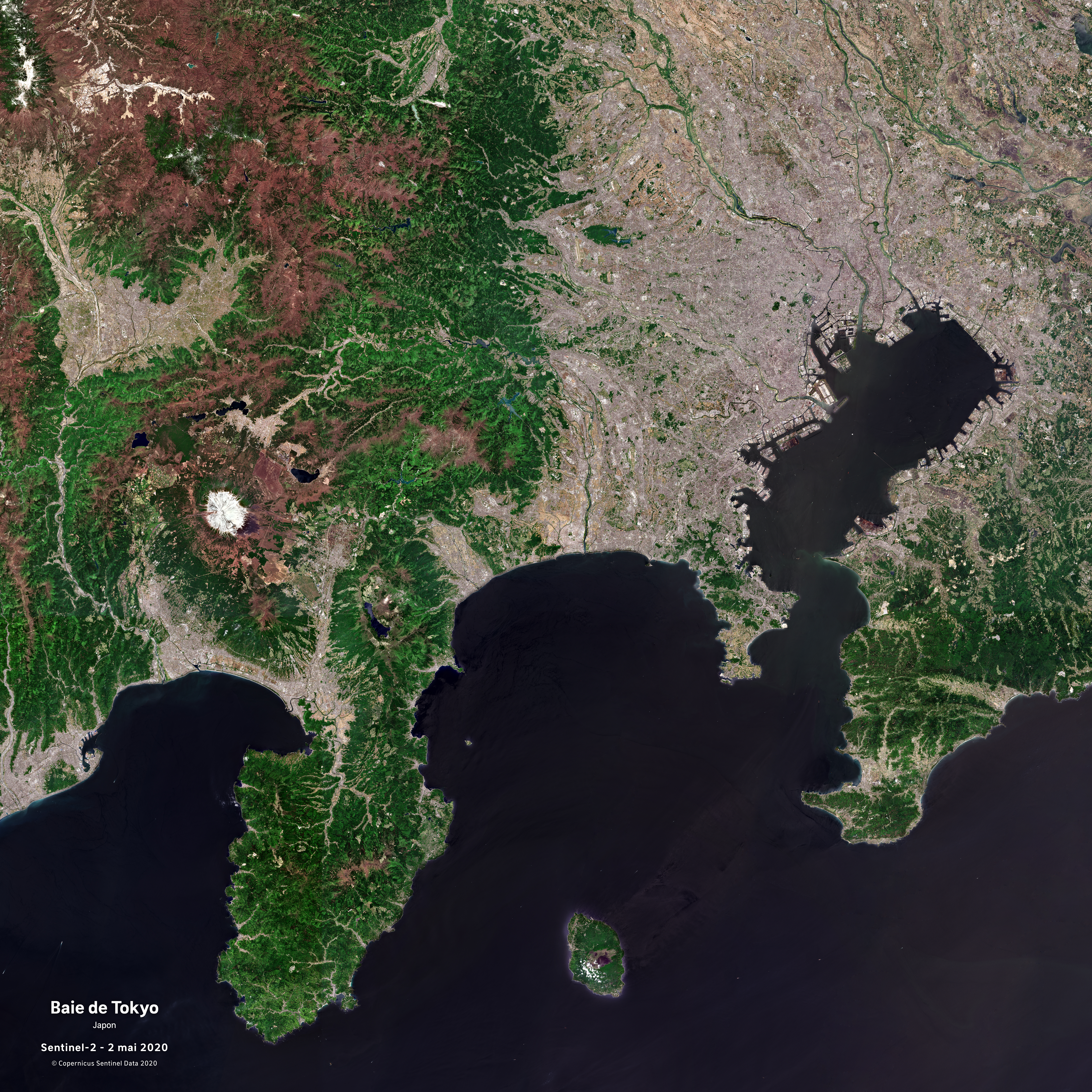
English: Baie de Tokyo vue par le satellite Sentinel 2, le 2 mai 2020.
La baie de Tokyo est un golf naturel le long de la cote est de l'ile d'Honshu, au Japon, au sud de la plaine de Kanto. A l'entree de la baie, cote ouest, on trouve le mont Fuji. La baie est presque fermee a son entree par la Miura (une ville de la prefecture de Kanagawa) et par la peninsule de Boso qui se situe dans la prefecture de Chiba a l'ouest. La baie est liee a l'ocean Pacifique par la ville portuaire japonaise Uraga. |
| Date | |
| Source | https://phototheque.cnes.fr/cnes/media/69130 |
| Author | European Space Agency / CNES |
Licensing
[edit]

|
This image contains data from a satellite in the Copernicus Programme, such as Sentinel-1, Sentinel-2 or Sentinel-3. Attribution is required when using this image.
Attribution: Contains modified Copernicus Sentinel data 2020
The use of Copernicus Sentinel Data is regulated under EU law (Commission Delegated Regulation (EU) No 1159/2013 and Regulation (EU) No 377/2014). Relevant excerpts:
Free access shall be given to GMES dedicated data [...] made available through GMES dissemination platforms [...].
Access to GMES dedicated data [...] shall be given for the purpose of the following use in so far as it is lawful:
GMES dedicated data [...] may be used worldwide without limitations in time.
GMES dedicated data and GMES service information are provided to users without any express or implied warranty, including as regards quality and suitability for any purpose. |
File history
Click on a date/time to view the file as it appeared at that time.
| Date/Time | Thumbnail | Dimensions | User | Comment | |
|---|---|---|---|---|---|
| current | 14:29, 26 May 2022 | | 5,000 × 5,000 (30.49 MB) | Don-vip (talk | contribs) | Uploaded a work by European Space Agency / CNES from https://phototheque.cnes.fr/cnes/media/69130 with UploadWizard |
You cannot overwrite this file.
File usage on Commons
There are no pages that use this file.