File:Baie de l'Amirauté.svg
Jump to navigation
Jump to search

Size of this PNG preview of this SVG file: 574 × 600 pixels. Other resolutions: 230 × 240 pixels | 459 × 480 pixels | 735 × 768 pixels | 980 × 1,024 pixels | 1,959 × 2,048 pixels | 1,349 × 1,410 pixels.
Original file (SVG file, nominally 1,349 × 1,410 pixels, file size: 490 KB)
Captions
Captions
Add a one-line explanation of what this file represents
| Description |
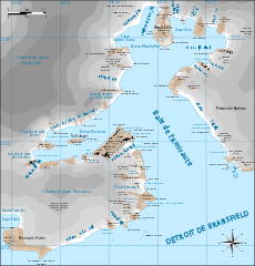
Français : Carte de la baie de l'Amirauté English: Map of Admiralty Bay |
| Date | (UTC) |
| Source | |
| Author |
|
| This is a retouched picture, which means that it has been digitally altered from its original version. Modifications: passage au svg + traduction. The original can be viewed here: Zatoka Admiralicji.png:
|
I, the copyright holder of this work, hereby publish it under the following license:
This file is licensed under the Creative Commons Attribution 3.0 Unported license.
- You are free:
- to share – to copy, distribute and transmit the work
- to remix – to adapt the work
- Under the following conditions:
- attribution – You must give appropriate credit, provide a link to the license, and indicate if changes were made. You may do so in any reasonable manner, but not in any way that suggests the licensor endorses you or your use.
Original upload log
[edit]
This image is a derivative work of the following images:
- File:Zatoka_Admiralicji.png licensed with Cc-by-3.0
- 2009-09-17T09:34:59Z Aotearoa 1346x1409 (1188337 Bytes) {{Information |Description={{en|1=Map of Admiralty Bay}} {{pl|1=Mapa Zatoki Admiralicji}} |Source=Praca własna osoby przesyłającej (own work by uploader) |Author=[[User:Aotearoa|Aotearoa]] |Date=2009-09-17 |Permission= |ot
Uploaded with derivativeFX
File history
Click on a date/time to view the file as it appeared at that time.
| Date/Time | Thumbnail | Dimensions | User | Comment | |
|---|---|---|---|---|---|
| current | 14:26, 6 November 2010 | | 1,349 × 1,410 (490 KB) | Treehill (talk | contribs) | {{Information |Description={{fr|Carte de la baie de l'Amirauté}}{{en|1=Map of Admiralty Bay}} {{pl|1=Mapa Zatoki Admiralicji<br>Nazewnictwo zgodne z oficjalnym gazeterem Antarktyki publikowanym przez SCAR [http://data.aad.gov.au/aadc/gaz/scar/], polskie |
You cannot overwrite this file.
File usage on Commons
The following page uses this file:
File usage on other wikis
The following other wikis use this file:
- Usage on ceb.wikipedia.org
- Usage on es.wikipedia.org
- Usage on fr.wikipedia.org
- Usage on lld.wikipedia.org
- Usage on nn.wikipedia.org
- Usage on www.wikidata.org