File:Balcony House (Imperial, Nebraska) from S 2.JPG
Jump to navigation
Jump to search

Size of this preview: 749 × 600 pixels. Other resolutions: 300 × 240 pixels | 600 × 480 pixels | 960 × 768 pixels | 1,279 × 1,024 pixels | 1,854 × 1,484 pixels.
Original file (1,854 × 1,484 pixels, file size: 1.05 MB, MIME type: image/jpeg)
Captions
Captions
Add a one-line explanation of what this file represents
|
This is an image of a place or building that is listed on the National Register of Historic Places in the United States of America. Its reference number is 767. |
Summary
[edit]_from_S_2.JPG&action=edit§ion=1)
| Description |
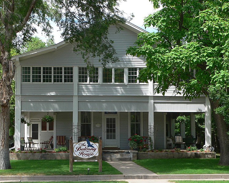
English: Balcony House at northeast corner of 10th Street and Court Street in Imperial, Nebraska; seen from the south. The building was constructed as a rural school in the 1880s, and was moved to Imperial in 1921, where it was used as a tourist camp. Soon thereafter, additions were made to it. It is currently operated as a bed-and-breakfast. The building is listed in the National Register of Historic Places. |
| Date | |
| Source | Own work |
| Author | Ammodramus |
| Object location | | View this and other nearby images on: OpenStreetMap |
|---|
_from_S_2.JPG¶ms=040.520000_N_-101.644444_E_globe:Earth_class:object_region:US_type:landmark_scale:1500_&language=en)
Licensing
[edit]_from_S_2.JPG&action=edit§ion=2)
| I, the copyright holder of this work, release this work into the public domain. This applies worldwide. In some countries this may not be legally possible; if so: I grant anyone the right to use this work for any purpose, without any conditions, unless such conditions are required by law. |
File history
Click on a date/time to view the file as it appeared at that time.
| Date/Time | Thumbnail | Dimensions | User | Comment | |
|---|---|---|---|---|---|
| current | 15:30, 26 July 2010 | | 1,854 × 1,484 (1.05 MB) | Ammodramus (talk | contribs) | {{Information |Description={{en|1=Balcony House at northeast corner of 10th Street and Court Street in {{w|Imperial, Nebraska}}; seen from the south. The building was constructed as a rural school in the 1880s, a |
You cannot overwrite this file.
File usage on Commons
The following page uses this file:
File usage on other wikis
The following other wikis use this file:
- Usage on de.wikipedia.org
- Usage on en.wikipedia.org
- Usage on www.wikidata.org
_from_S_2.JPG&oldid=815660618)