File:Balkans 4087 cut iztochna makedonia trakia.png
Jump to navigation
Jump to search

Size of this preview: 800 × 366 pixels. Other resolutions: 320 × 146 pixels | 640 × 293 pixels | 1,024 × 468 pixels | 1,280 × 585 pixels | 2,560 × 1,170 pixels | 9,681 × 4,426 pixels.
Original file (9,681 × 4,426 pixels, file size: 45.01 MB, MIME type: image/png)
Captions
Captions
Add a one-line explanation of what this file represents
Summary[edit]
| Description |
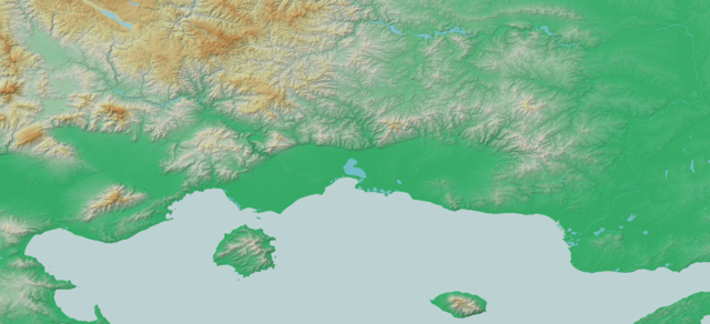
Български: релефна карта на Източна Македония и Тракия в Гърция
English: map of Eastern Macedonia and Thrace region in Greece |
| Source | Own work |
| Author | Deyan Vasilev ( Dido3 ) |
| Permission (Reusing this file) |
Elevation data: "The original data used for this product have been supplied by JAXA’s AW3D." Water body polygons: "© OpenStreetMap Contributors, CC-BY-SA" |
Licensing[edit]
Deyan Vasilev ( Dido3 ), the copyright holder of this work, hereby publishes it under the following licenses:

|
Permission is granted to copy, distribute and/or modify this document under the terms of the GNU Free Documentation License, Version 1.2 or any later version published by the Free Software Foundation; with no Invariant Sections, no Front-Cover Texts, and no Back-Cover Texts. A copy of the license is included in the section entitled GNU Free Documentation License. |
This file is licensed under the Creative Commons Attribution-Share Alike 3.0 Unported, 2.5 Generic, 2.0 Generic and 1.0 Generic license.
Attribution: Deyan Vasilev ( Dido3 )
- You are free:
- to share – to copy, distribute and transmit the work
- to remix – to adapt the work
- Under the following conditions:
- attribution – You must give appropriate credit, provide a link to the license, and indicate if changes were made. You may do so in any reasonable manner, but not in any way that suggests the licensor endorses you or your use.
- share alike – If you remix, transform, or build upon the material, you must distribute your contributions under the same or compatible license as the original.
You may select the license of your choice.
File history
Click on a date/time to view the file as it appeared at that time.
| Date/Time | Thumbnail | Dimensions | User | Comment | |
|---|---|---|---|---|---|
| current | 16:37, 8 March 2021 | | 9,681 × 4,426 (45.01 MB) | Dido3 (talk | contribs) | == {{int:filedesc}} == {{Information |Description= {{bg|релефна карта на Източна Македония и Тракия в Гърция}} {{en|map of Eastern Macedonia and Thrace region in Greece}} |Source={{own}} |Date= |Author=Deyan Vasilev ( Dido3 ) |Permission=Elevation data: "The original data used for this product have been supplied by JAXA’s AW3D." Water body polygons: "© OpenStreetMap Contributors, CC-BY-SA" |other_versions= }} == {{int:license-header}} == {{self|GFDL|cc-by-sa-3.0,2.5,2.0,1.0|au... |
You cannot overwrite this file.
File usage on Commons
There are no pages that use this file.
File usage on other wikis
The following other wikis use this file:
- Usage on bg.wikipedia.org
- Филипи
- Абдера
- Ксанти
- Драма (град)
- Гюмюрджина
- Доганхисар
- Дедеагач
- Фере
- Кавала
- Карлъково
- Орестиада
- Черномен
- Димотика
- Булгаркьой (дем Димотика)
- Мерхамли
- Дервент (дем Дедеагач)
- Голям Дервент (дем Софлу)
- Малък Дервент
- Башклисе
- Салтиково
- Плевня (дем Просечен)
- Каяджик
- Дерекьой (дем Гюмюрджина)
- Софлу
- Шапчи
- Търлис
- Осеница
- Владиково
- Ловчища
- Либан
- Попово село (дем Драма)
- Волак
- Тисово
- Лутрос (дем Дедеагач)
- Мущени
- Бук (Гърция)
- Кръстополе
- Габрово (дем Ксанти)
- Халваджи
- Манастир (Драмско)
- Правища
- Зърнево (дем Неврокоп)
- Куманич
- Долно Броди
- Елес
- Руждене
- Белотинци (дем Неврокоп)
- Старчища
- Каракьой
- Възмен
View more global usage of this file.