File:Balkans 4087 cut kavalsko.png
Jump to navigation
Jump to search

Size of this preview: 800 × 532 pixels. Other resolutions: 320 × 213 pixels | 640 × 425 pixels | 1,024 × 681 pixels | 1,280 × 851 pixels | 2,560 × 1,702 pixels | 3,296 × 2,191 pixels.
Original file (3,296 × 2,191 pixels, file size: 6.35 MB, MIME type: image/png)
Captions
Captions
Add a one-line explanation of what this file represents
Summary[edit]
| Description |
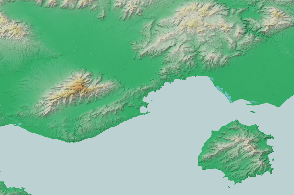
Български: релефна карта на Кавалско в Гърция
English: map of Kavala region in Greece |
| Source | Own work |
| Author | Deyan Vasilev ( Dido3 ) |
| Permission (Reusing this file) |
Elevation data: "The original data used for this product have been supplied by JAXA’s AW3D." Water body polygons: "© OpenStreetMap Contributors, CC-BY-SA" |
Licensing[edit]
Deyan Vasilev ( Dido3 ), the copyright holder of this work, hereby publishes it under the following licenses:

|
Permission is granted to copy, distribute and/or modify this document under the terms of the GNU Free Documentation License, Version 1.2 or any later version published by the Free Software Foundation; with no Invariant Sections, no Front-Cover Texts, and no Back-Cover Texts. A copy of the license is included in the section entitled GNU Free Documentation License. |
This file is licensed under the Creative Commons Attribution-Share Alike 3.0 Unported, 2.5 Generic, 2.0 Generic and 1.0 Generic license.
Attribution: Deyan Vasilev ( Dido3 )
- You are free:
- to share – to copy, distribute and transmit the work
- to remix – to adapt the work
- Under the following conditions:
- attribution – You must give appropriate credit, provide a link to the license, and indicate if changes were made. You may do so in any reasonable manner, but not in any way that suggests the licensor endorses you or your use.
- share alike – If you remix, transform, or build upon the material, you must distribute your contributions under the same or compatible license as the original.
You may select the license of your choice.
File history
Click on a date/time to view the file as it appeared at that time.
| Date/Time | Thumbnail | Dimensions | User | Comment | |
|---|---|---|---|---|---|
| current | 13:20, 8 March 2021 | | 3,296 × 2,191 (6.35 MB) | Dido3 (talk | contribs) | == {{int:filedesc}} == {{Information |Description= {{bg|релефна карта на Кавалско в Гърция}} {{en|map of Kavala region in Greece}} |Source={{own}} |Date= |Author=Deyan Vasilev ( Dido3 ) |Permission=Elevation data: "The original data used for this product have been supplied by JAXA’s AW3D." Water body polygons: "© OpenStreetMap Contributors, CC-BY-SA" |other_versions= }} == {{int:license-header}} == {{self|GFDL|cc-by-sa-3.0,2.5,2.0,1.0|author=[[User:Dido3|Deyan Vasilev ( Dido3... |
You cannot overwrite this file.
File usage on Commons
There are no pages that use this file.
File usage on other wikis
The following other wikis use this file:
- Usage on bg.wikipedia.org
- Кушница
- Люти рид
- Мущени
- Урвил
- Керамоти
- Ески Кавала
- Корита (дем Кавала)
- Кокала
- Кинали
- Пренчово
- Кучкар (дем Кушница)
- Дранич
- Дряново (дем Кушница)
- Кочан (Правищко)
- Самоков (дем Кушница)
- Лекани
- Полинеро
- Скопос (дем Места)
- Екали (дем Места)
- Саръшабан
- Никищан
- Горян
- Палеохори (дем Кушница)
- Орфано
- Долна Локвица
- Елевтерес
- Топлян
- Подгоряни
- Косруп
- Боблен
- Кале чифлик
- Четакли
- Чиста
- Филипи (дем Кавала)
- Неа Карвали
- Амигдалеонас
- Дато
- Зигос
- Крионери (дем Кавала)
- Кринидес
- Вунохори (дем Кавала)
- Лидия (дем Кавала)
- Кранохори (дем Кавала)
- Ликостомо (дем Кавала)
- Полистило
- Левки (дем Кавала)
- Ано Левки (дем Кавала)
- Халкеро
- Горно Дряново (дем Кушница)
- Каряни
View more global usage of this file.