File:Barry Point Fire map, Oregon and California, 2012.jpg
Jump to navigation
Jump to search

Size of this preview: 473 × 599 pixels. Other resolutions: 189 × 240 pixels | 379 × 480 pixels | 606 × 768 pixels | 809 × 1,024 pixels | 1,617 × 2,048 pixels | 2,851 × 3,610 pixels.
Original file (2,851 × 3,610 pixels, file size: 983 KB, MIME type: image/jpeg)
Captions
Captions
Add a one-line explanation of what this file represents
Summary
[edit]
| Description |
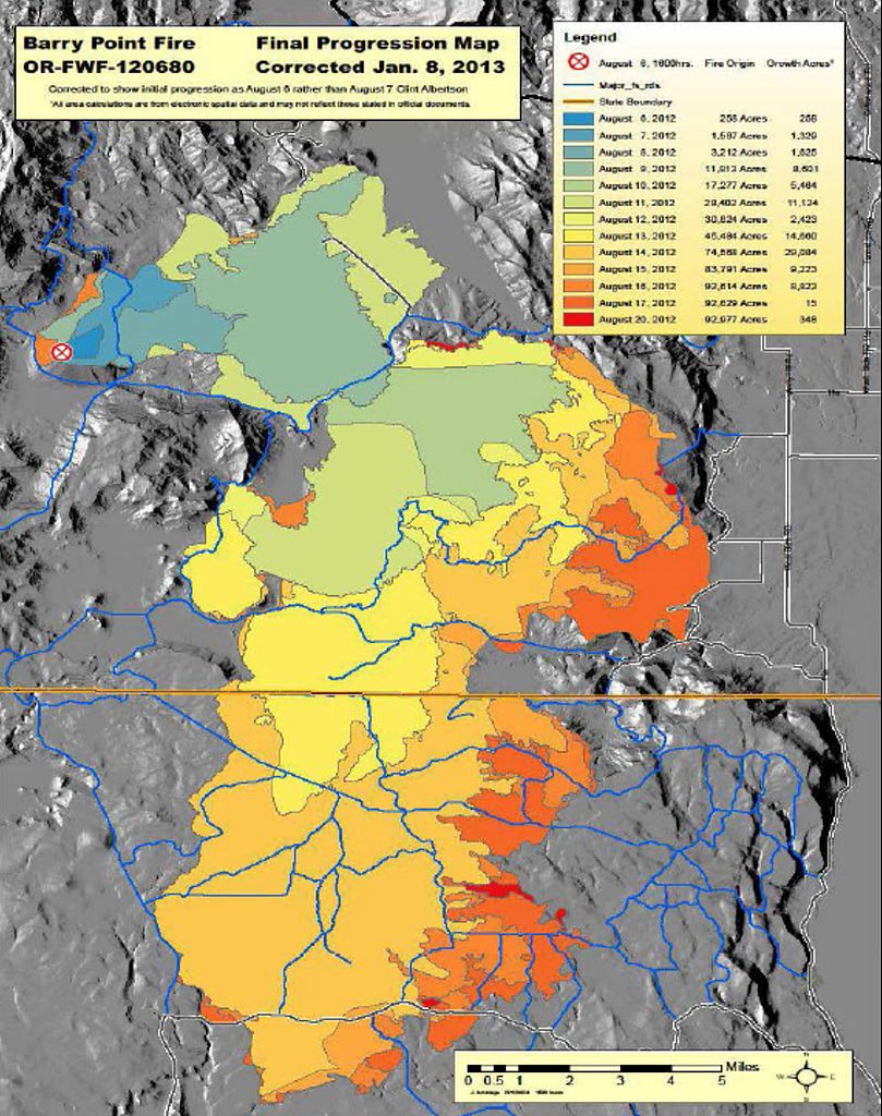
English: Fire progress map for the Barry Point Fire, a large wildfire that burned forest land in south central Oregon and northeastern California in 2012. |
| Date | |
| Source | http://www.fs.usda.gov/Internet/FSE_DOCUMENTS/stelprdb5424730.pdf |
| Author | United States Forest Service |
Licensing
[edit]
This image is a work of the Forest Service of the United States Department of Agriculture. As a work of the U.S. federal government, the image is in the public domain.
|
File history
Click on a date/time to view the file as it appeared at that time.
| Date/Time | Thumbnail | Dimensions | User | Comment | |
|---|---|---|---|---|---|
| current | 06:56, 12 September 2015 | | 2,851 × 3,610 (983 KB) | Orygun (talk | contribs) | User created page with UploadWizard |
You cannot overwrite this file.
File usage on Commons
There are no pages that use this file.
File usage on other wikis
The following other wikis use this file:
- Usage on en.wikipedia.org