File:Battle of Waterloo.svg
Jump to navigation
Jump to search

Size of this PNG preview of this SVG file: 800 × 527 pixels. Other resolutions: 320 × 211 pixels | 640 × 421 pixels | 1,024 × 674 pixels | 1,280 × 843 pixels | 2,560 × 1,685 pixels | 1,200 × 790 pixels.
Original file (SVG file, nominally 1,200 × 790 pixels, file size: 709 KB)
Captions
Captions
Add a one-line explanation of what this file represents
| Camera location | | View this and other nearby images on: OpenStreetMap |
|---|
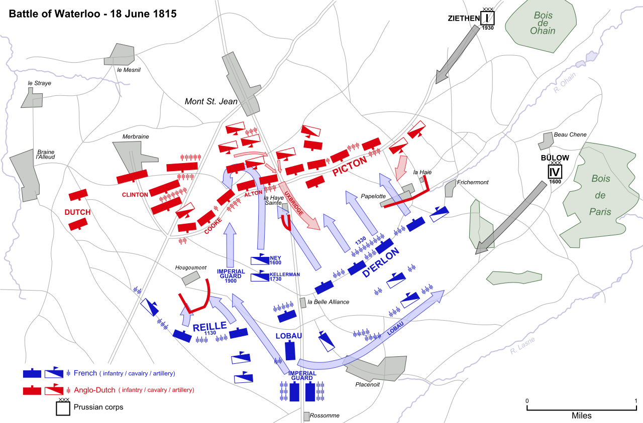
| Description | Map of the Battle of Waterloo, 18 June 1815, showing major movements and attacks. | ||
| Date | |||
| Source |
Vectorized from raster image  |
||
| Author | Ipankonin | ||
| Permission (Reusing this file) |
|
This W3C-unspecified vector image was created with Inkscape .
File history
Click on a date/time to view the file as it appeared at that time.
| Date/Time | Thumbnail | Dimensions | User | Comment | |
|---|---|---|---|---|---|
| current | 18:17, 23 December 2020 | | 1,200 × 790 (709 KB) | Razorblack (talk | contribs) | Corrected spelling "Hougomont" to "Hougoumont". DPI changed from 90 to 96. |
| 03:27, 2 January 2008 |  | 1,200 × 790 (766 KB) | Ipankonin (talk | contribs) | {{Inkscape}} {{Information |Description=Map of the Battle of Waterloo, 18 June 1815, showing major movements and attacks. |Source=Vectorized from raster image 100px |Date=1/1/2008 |Author=[[u |
You cannot overwrite this file.
File usage on Commons
The following 3 pages use this file:
File usage on other wikis
The following other wikis use this file:
- Usage on bg.wikipedia.org
- Usage on ca.wikipedia.org
- Usage on cs.wikipedia.org
- Usage on el.wikipedia.org
- Usage on en.wikipedia.org
- Usage on es.wikipedia.org
- Usage on et.wikipedia.org
- Usage on fr.wikipedia.org
- Usage on it.wikipedia.org
- Usage on ja.wikipedia.org
- Usage on lt.wikipedia.org
- Usage on ml.wikipedia.org
- Usage on nl.wikipedia.org
- Usage on nn.wikipedia.org
- Usage on no.wikipedia.org
- Usage on ru.wikipedia.org
- Usage on sk.wikipedia.org
- Usage on sv.wikipedia.org
- Usage on uk.wikipedia.org
- Usage on vi.wikipedia.org
- Usage on zh.wikipedia.org