File:Bay of Bengal map pl.svg
Jump to navigation
Jump to search

Size of this PNG preview of this SVG file: 605 × 599 pixels. Other resolutions: 242 × 240 pixels | 485 × 480 pixels | 775 × 768 pixels | 1,034 × 1,024 pixels | 2,068 × 2,048 pixels | 1,662 × 1,646 pixels.
Original file (SVG file, nominally 1,662 × 1,646 pixels, file size: 508 KB)
Captions
Captions
Add a one-line explanation of what this file represents
Summary[edit]
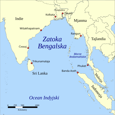
| Description | Zatoka Bengalska |
| Date | (UTC) |
| Source |
This file was derived from: Bay of Bengal map de.svg:  |
| Author |
|
Licensing[edit]
I, the copyright holder of this work, hereby publish it under the following licenses:
| This file is licensed under the Creative Commons Attribution-Share Alike 3.0 Unported license. | ||
| ||
| This licensing tag was added to this file as part of the GFDL licensing update. |

|
Permission is granted to copy, distribute and/or modify this document under the terms of the GNU Free Documentation License, Version 1.2 or any later version published by the Free Software Foundation; with no Invariant Sections, no Front-Cover Texts, and no Back-Cover Texts. A copy of the license is included in the section entitled GNU Free Documentation License. |
You may select the license of your choice.
Original upload log[edit]
This image is a derivative work of the following images:
- File:Bay of Bengal map de.svg licensed with Cc-by-sa-3.0-migrated, GFDL
- 2016-01-03T10:03:14Z Furfur 1662x1646 (520006 Bytes) moved Dhaka and Kolkata more to the North
- 2009-02-21T19:27:18Z Bamse 1662x1646 (527471 Bytes) Indonesien
- 2009-02-21T17:58:05Z Bamse 1662x1646 (527471 Bytes) {{Information |Description=A map showing the location of the Bay of Bengal and the Andaman Sea in southeast Asia. |Source=*[[:File:Bay_of_Bengal_map_ta.svg|]] |Date=2009-02-21 17:56 (UTC) |Author=*[[:File:Bay_of_Bengal_map_ta
Uploaded with derivativeFX
File history
Click on a date/time to view the file as it appeared at that time.
| Date/Time | Thumbnail | Dimensions | User | Comment | |
|---|---|---|---|---|---|
| current | 06:15, 17 July 2018 | | 1,662 × 1,646 (508 KB) | Okcydent (talk | contribs) | Pochylenie nazw wód. |
| 06:05, 17 July 2018 |  | 1,662 × 1,646 (508 KB) | Okcydent (talk | contribs) | User created page with UploadWizard |
You cannot overwrite this file.
File usage on Commons
There are no pages that use this file.
File usage on other wikis
The following other wikis use this file:
- Usage on pl.wikipedia.org
- Usage on pl.wiktionary.org